It’s only a line on the map
A casual look at a map of southern Chile tells you the obvious – there aren’t many roads down here. The severe mountains, glaciers, fjords, inland waterways, rivers and extreme weather make roads a luxury. After more than a week in northern Chile we had jumped over into Argentina to take the memorable Ruta National 40 bypass of the roadless section of Chile. Now we were crossing back into the country to check out some of their most spectacular scenery, including the famous Torres del Paine National Park.
In the remote parts of southern Patagonia Chile and Argentina seem to work as an entangled team to provide access to their respective attractions and territories. The only way to drive to Torres Del Paine in Chile is to enter it from Argentina. And the only way to drive to Tierra del Fuego in Argentina is to enter through Chile. That’s just the way it is down here.
No matter where you draw the line on the map the scenery is magnificent. We thought Glaciers National Park in Argentina would be hard to beat but despite the low cloud, rain and wind we could tell Torres del Paine National Park was at least its equal.
Entering Chile for the second time was easy, even if we had to sacrifice more fruit and veggies, and the drive into Torres del Paine showcased this section of the Andes. Across the rolling hills, covered golden yellow in desert tundra grass, we could see the base of these mountains with fresh snow peaking out from below the clouds. The howling wind and freezing rain might have kept us indoors but the scenery rocked. As we closed in on the park we started coming across these beautiful glacier-fed lakes with their milky-green water and raging white caps.
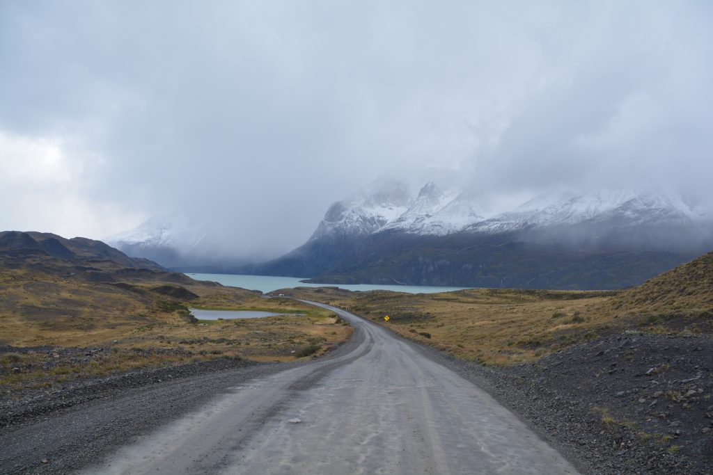
The roads near and in the national park were gravel and a bit slippery in the rain but the views shined anyway
Torres del Paine National Park is a trekker and backpacker paradise, including the famous W track and the Grand Circuit. We were too late in the season and too short on time for any walk but we drove through the park, stopping for photos which were typically of three parts – lake in the foreground, snowy mountain in the middle and cloud cover at the top. At one mountain pass we crossed the rain turned to snow, indicative of the type of weather day it was.
We camped that night in the national park near Pehoe Lake, sheltered from the wind if not the rain, and thought there was half a chance it would snow while we slept. We woke the next morning, in the dark as always, to find no snow but instead surrounded by thick low cloud, rain and wind. Great.
The dirt road south to Puerto Natales was muddy, slippery and pot-holed as we weaved our way through the lakes just below the snow line. Wind-swept, cold and miserable Puerto Natales was uninspirational in every way except to escape after supplies and lunch. We proceeded south and east through the flat open grass ranges only suitable for grazing sheep, the livestock of last resort. The weather mirrored the latitude and the geography – miserable – as we finally reached the shores and travelled along the famous Straits of Magellan.
When the Portuguese explorer Ferdinand Magellan discovered this passage through the islands of southern Patagonia in the early 16th century it meant that all future ships could take this relatively safe and calm shortcut rather than have to sail around the notoriously dangerous Cape Horn. The waterway fell out of favour 300 years later with the building of the Panama Canal but by that stage had made its permanent mark on the colourful history of global seafaring.
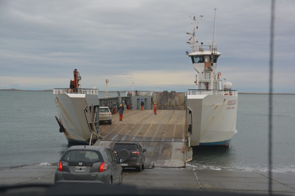
Crossing the Straits of Magellan was a real treat for its historic significance as well as geographically crossing over to Tierra del Fuego
We drove onto the ferry that crosses the Straits of Magellan and connects the island of Tierra del Fuego to the South American mainland and stood up on the ferry’s top rail to take in the scenic and historic views. Our landing on the other side also meant the return for Julie and I to Tierra del Fuego following our visit nine years ago. It was quite a special moment.
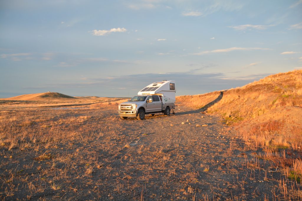
Our first night camping on the island of Tierra del Fuego – in an old gravel pit of course – with sub-zero temperatures
After a night camped in sub-zero temperatures amongst the rolling grass hills of the island, still on the Chilean side of the arbitrary line on the map, we continued our quest for Ushuaia, the southern most town of Argentina and the end of the road. From there all roads lead north – only Antarctica is further south.
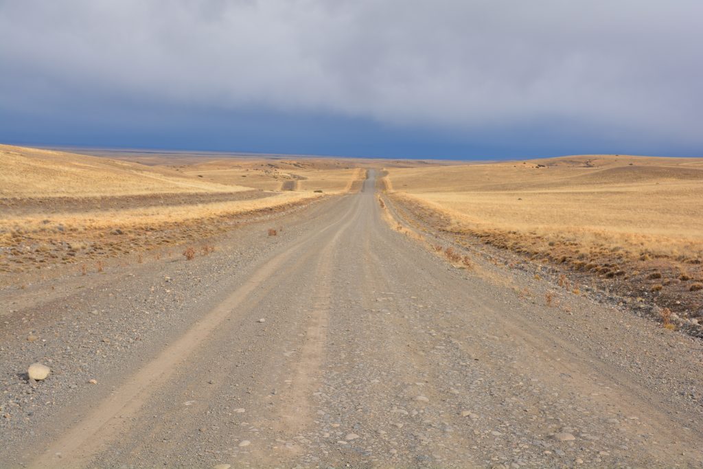
The northern stretches of the island of Tierra del Fuego gave us long consistent views of the same thing
We cruised out of Chile for the second time and into Argentina for the second time, almost able to ignore the line on the map, and crossed the flat grazing land of Tierra del Fuego. Near the small town of Tolhuin it all started to look familiar again and with good reason…we had been here before.
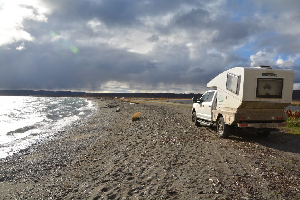
Tramp stops for a cold and windy picnic lunch on the shores of one of the many lakes in Tierra del Fuego
Nine years ago Julie and I came to southern Argentina as part of our extraordinary trip to Antarctica (I hate to drop names but its part of the story!) and after the cruise we hired a car and explored the southern tip of the island for a couple of days. We stayed at a little hosteria on the shores of Lake Fagnano, which we passed again this time, but that was January, the middle of summer, and this was late April, the start of winter.
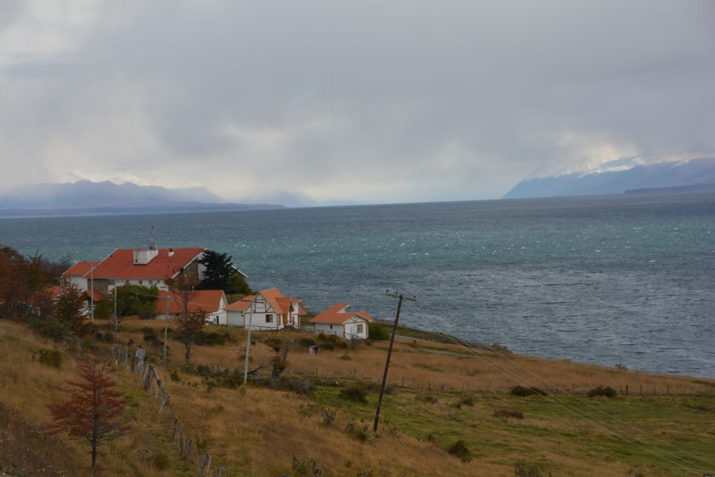
It was fun seeing again the expansive views of Lake Fagnano from the hosteria we stayed at nine years ago
The trees along the shores of the lake were all turning yellow and orange while the top of the mountains were smooth white from an overnight snowfall. We climbed up and over the modest pass that separates the flat grazing land from the port town of Ushuaia and enjoyed the spectacular views as the sun peaked through the clouds. Snow was falling on the pass and accumulating on the sides of the road, a sure sign that winter was coming.
Ushuaia is a special town, squeezed in between its protected harbour and the steep mountains rising behind it. Originally a penal colony for Argentina, it has since blossomed as a major port for cruises to Antarctica (yeah!) and an adventure sport centre for the nearby mountains, national park and ski resort.
We spent the afternoon exploring the town, reminiscing about our dreamlike visit here before and after our Antarctic cruise, recognising old hotels and drinking holes, noticing some changes but mostly feeling very familiar.
But Ushuaia also represents a HUGE achievement for us – we had successfully driven from Prudhoe Bay on the shores of the Arctic Ocean in northern Alaska all the way through North America, Central America and South America to finally reach the southernmost point in the Americas. Very few people can make this claim and we celebrated our achievement by checking into a nice hotel and treating ourselves to a big Argentinean dinner that night.
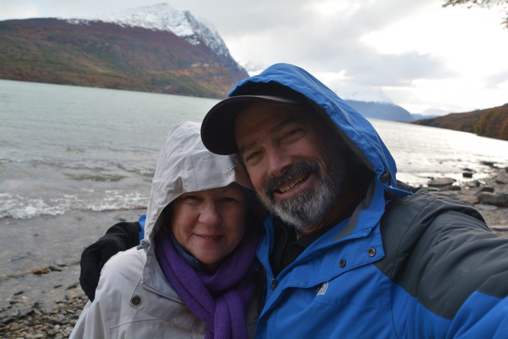
Tierra del Fuego National Park just outside Ushuaia provided great views but a very cold Antarctic wind
But even by Argentinean standards Ushuaia is not at the fin del mundo (end of the world). That honour is held by the end point of National Route 3 which runs past Ushuaia for about 24 kilometres, through Tierra del Fuego National Park and finishes at Bahia Lapatia, the true end of the road.
Julie and I followed this road into the national park which protected a magnificent coastline and waterways right up to the Chilean border. From there we drove to the end of the road and triumphantly posed for photos to mark the occasion at this famous sign. The sign says it is 17,848 kilometres to Alaska – well, we’re not sure how they came up with this measurement but I checked the spreadsheet and since leaving Prudhoe Bay, Alaska on the shores of the Arctic Ocean to get to this point we had driven 41,220 kilometres or 25,760 miles. Now that’s an adventure and a half!
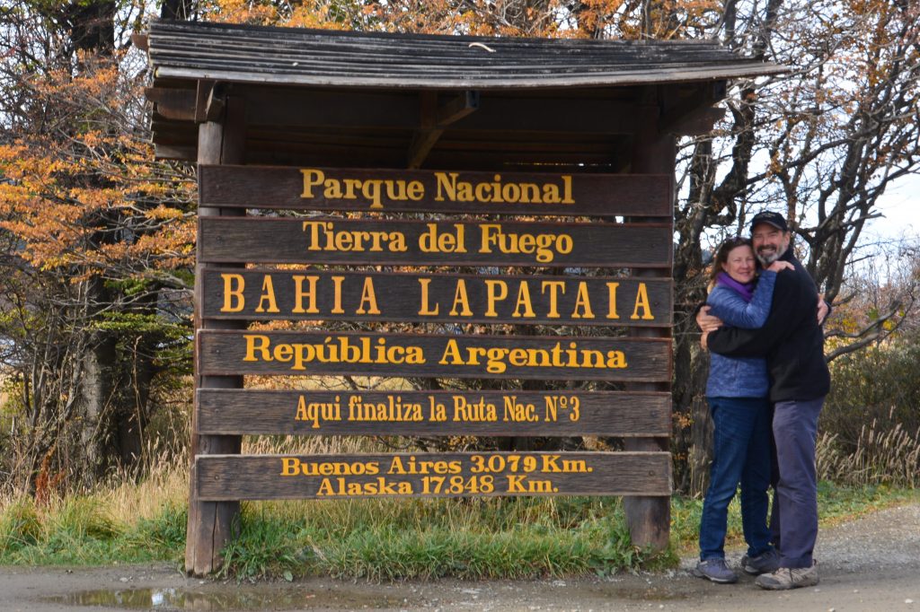
A really special moment, Julie and I have completed our journey from the northern shores of North America to the southern shores of South America
Nine years ago Julie and I posed in front of this sign but we were in a hire car from Ushuaia and our total journey was about 24 kilometres. At that time we spoke longingly and hopefully about some day on our Follow the Sun journey we would be standing at the same place having driven here from North America. And today we fulfilled that outrageous ambition – really one of the true highlights of our entire trip.
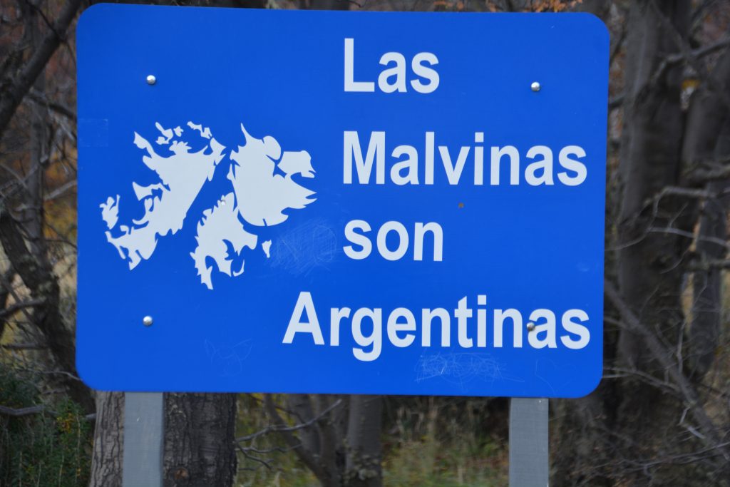
Another sign at the end of the road, one that we have seen many times, saying “The Malvinas (Falkland Islands) are Argentinians”. Wishful thinking.
We camped that night in the Tierra del Fuego National Park with its yellow and orange trees, grey mountains and sparkling white-covered tops. The next day we would turn around and start heading north.


What an amazing achievement Mum and Dad.
The worst part about your travels is that my list keeps getting longer!
Thanks Zach. There’s nothing better than a good travel list!
Thank you, thank you, thank you. You cannot know how much I am enjoying your story, so many places I have heard of, but will never see, and so many more that I need Google Maps to find for me. Your story and beautiful photos make me feel like I am there with you both. As our temperatures drop for winter, I can almost believe how cold you are, just without the beautiful scenery. Please stay safe, as you continue your journey back to the Northern Hemisphere and a warmer Sun.
Lots of love and hugs, Anne xoxoxo
Thank you Anne, that’s very kind. It’s been a wonderful journey so far and we’ve got much more to do! Hi to Steve.
Cheers,
Bill
Fabulous photos. Again. Thanks for sharing the beauty of your journey with us Bill and Julie.
Thanks Tracy. The photos are part of the fun, seeing new places with a different perspective and reliving them anytime we want. Take care, Bill