Let’s get high!
Peru is unquestionably most famous for the ancient Inca capital of Machu Picchu, and with good reason, but beyond that Peru is associated with the dramatic Andes mountains that run down its spine and provide some of the most spectacular mountains in the world. People come from all over to trek, climb, raft, backpack, drive, photograph and admire the Peruvian Andes. We had spent a few days exploring northern Peru and passing through its vast desert, now we were ready to go uphill and find out what all the mountain fuss was about.
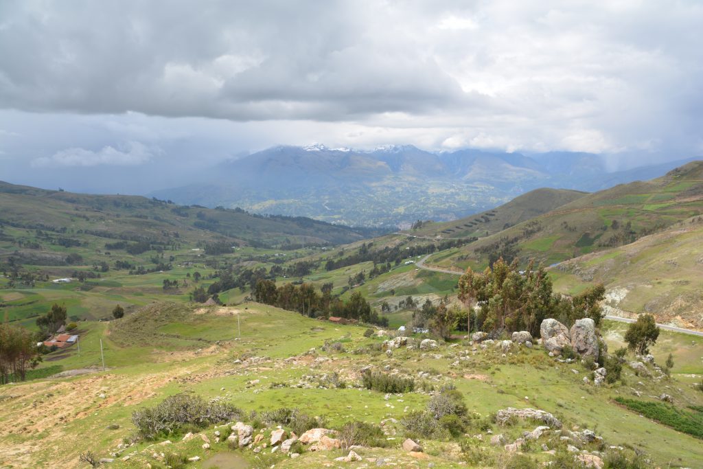
Great views on every corner – the climb into the mountains took our breath away in more ways than one
Our target the first day was the high-altitude town of Huaraz, smack dab in the middle of the famous Cordillera Blanca mountain range and a busy hub for all things mountain. The Cordillera Blancas are mecca for those who want to get high with its 18 summits above 6,000 metres and neck-bending views of jagged peaks, imposing glaciers and raging streams. Our visit was in the low season, the rainy season, but we were determined to take in as much as we could.
We drove from sea level to the high mountain pass standing between us and Huaraz, having a chilly lunch at an amazing 4,202 metres, or about 13,800 feet. The road to get to this point was a stunning sequence of sections carved into the steep mountain, switchbacks, rockfalls, missing guardrails, dizzy views, narrow gravel sections, more switchbacks, more breathtaking views. This was the highest point we had made on this trip but the fog and cold wind deprived us of the higher mountain views all around.
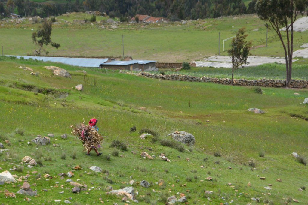
Hard work – this woman was herding sheep, collecting firewood and probably running the household as well
We repeated the sequence down into Huaraz, trying to photograph the patchwork crops tendered by these hard-working Peruvians. It wouldn’t be easy living at 3,500 metres with the thin air, terrible weather and remote conditions but the small communities clinging to the hillsides somehow survive on their small plots of corn and other hearty crops.
Huaraz was a pleasant surprise, a bustling regional centre, the market in full blast, people everywhere, most of the women in traditional dress with that striking top hat, often tilted slightly on their head with a bit of panache. At 3,000 metres (10,100 feet) it was easy to get dizzy or out of breath by simply crossing the street. We explored the markets and some of the side streets, occasionally gazing up at the mountains that peaked out of the clouds. By late afternoon it was starting to rain and we camped inside the locked gates of a three-star hotel, staying warm and cosy.
But we wanted more, much more. The next day we aimed for Huascaran National Park which protects the biggest and the best of the Cordillera Blanca range. Our plan was to cross the range and end up at the high mountain isolated town of Chacas but to do that would mean crossing what has to be one of the most spectacular mountain pass roads anywhere in the world.
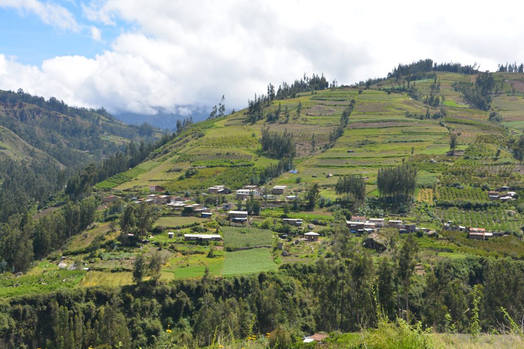
The terraces up the mountain slopes give some indication about how hard these farmers must work at these high altitudes
We saw the narrow canyon well before starting the steep climb and thought for certain the road must surely take us somewhere else. But up and up the road went, winding its way through small communities and terraced fields, goats, pigs and cattle scattered about. Sure enough, the road took us through this narrow canyon with its steep walls, switchback after switchback taking us ever higher.
The clouds gave us glimpses of the snowy mountain peaks and the huge glaciers above us but as we climbed the continuous switchbacks the glaciers got closer until finally we were level with them. By now the light rain had turned to a slushy snow, the headlights cut through the fog and the thermometer dropped to about 5C (41F). We topped out at a dizzying 4,734 metres (15,500 feet) which is much higher than the highest point in the Continental United States and much higher than the clouds in Australia. We entered a mile long tunnel that took us through to the other side and began our long switchback descent, passing some gorgeous glacier lakes along the way.
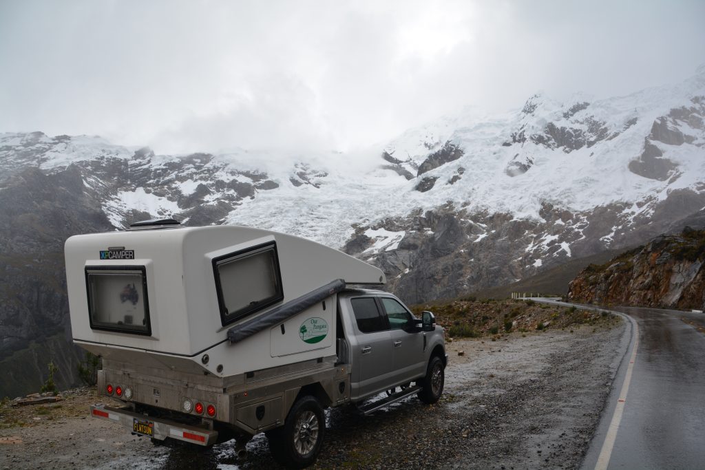
Tramp rests near the top. Its cold, its snowing and the air is thin, not ideal for his digestive system.
The small mountain town of Chacas, elevation 3,800 metres, has none of the hustle and bustle of its big brother Huaraz from the other side of the mountains. Here things move to the rhythm of the mountains all around it, which means slow. We parked on the main square, suddenly becoming a spectacle for all the locals who were enjoying a relaxing Palm Sunday afternoon. We visited the church and explored the neighbouring streets, loving the traditional dress of the women and marvelling at the old buildings and the weathered faces of those standing in the doorways.

There’s no hurry in Chacas – these women are sitting in the windows that form the base of the church on the main square
After checking at a hotel that the road heading south on the eastern side of the mountains was passable, and being told it was ‘normal’, we headed out of town for the village of San Luis, then south toward San Marcos.
But hang on, what is normal to a girl in Chacas is not normal to us. This road, which on the maps was showing as National Highway 105, was nothing more than a single lane dirt track, winding its way up and around the mountains, through small muddy villages, rough rocky switchbacks, steep mountainsides, no guardrails. Our GPS kept getting confused, we fluctuated between confusion and excitement, a few wrong turns were corrected by humoured locals who would wave their hands and send us another way. Ya gotta laugh.
But this road also went up, seriously up, and eventually we topped out at 4,325 metres (14,200 feet) where nothing was growing but arctic tundra grass. Our second 4,000 metre peak in one day, neither of them expected, both of them welcomed, both of them celebrated.
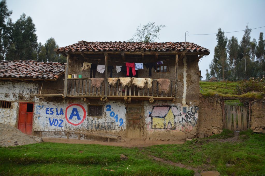
In Peru the political parties pay the home-owners to have their house painted with party colours and slogans
But steep dirt tracks, even if they are National Highway 105, go bad when it starts to rain, which is what it did. So as dusk settled on us the track turned into more like a canal and we were lucky to find a flattish spot next to a raging little creek along the side of the road that was big enough to park Tramp. We named the creek Desperation Creek in honour of our predicament. At 3,400 metres (11,150 feet) it was our highest camping spot and a bit challenging with the light-headedness but the view down the valley was great and we stayed warm and dry inside while it steadily rained outside.
But one does not escape from the Cordillera Blanca easily. The next morning the narrow muddy track continued as we weaved our way through little villages, often hearing a loud ‘Gringo!’ when we were spotted by the locals, or sometimes just starred at as if we were aliens – and considering the simple life of these remote villagers I guess we were.
And then magically, and thankfully, the road turned to pavement. Soon after it started winding it’s way back up the mountain, passing back into Huascaran National Park, climbing through a series of steep switchbacks, dramatic snow-capped mountains all around us, until it topped out at 4,335 metres (14,200 feet) and passed through another tunnel onto the other side. From there it was dramatically down the mountain again and out onto a broader open plain.
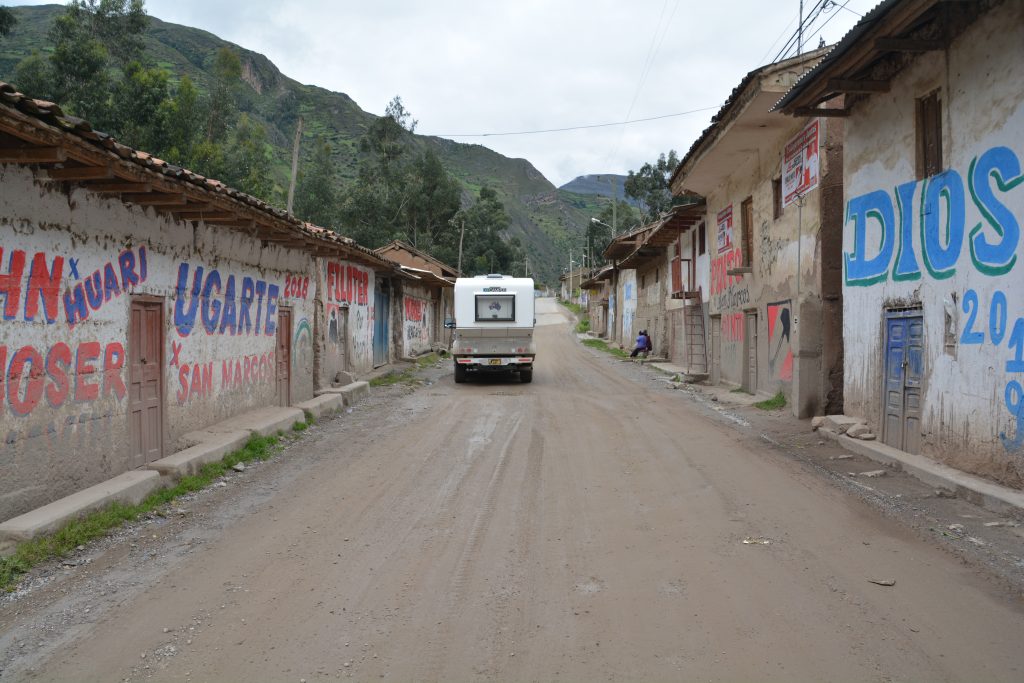
We went through dozens of these little villages, dirt road, political paintings on the walls, very little sign of activity
But wait – we’re not finished yet because in order to cross the final range before descending back down the coast there is one more pass to cross. We followed the endlessly winding road up to 4,100 metres, our fourth pass of such height in two days, which featured vast open plains at a level where usually you would expect jagged snow-covered peaks. But in this case the jagged peaks were hiding behind the clouds in the background at a numbing 6,000 metres.
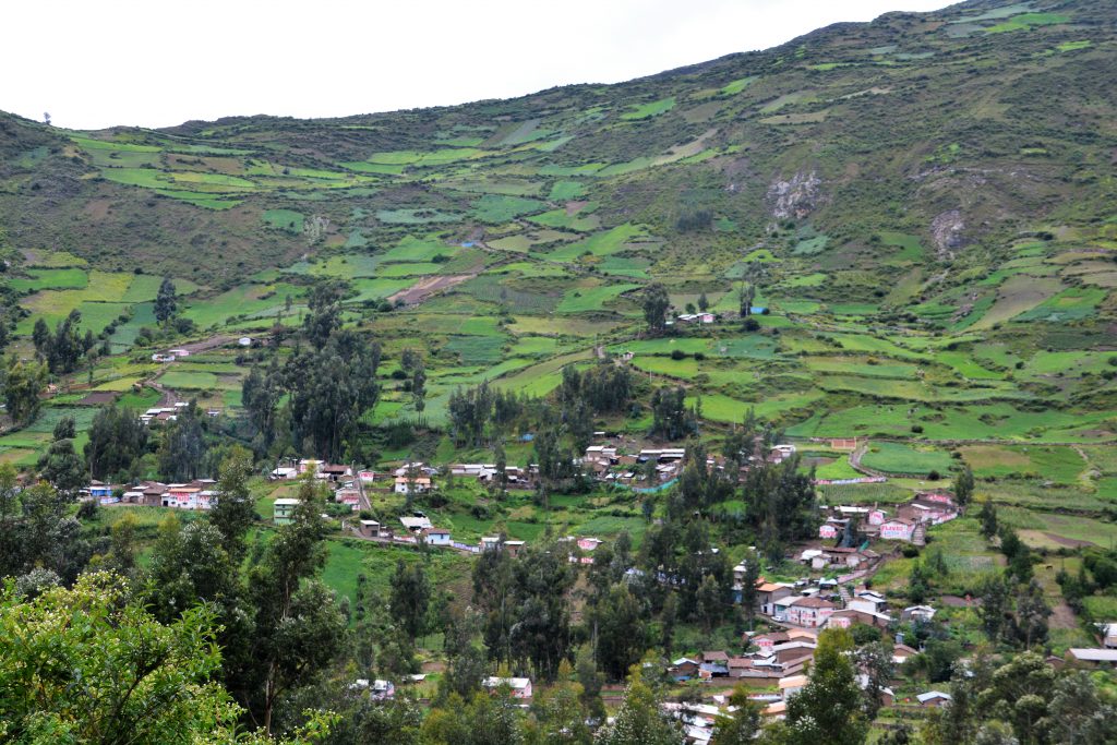
The farmers’ patchwork fields up the mountain slopes always amazed us – imagine the hard work at this altitude
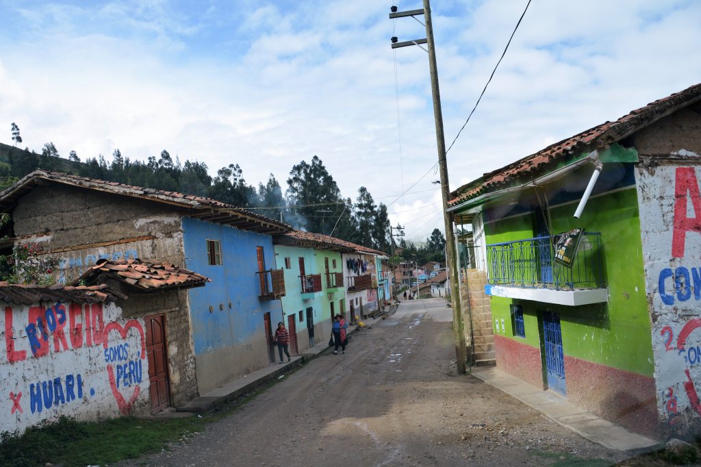
Another typical village scene – we always got stares and sometimes heard a friendly ‘Gringo!’ called out

One lesson of the Cordillera Blancas – the switchbacks are either going up or going down but they never end
After another million switchbacks the road finally led us back down to the brown desert mountains of the coast and before long the ocean was in sight again. But the feature of Peru’s northern coast is endless desert, high rocky mountains and extensive lifeless sand dunes. I say lifeless but that’s not quite right – there are the occasional villages and towns that somehow hang on despite the omnipresent sand and the sandy haze that obliterates any blue skies.
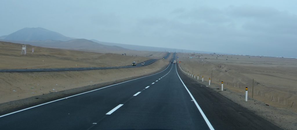
How can we go from the mountains to this desolate desert scene in just a couple of hours? Only in Peru.
Home for us that night was in the Lomas de Lachay National Reserve, an odd place in the desert that captures and retains thick fog on its mountainous shoulders, thereby giving the place a somewhat eerie and otherworldly feel. Never mind, we drove up the sandy hill and had the place to ourselves, surrounded by fog-shrouded views from our lofty perch and our loving coveted peace and quiet.
We spent another day moving south along the coast, the morning marked by apocalyptic gloom as the thick haze and sand blowing over the highway gave the drive a real Mad Max feeling. We hit Lima, a sprawling chaotic city of ten million (fun fact: Lima is ten times bigger than the next largest city in Peru) and agonisingly crawled through the lunatic traffic, popping out at the south side almost two hours later.
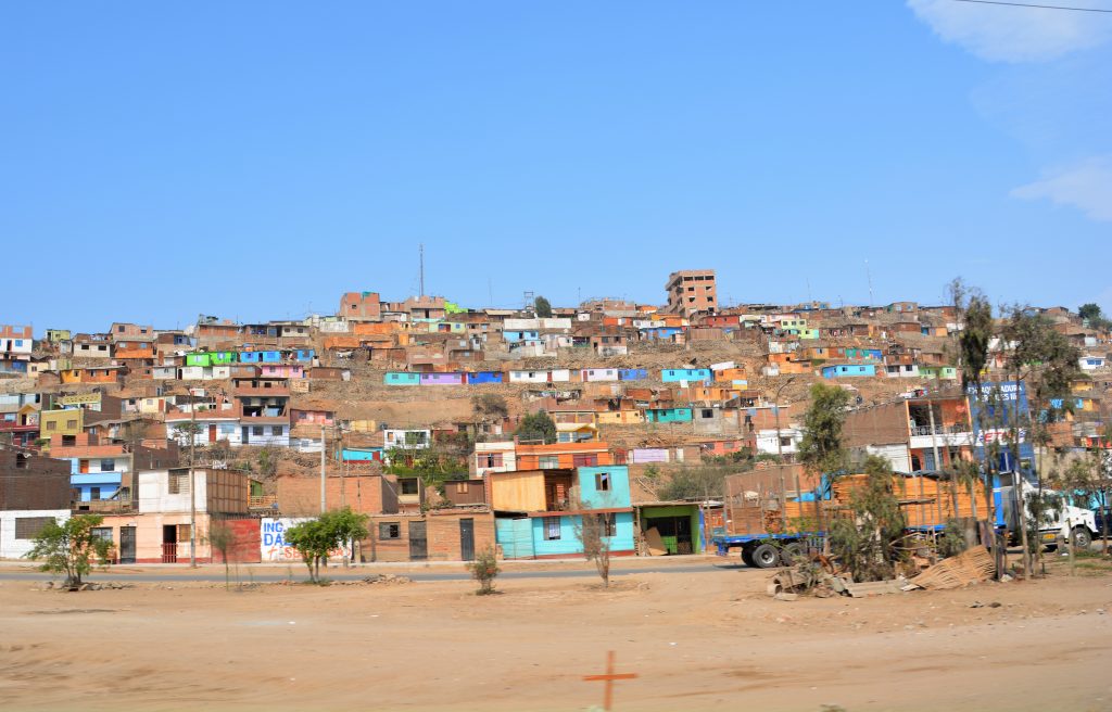
A suburb of Lima shows a rare bit of colour and made the community look much brighter than just the standard desert shade
We then fluked a sighting of a Goodyear tire store and had Tramp’s poor front right paw, which had a slow leak needing reinflation every day, repaired and swapped with the new spare. That single tire has copped the blunt from our driving and now sits in semi-retirement with five patches and one plug in it. No other tire has more than a scratch.
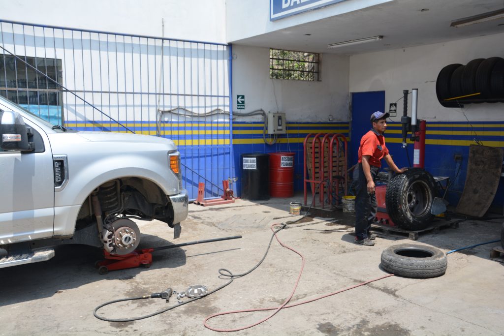
Tramp gets a quick repair job at the dentist – one tire has copped all the pain while the rest are almost perfect
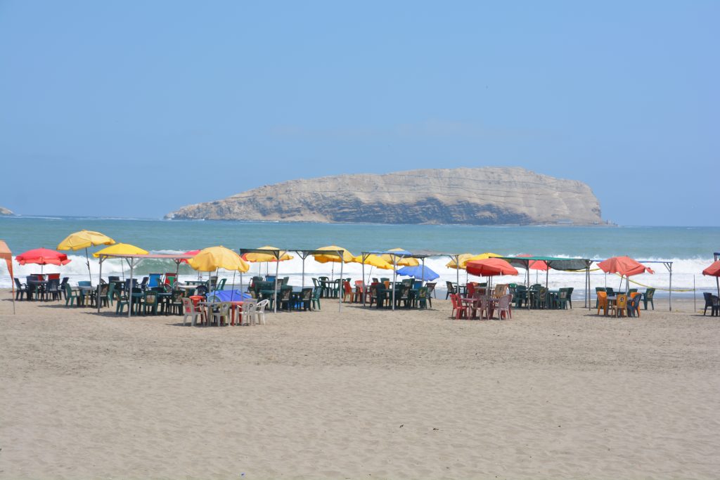
The beaches south of Lima had potential and the offshore islands looked cool but we were there out of season and it was very quiet
The haze blessedly cleared and as we moved south past big wide beaches that the good people of Lima flock to on the weekends the sand dunes became bigger and continuous such that any pretence of rock or mountain was lost to the ginormous sand dunes. We ended the day at a town called Huacachina at the base of some of the largest and most imposing sand dunes. This site is on the tourist trail for people to ride dune buggies up and around these massive dunes and to ride sand boards down their steep slopes. We ended the day around a pool at an ‘ecocamp’ at the base of these mountainous dunes, an extraordinary setting.
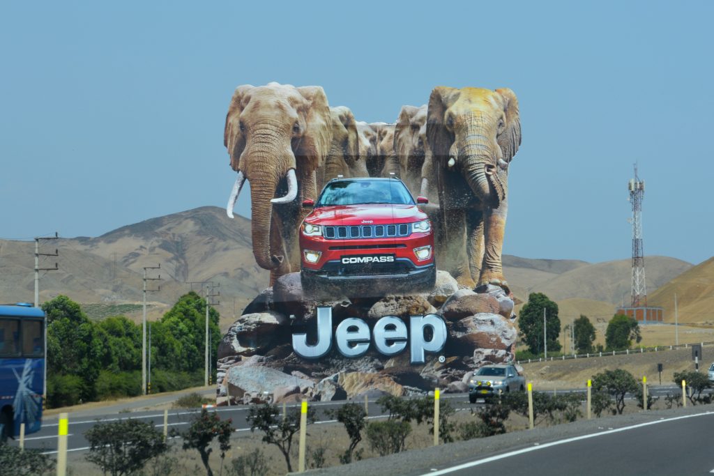
They take their billboards very serious here – we saw many imposing signs like this one along the desert highway
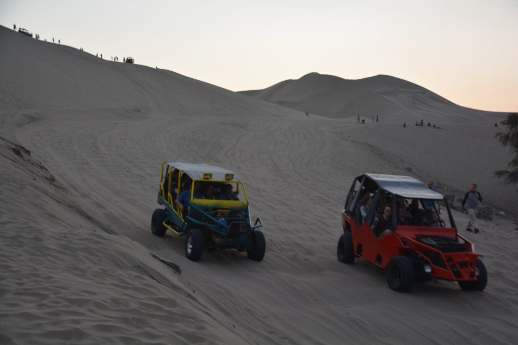
We camped in Huacachina at the base of massive sand dunes and watched the dune buggies race up and down the slopes at sunset
Peru has many more surprises in store for us, including another jaunt into the mountains to the famed Inca city of Cusco and Machu Picchu. We couldn’t wait.



Comments
Let’s get high! — No Comments
HTML tags allowed in your comment: <a href="" title=""> <abbr title=""> <acronym title=""> <b> <blockquote cite=""> <cite> <code> <del datetime=""> <em> <i> <q cite=""> <s> <strike> <strong>