Guatemala is go!
What did we know about Guatemala before hitting the border? Well, actually, not that much. Northern Guatemala hosts the world-renowned Mayan ruin of Tikal, which was our first port of call, but otherwise the country has a fairly grim reputation and for many years was a complete no-go zone. We knew the situation had improved from those bad days but despite the excitement of hitting a new country there was some apprehension about what we might encounter. In any case, here we go!
Guatemala is one of those smallish Central American countries, a high percentage of Mayan indigenous people, another Spanish conquest and subsequent unsettled colony, a 30 year civil war marked by some dark periods of violence, drugs, disappearances and persecution. The last 20 years have been much better, some stability and growth but still significant poverty in rural areas, low literacy rates, poor medical care and high unemployment. Like many developing countries, Guatemala is a work in progress with some bright spots and still a lot of room for improvement.
We hit the Guatemalan border, now becoming more familiar with the whole routine, and made it out of Belize and into Guatemala inside of 45 minutes, our new record. The process involved paying a Belizean exit fee, cancelling our vehicle import permit, getting stamped out, then getting stamped into Guatemala, getting a vehicle import permit and getting Tramp fumigated.
We had to laugh when the Guatemalans, who normally charge Q17 (about US$3) for you to drive through a carwash-type structure to ‘fumigate’ made us do it twice – for twice the cost – because Tramp was so muddy. The whole idea of fumigating a car by driving through a single spray is ridiculous but to make us do it twice because we are muddy is double funny.
The Guatemalan countryside opened up to us as green rolling hills with cattle sometimes seen grazing in nearby paddocks. The villages lacked any graces, mostly muddy tracks leading to very modest homes, some with the traditional Mayan thatch roofs. We headed west, then north, our target the famous Tikal ruins, one of the extensive and significant Mayan ruins in Central America.
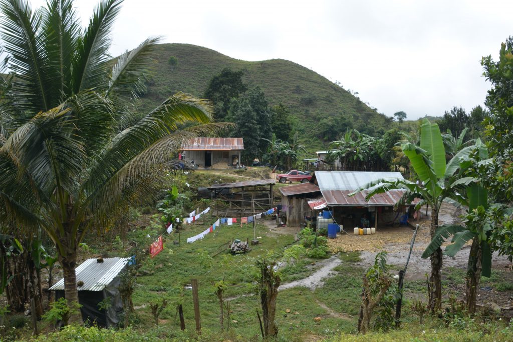
Living in the Guatemalan highlands is not easy – its hot, rains alot in season and you have to eke out a living from your small crops
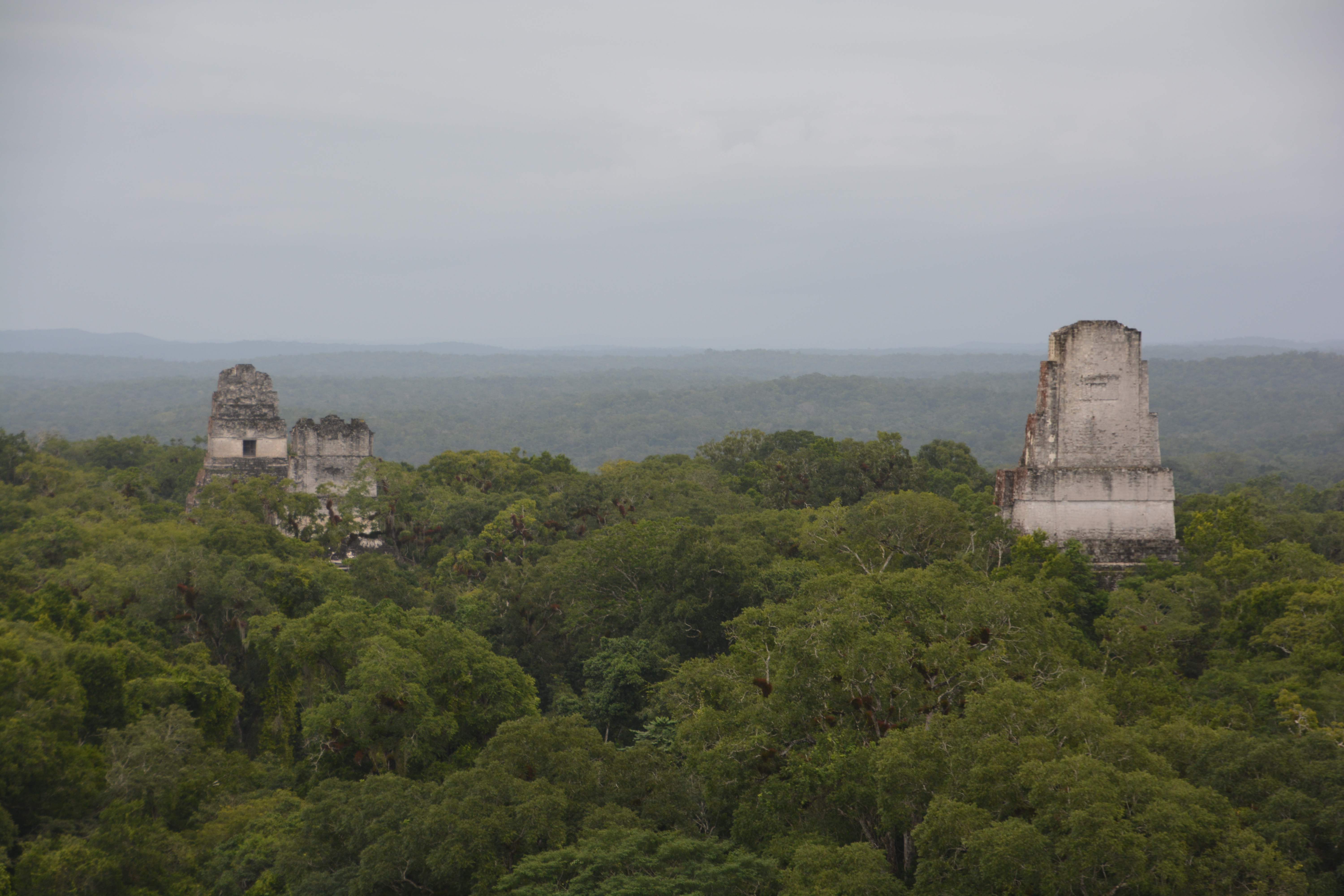
The city of Tikal began two centuries before Christ and by around 300 AD may have had 100,000 citizens. It is uniquely marked by its tall temples rising above the jungle canopy, some of them over 50 metres (165 feet) high and one an astonishing 65 metres. Their steep steps, sometimes at a 50 degree angle, provide breathless views of the surrounding hills and valleys.
But Tikal is also unique because it is quite spread out and there is thick dark jungle between the temples or the various acropolises. This means you have to follow the ancient paths through the jungle, sometimes for 20 minutes or more, often times without any sound other than the monkeys or other strange critters that live amongst the vines, trees and thick bushes that make up the jungle.
We loved the grand plaza with the site’s most famous structure – the Grand Jaguar Temple – and climbed as many temples as we could before closing time. Tikal was ruled by a dynastic family for many centuries, by one count 34 continuous rulers from the same family, and its fortunes rose and fell as its army won or lost battles against neighbouring empires and droughts affected their water supply and crops. Like many Mayan cities, Tikal declined and was abandoned sometime around the 10th century but the city’s legacy is its towering temples scraped clear of the thick jungle and proudly proclaiming its robust history. We loved the whole experience.
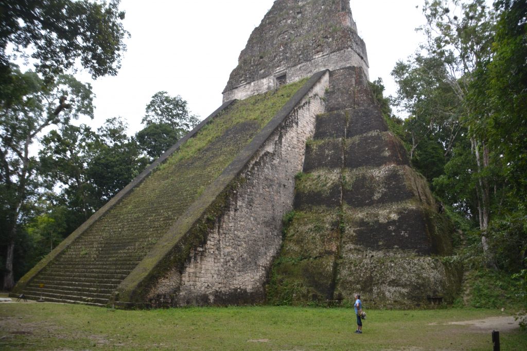
Julie is dwarfed by Temple 5, an impressive temple set apart from the other structures but poking up over the trees
The next morning we headed south to the picturesque town of Flores which covers a little island on Lake Peten Itza, connected to the mainland by a 500 metre causeway. We spent some time wandering its narrow cobblestone streets with its old brightly coloured buildings, enjoying all the red tuk tuks that took us back to Thailand and soaking up the picturesque scenes that surrounded us. Flores is very cool.
After buying optional third-party car insurance for Guatemala and neighbouring countries we headed south on the main road which eventually leads to the country’s capital Guatemala City. The road followed the contours of the land, up and over the rolling hills, between the rounded limestone karst mounds that popped up across the countryside like a field of giant boobs, past rich fertile fields sporting corn – the staple crop of Guatemala, through villages with women carrying water on their heads and everyone’s clothes hanging out to dry, dealt with the goats, pigs, dogs and children that frequented the roads plus the occasional knee deep potholes and knee high speed bumps. It was a fabulous driving experience.
We camped in the town of Rio Dulce in the grounds of a small hotel near the San Felipe Castle, a fortress built by the Spanish on Lake Izabel to help defend their newly claimed land. The next day we drove across the country, and in effect almost entirely across the isthmus of Central America, to the historic old town of Antigua.
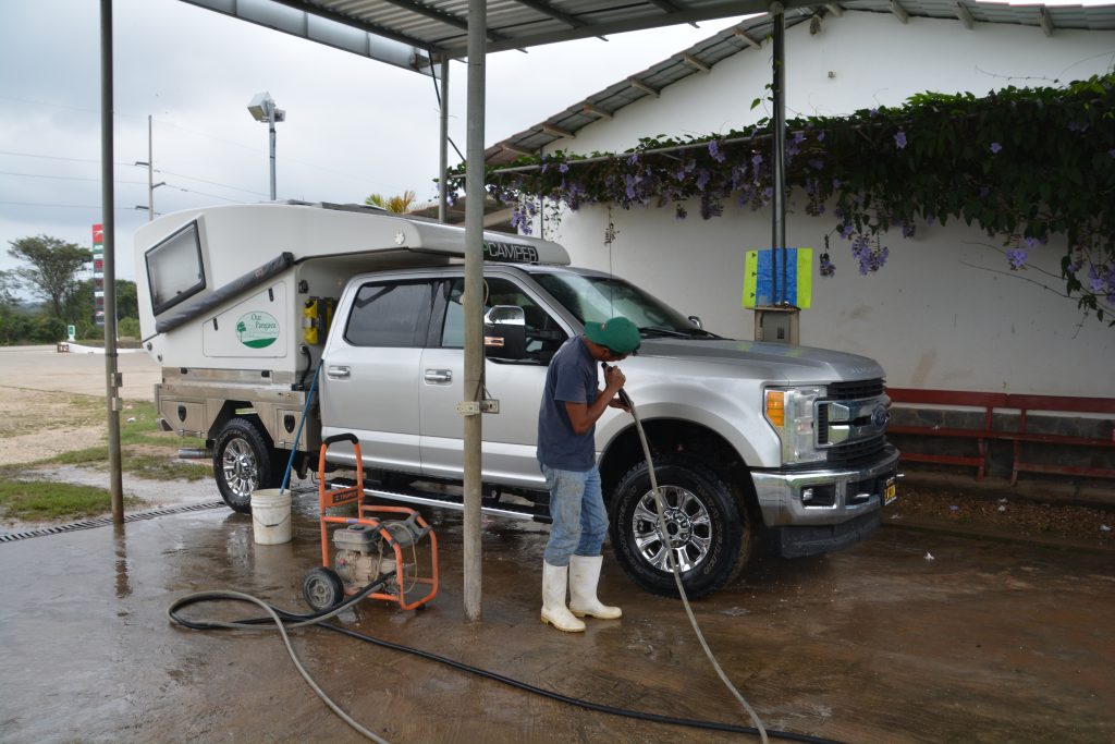
We decided to give Tramp a bath since it was still covered with Belizean mud and Guatemalan fumigation fluid. Cost: $1.50
The drive proved to be one of the most diverse and interesting days we’ve had on our entire trip. It started off in the wet jungle of eastern Guatemala, passed over some mountains into dry rolling hills with crops of corn and melons interspersed with extensive cattle ranches, survived the massive traffic-clogged capital of Guatemala City but not before battling extreme road construction over some extreme mountains and finished in the beautiful historic town of Antigua.
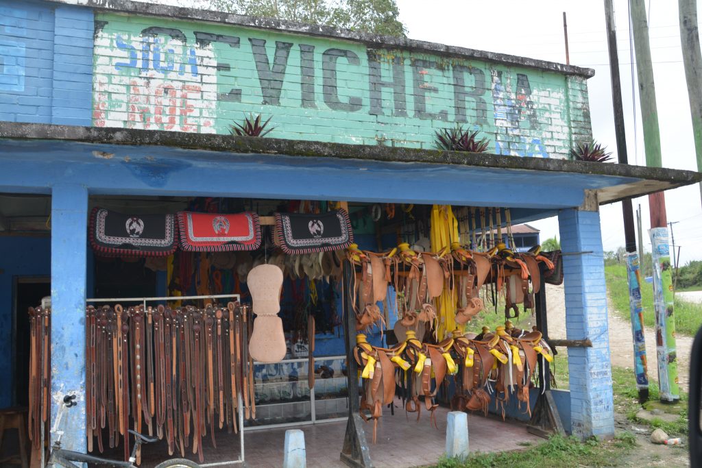
We saw quite a few people on horseback, not just working their cattle but also just as transport. Many shops offered gear for cowboys.
The roads of Guatemala are generally good, or good enough, but the challenge is the long line of huge trucks which chug along these roads, often creating slowed traffic of more than 30 vehicles. This causes some drivers to act suicidally (or murderously) and when you throw in the occasional long stretch of permanent road construction, the animals, the motorbikes and the pedestrians – all on the national highway – you can have some serious chaos.
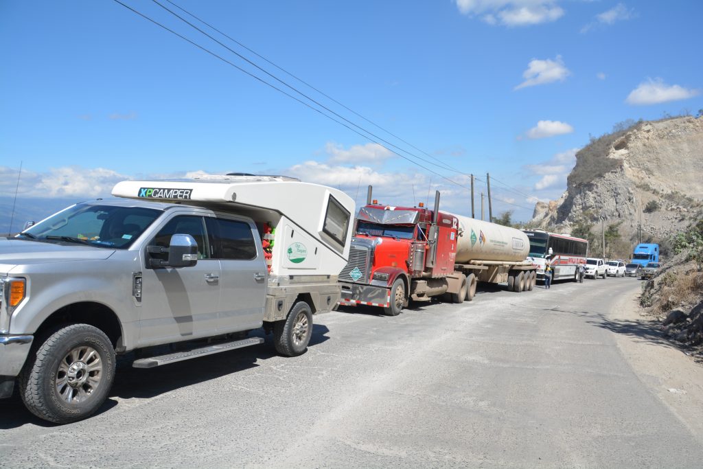
Traffic on the national highway came to a complete stop for almost an hour because of construction on the mountain pass near the capital. You have to take everything in your stride and keep the engine running for the air-con.
But Antigua was worth the effort. Originally founded by the Spanish as the capital of the territory before it was partially destroyed by earthquakes, the town features numerous beautiful old churches and other grand buildings, cobblestone streets and shady tree-lined plazas from the 16th and 17th century. Julie and I walked through the town at night, loving the historic and cultural atmosphere of a busy Friday night and supported the local economy with drinks and a delicious dinner.
The next day we did more of the same, visiting many of the town’s old churches, some of them in partial ruins from the earthquake in the 1770’s but still defiantly standing, the old plaza with its two original palaces and all the many shops selling colourful textiles made by Guatemalans, much of the most beautiful material all hand stitched. We also walked up the hill overlooking town for aerial views of the red tile roofs, church domes and the cloud-covered volcano that stood guard over the town.
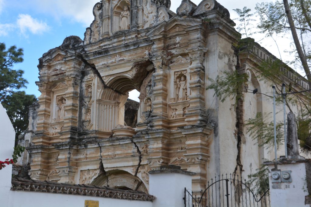
One of the many Spanish-built churches that were damaged in an 18th century earthquake, abandoned as a church but still stubbornly standing
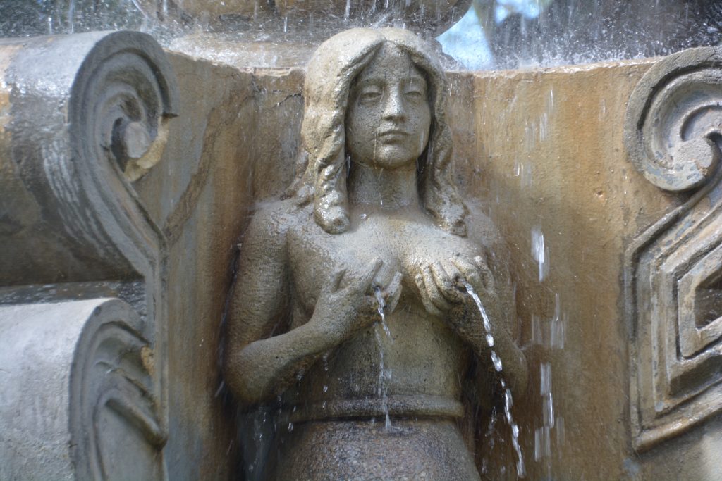
Okay, this fountain is a little unusual, mainly because it is the only one we’ve seen lately with water in it
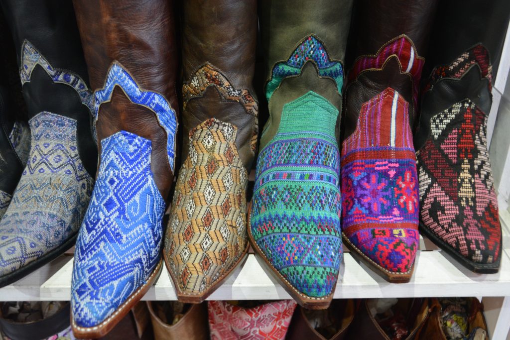
Guatemalans are famous for their colourful traditional clothes but how about a pair of Guatemalan boots?
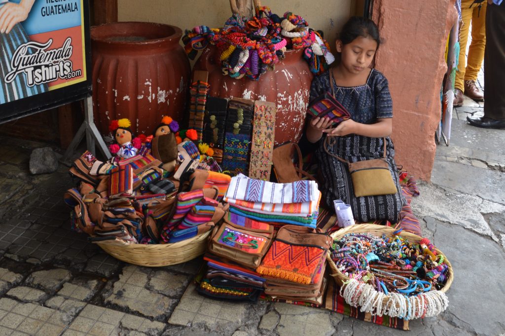
A young girl sells a variety of touristy-type things in Antigua but its usually about the bright traditional colours
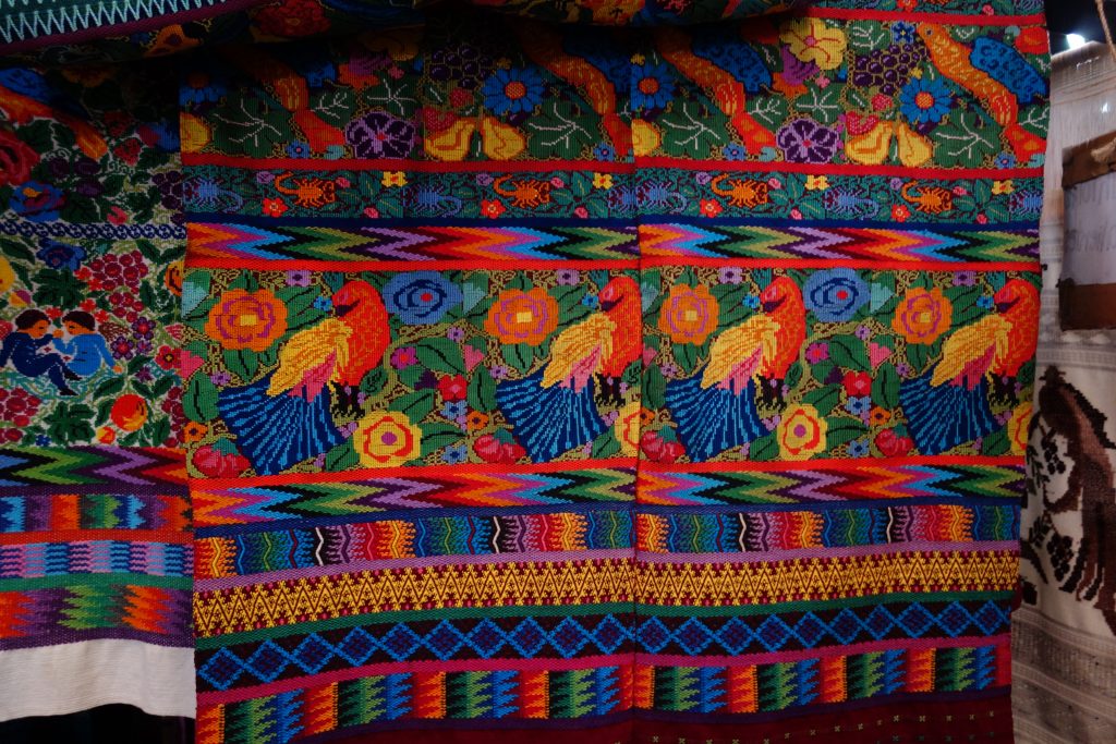
Julie was completely smitten by the beautiful hand-embroidered clothing that was available through the many shops and village co-ops. This detailed work was just stunning and selling for relatively cheap prices.
Antigua today is also known for its Spanish language schools and up to 1,000 students from all over the world can be in town at any time learning Spanish in intense one-on-one classes. We also saw this in the Mexican town of Guanajuato and both cities would be delightful places to hang out for a month while you habla Espanol.
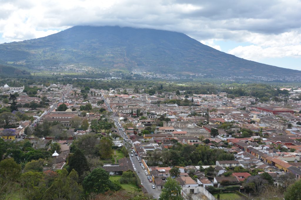
Antigua from the top of a nearby hill – its all about (cloud-covered) volcanos, red tile roofs and domed churches
Our next target was Lake Atitlan, perched high in the volcanic mountains not far from Antigua but the drive there had two halves. The first half was a grid-lock traffic jam in the small town of Chimaltenango where the only road through town came to a standstill because of one intersection and the selfish Guatemalan drivers. We sat for one and a half hours virtually without moving before finally breaking through.
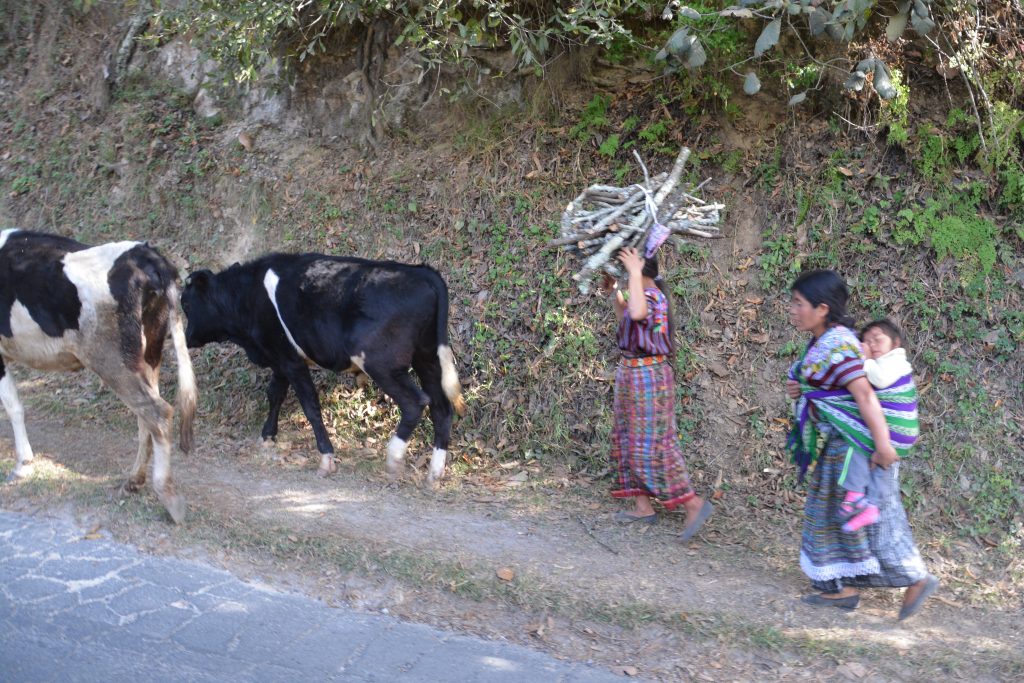
Amazing roadside scenes – a mother carries her infant on her back while another woman carries a supply of firewood while they walk their two cows home
The second half was an extraordinary drive through some B roads (our choice, we could have gone the conventional way on the main road) through a few traditional villages where women still wear their beautiful hand-stitched dresses and wash their clothes in the communal water trough in the centre of town. The winding mountainous roads rose up and down across incredibly steep mountain faces, the roads in terrible condition, frequent landslides, even bridges washed out. Crazy stuff but exceptionally good fun.
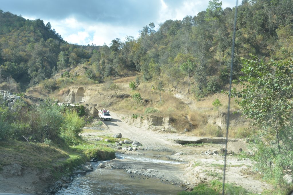
A crazy mountain road led us along steep mountainsides and through some beautiful country but also across this creek after the bridge had been washed out
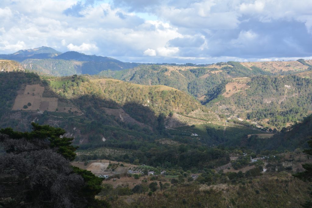
Some of the mountain scenery we passed through – note the steep hillside that has been cleared for corn crops
We arrived at the rim of Lake Atitlan to gaze down on its blue waters with three huge volcanoes surrounding it. No wonder this is a popular place to visit for Guatemalans and foreigners – the views were stunning. We drove down the narrow road to the town of Panajachel where we camped for the night in a friendly car park and enjoyed the colourful souvenir shopping, bars and a restaurant of the town.
When visitors to Lake Atitlan are not climbing volcanos or growing their dreadlocks they are doing a boat tour of the lake so the next day Julie and I jumped on one of the many small tourist boats and spent the day visiting four different villages on the shores of this dramatic lake. Each small community had their own characteristics, one a hangout for young foreigners to do nothing, another an artist colony for beautiful Guatemalan art, one a large town with a cathedral built by the Spanish in 1547. It’s amazing to me that the Spanish were building a huge church in such a remote spot only a few years after stepping ashore.
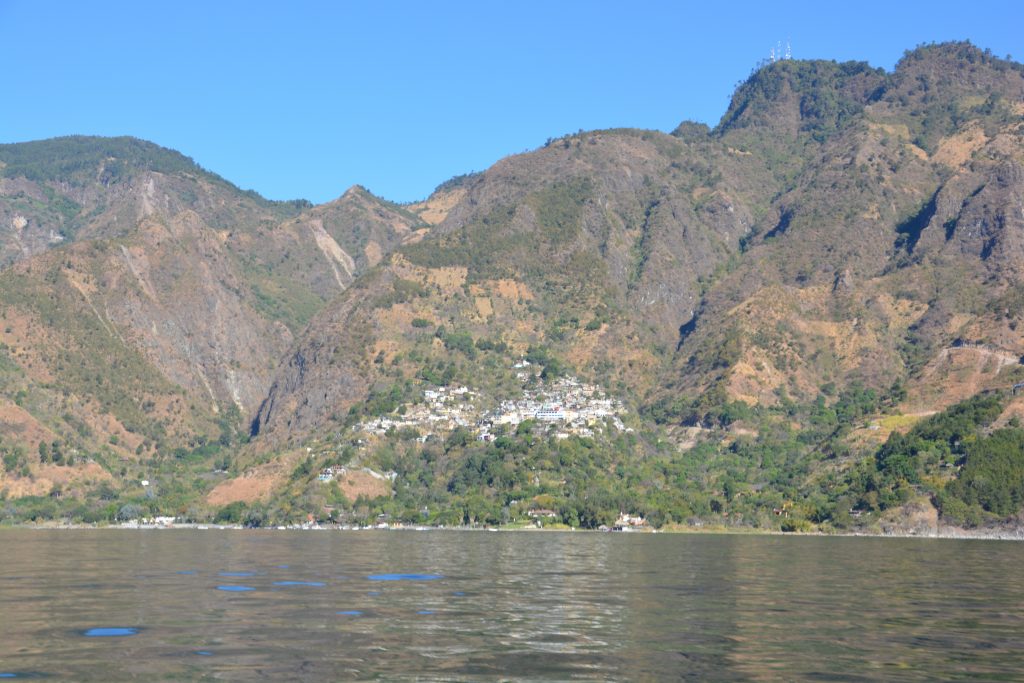
A small village pitched on the slope of the mountain near the shores of the lake – I can’t imagine what it would be like living there
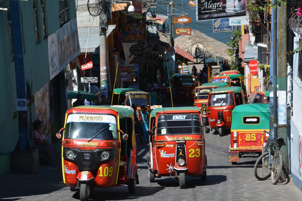
The lakeshore village of San Pedro was absolutely packed with tuk tuks, mainly because the village is built on such a steep slope
But the star of the day was the lake itself, its clear water a reminder to my youthful days at Lake Tahoe, its towering mountain slopes providing scant room for people to build their homes, let alone grow crops up the steep mountainside, and above all the three huge volcanos looming over our heads the whole day. Very cool stuff.
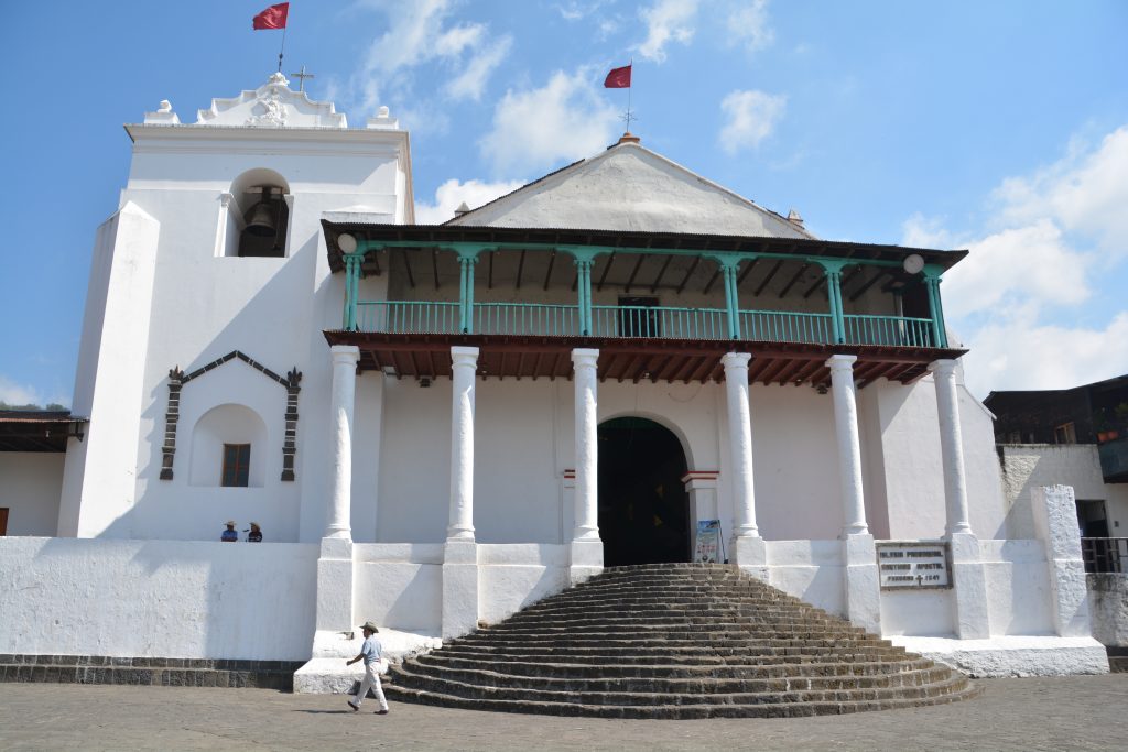
The town of Santiago had great views of the lake and an amazing Spanish cathedral from the 16th century
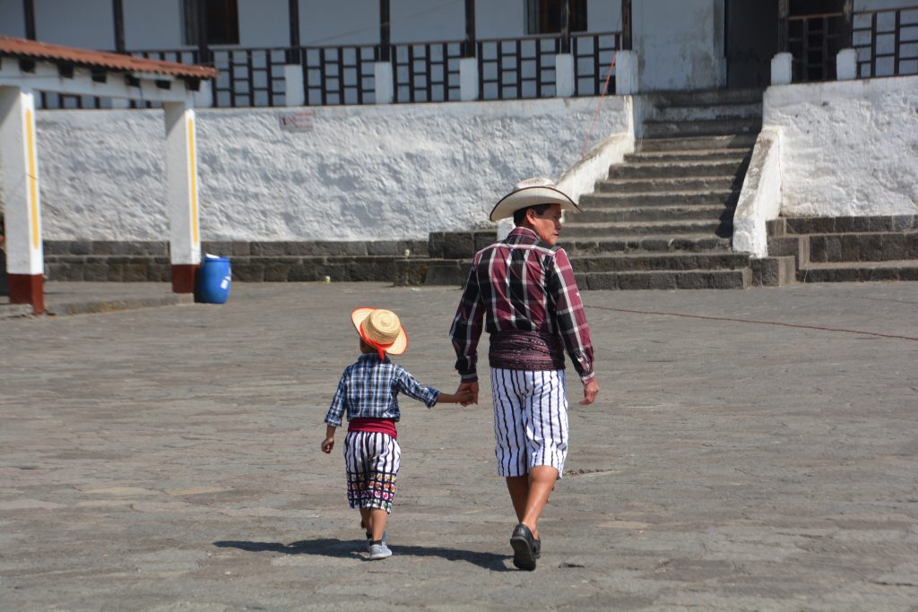
Father and son sport the local traditional dress in the large courtyard of the cathedral and don’t they look fabulous!
That evening back in Panajachel we treated ourselves to a night in a sports bar to watch the American Super Bowl game with a mixed crowd of North Americans and Guatemalans, great fun.
But our time in Guatemala was reluctantly coming to an end. The next morning we retraced our steps along the dramatic road that follows the rim of mountains around the lake, then headed south, dropping down through the large coffee plantations, corn and rubber trees. The temperature hit 98 degrees (36C) but it seemed like life in the villages and out in the fields carried on regardless. We hit the El Salvador border and easily passed through the Guatemalan side in less than 15 minutes. The El Salvador side would prove to take much longer.
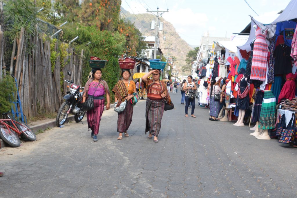
We loved the traditional dress of the women up in the mountain villages. They were beautifully hand embroidered, colourful and stylish. Great stuff!
Guatemala was a total surprise to us, partly because we had no expectations and went in with an open mind. The Mayan history, still seen on the round faces of people in the north and in their colourful traditional hand-stitched cloth, was fabulous, their beautiful mountains, rushing rivers, high altitude lakes, historic cities and warm, generous people really made this place special.
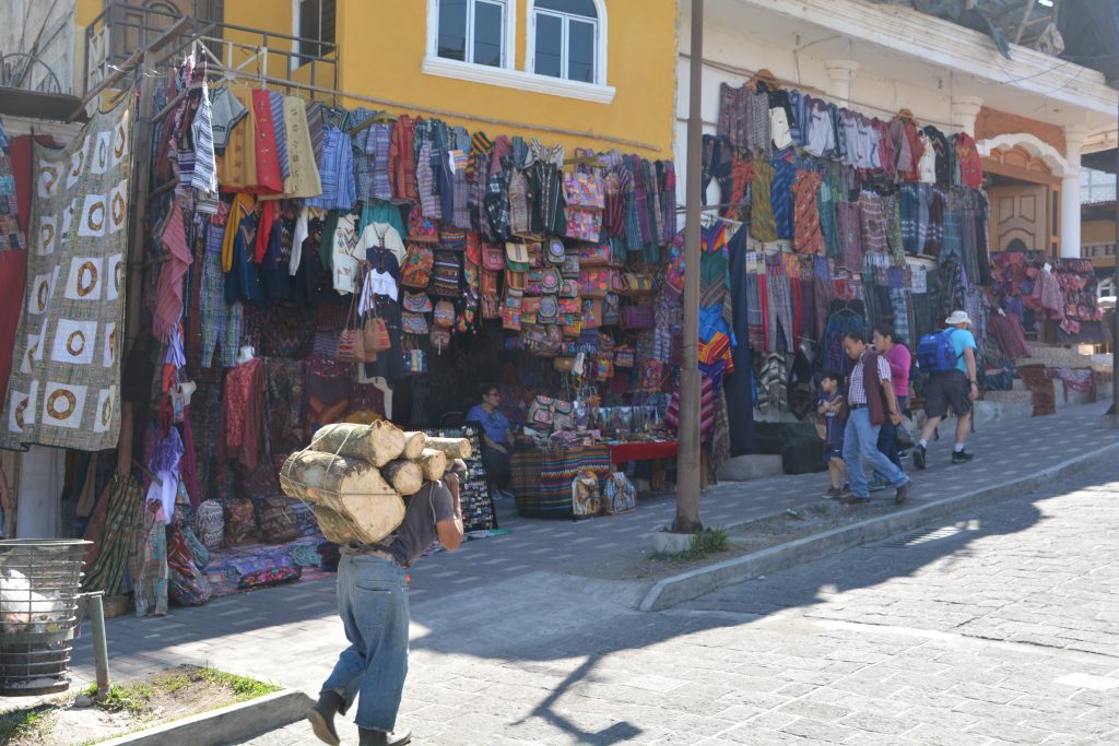
An old man is overloaded with wood which he will cut down for firewood while he walks past the tourist shops of Santiago
We didn’t have a single police check or hassle at all, not one moment passed where we felt at risk or threatened and every person we encountered was friendly and helpful without fail. We liked the T-shirts and beer, the food was okay if you’re into beans and rice, and the drivers were entertaining in a kamikaze sort of way. We were really bummed we couldn’t stay longer, there was much more to see if we had the time. Guatemala is go!




Comments
Guatemala is go! — No Comments
HTML tags allowed in your comment: <a href="" title=""> <abbr title=""> <acronym title=""> <b> <blockquote cite=""> <cite> <code> <del datetime=""> <em> <i> <q cite=""> <s> <strike> <strong>