Who wants to go to Bolivia?
Its a bit bright here in the middle of the Salar de Uyuni but what an amazing place
After 16 great days in Peru we finally made our way to the border near Lake Titicaca and passed into Bolivia. The full border crossing took only about 40 minutes, very fast, and there were only two lame attempts by Bolivian officials to extract a bribe from me. We climbed up and over a 4,200 metre pass and then took a ferry, which was really more like a barge, across a narrow neck of the lake before travelling towards Bolivia’s large capital La Paz.
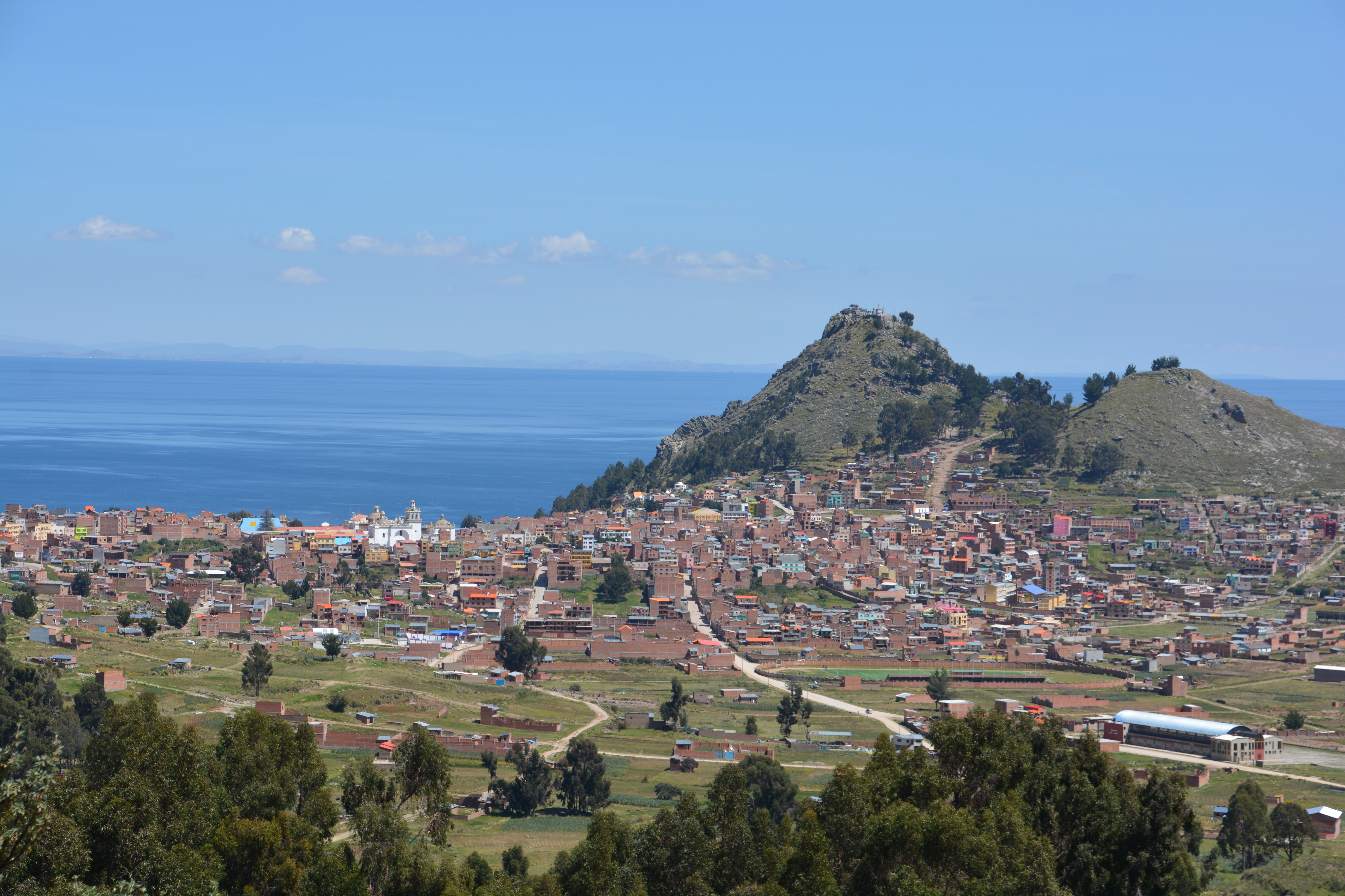
Our first view of Bolivia was a beauty, a small town nestled in against this mountain on the shores of Lake Titicaca
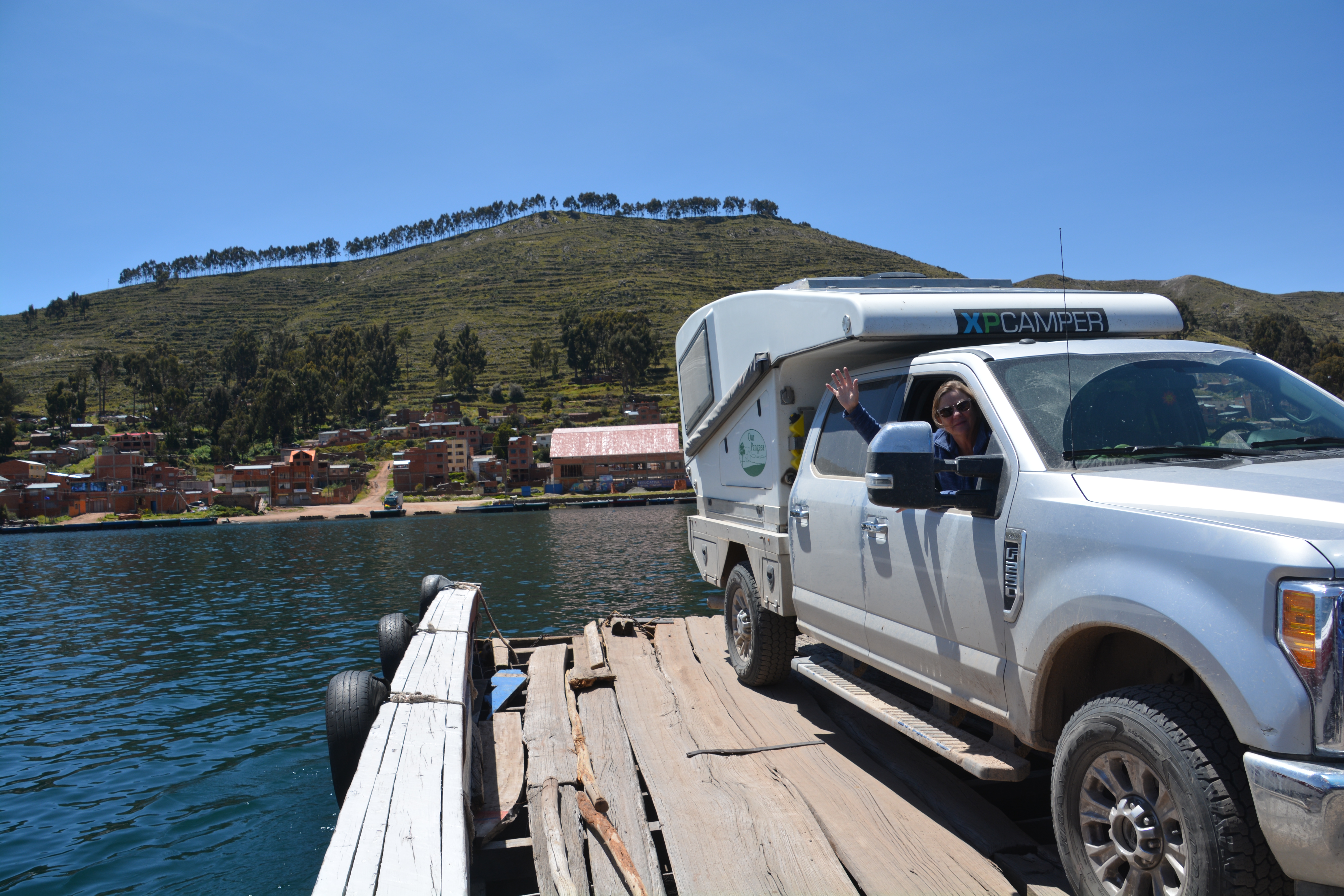
You call that a ferry? We crossed this narrow neck of the lake on an old barge powered by a single outboard motor
Bolivia is the poorest country in South America and has been wracked by political and social upheaval since its independence in 1825 (an independence, by the way, thanks to the efforts of our hero Simon Bolivar, for whom the country is named). It has been described as the Tibet of the Americas due to it being landlocked, its high elevation, isolation and rugged mountains.
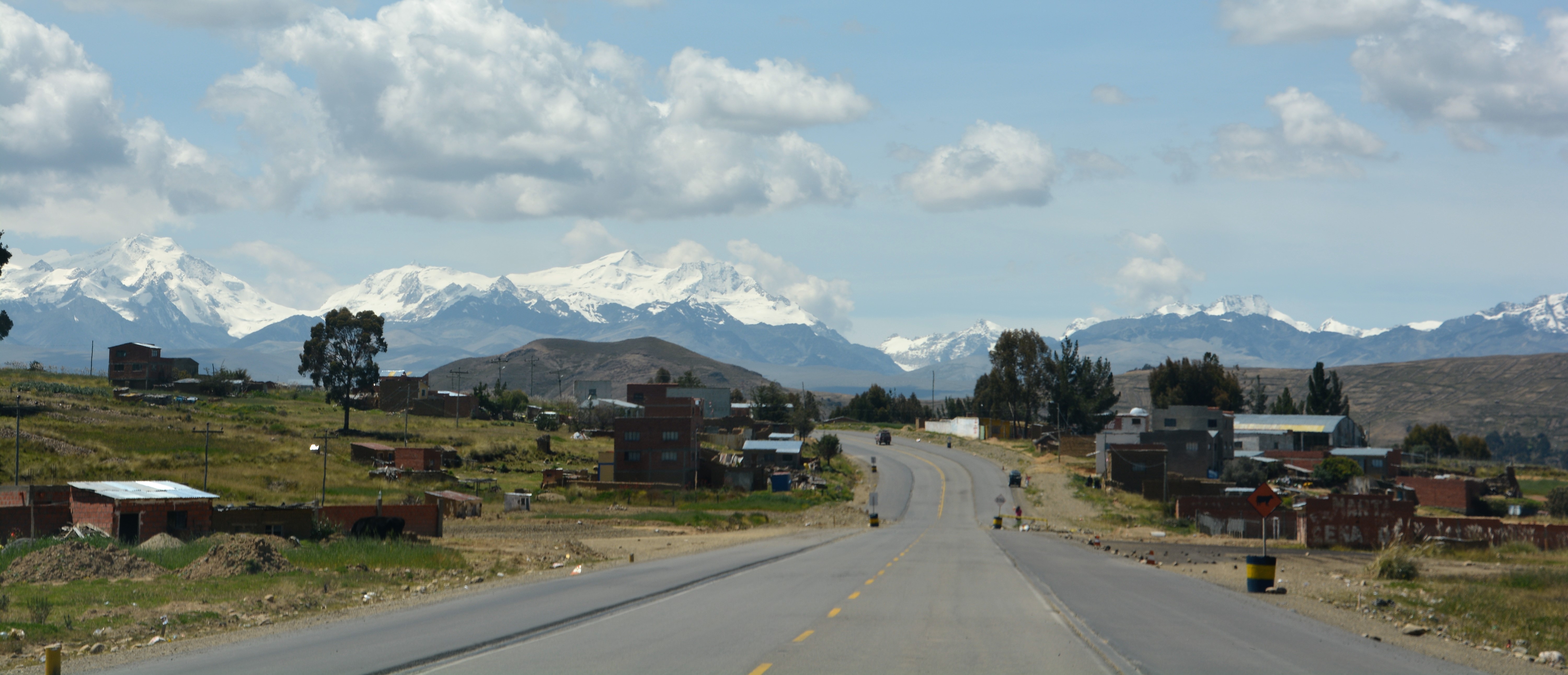
A taste of things to come – fertile land and huge snow-capped mountains in the background
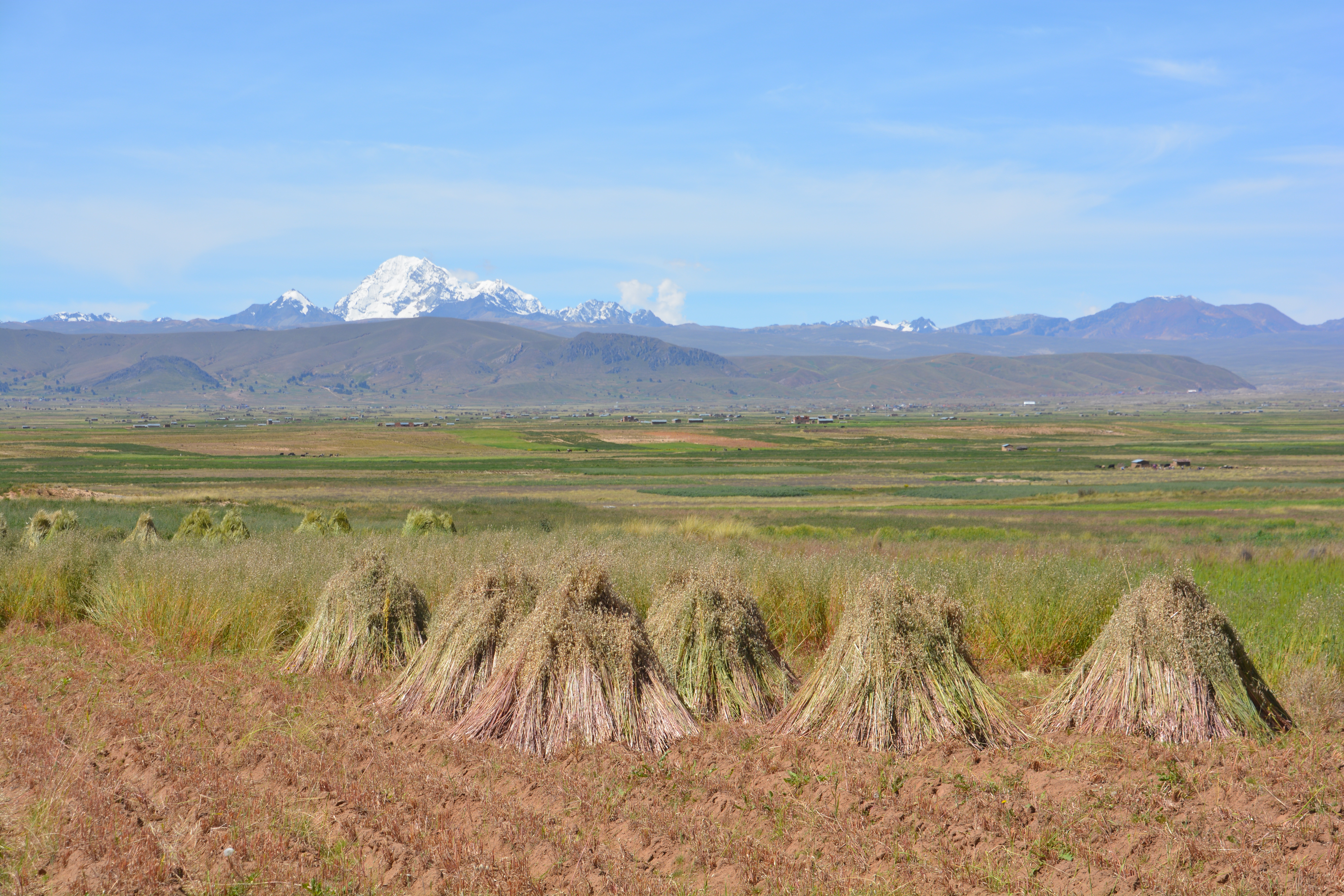
But Bolivia has yet to step on the 21st century escalator to economic prosperity and we saw that immediately as we drove towards La Paz. Most of the buildings were built of the mud bricks and lacked any colour, imagination or creature comforts. The soil appeared rich and there were crops growing in all directions, right up to the slopes of the snow-covered mountains on the horizon. As we saw in Peru, it appeared the Bolivians were working hard and doing the best they could.
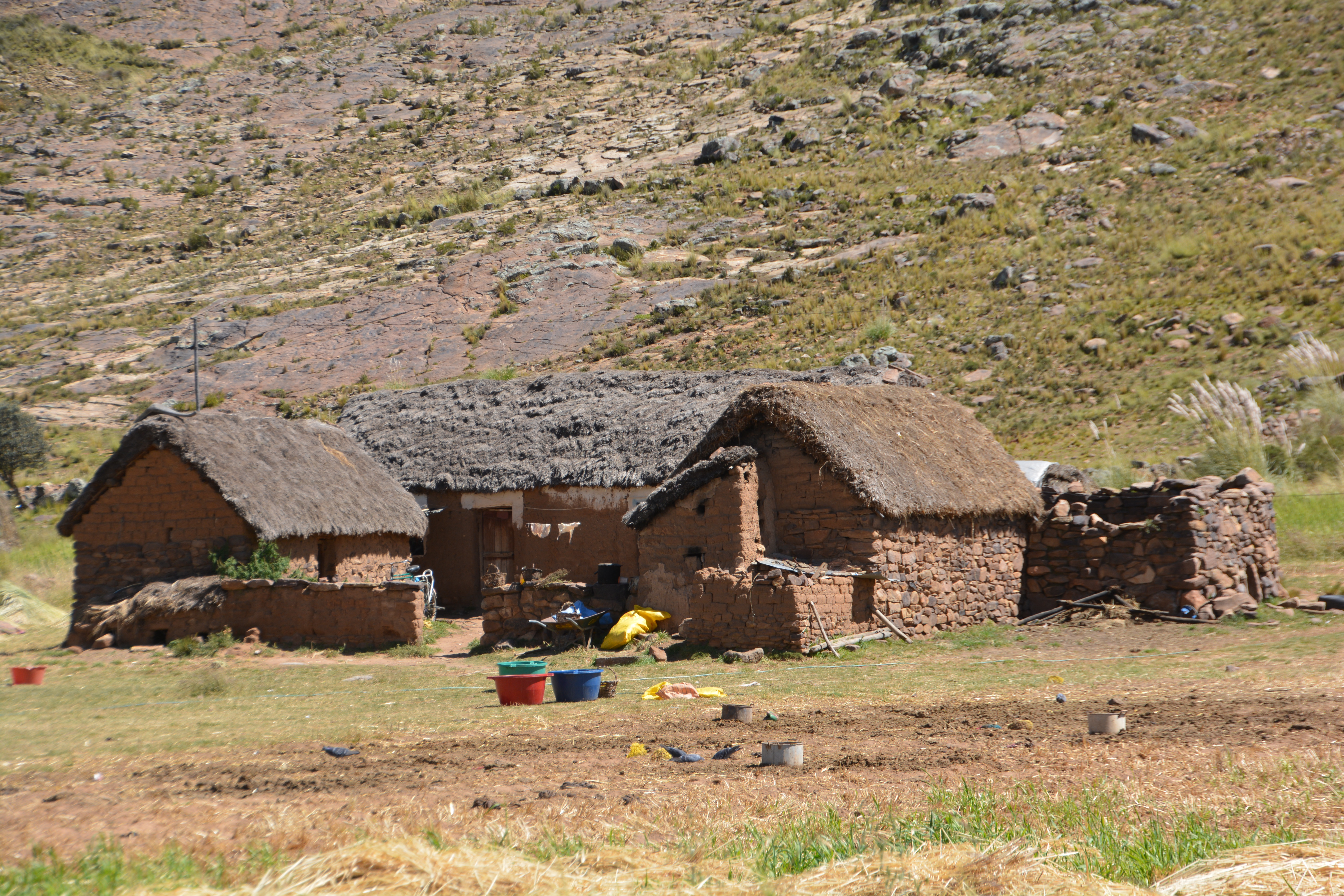
In the rural farming areas life didn’t get any more basic for Bolivians
We wanted to move south of La Paz without dealing with big city traffic so we opted for a series of back roads that eventually put us on the National Highway 1 heading south out of the capital. Unfortunately this strategy backfired a bit as these back roads were mostly rough dirt tracks, sometimes just farmers tracks between their crops, a fascinating insight into how these people live but very slow.
Wow – another grand view as we drove along these small farming tracks
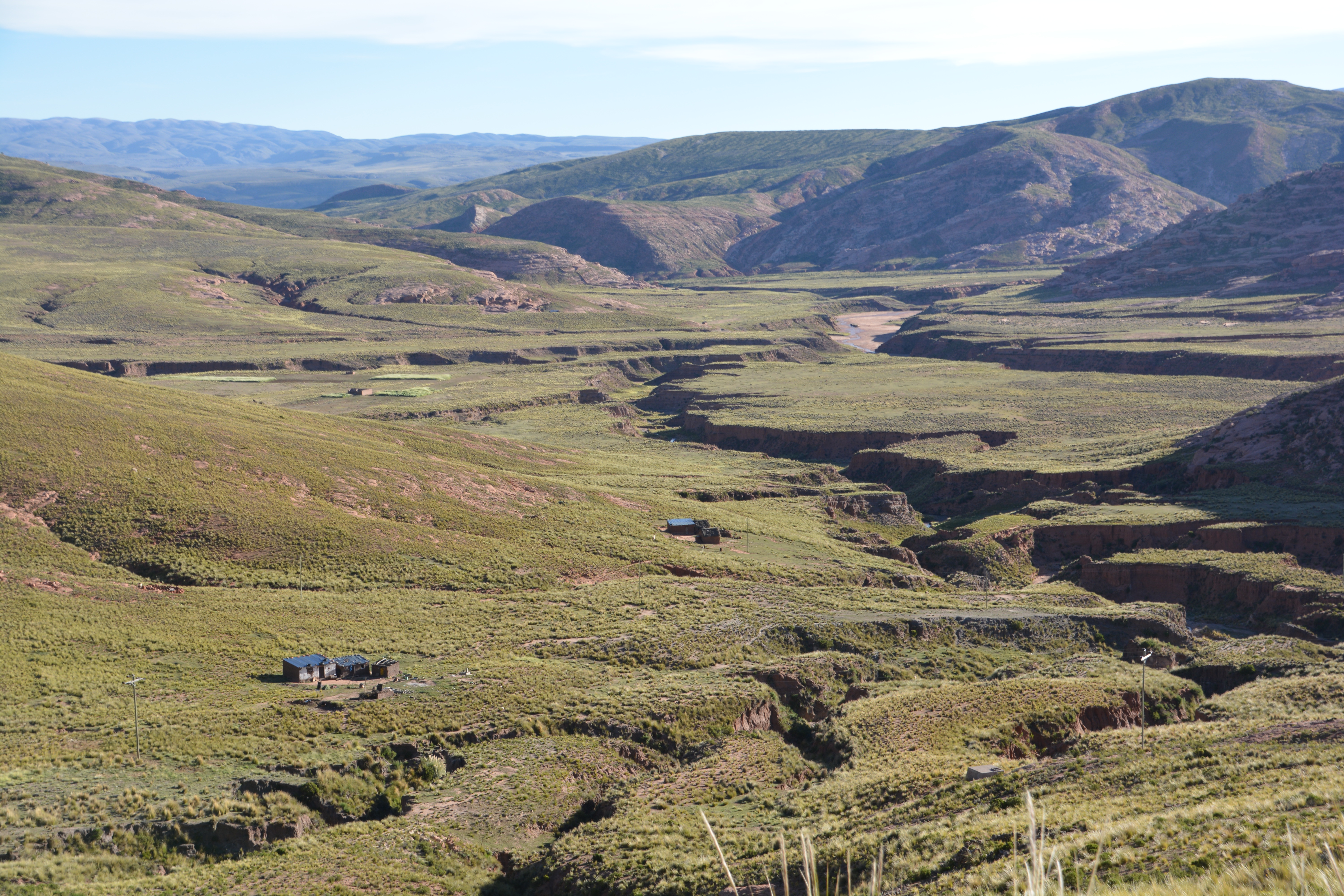
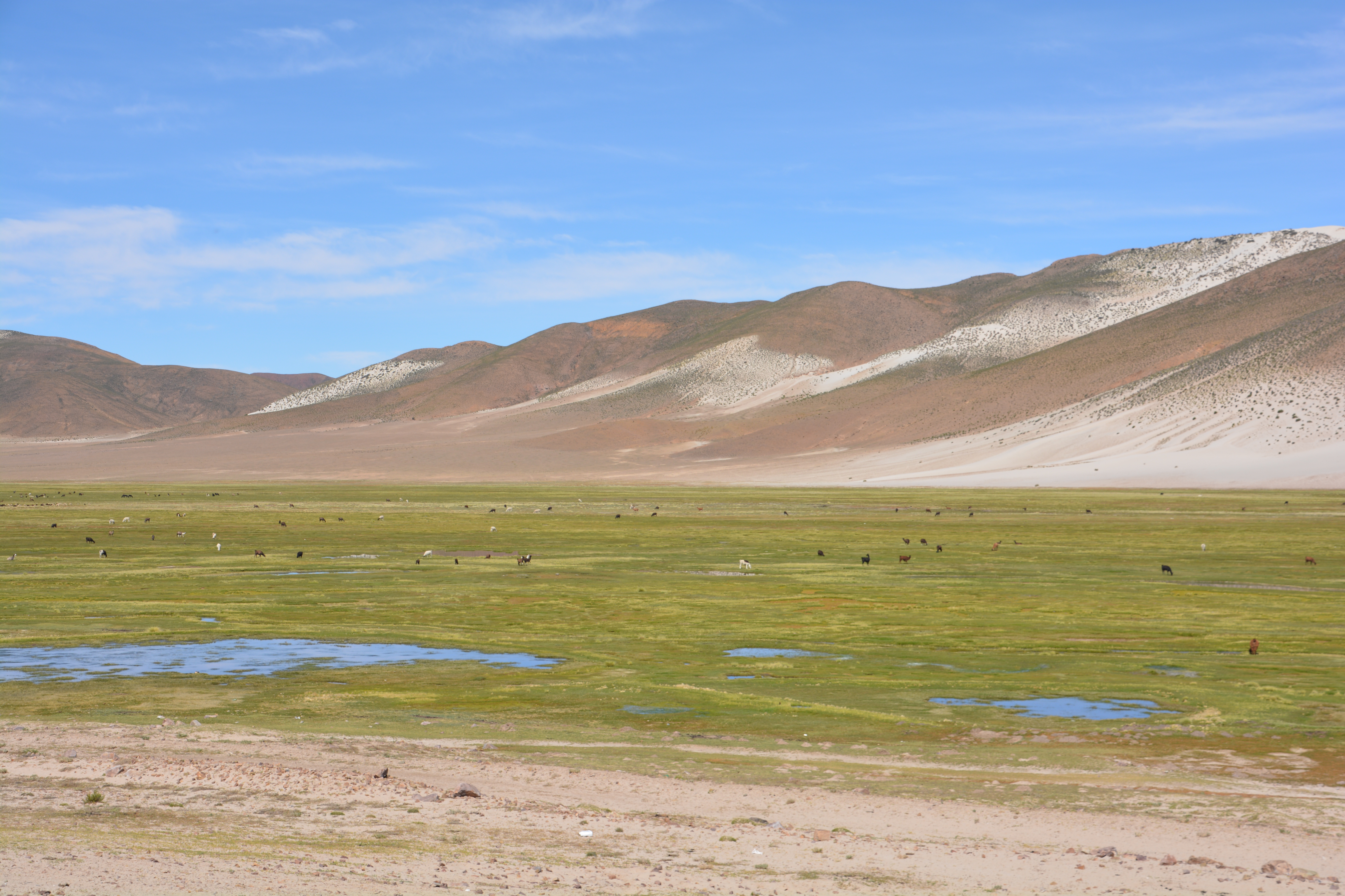
The villages we passed through, sometimes no more than a few family homes scattered amongst the small plots of potatoes, corn or indistinguishable grain, were as basic as could be imagined. The houses were made of mud clay bricks, the roofs usually thatch or grass of some sort although occasionally we would see corrugated iron being used. The houses were no bigger than just one room, the bare minimum of a separate outhouse, clothes frequently strung up to dry. Chickens, pigs and children roamed about in the dirt. A few cattle, sheep or llamas might be in a stone-walled corral or out grazing under the watchful eye of a responsible family member.
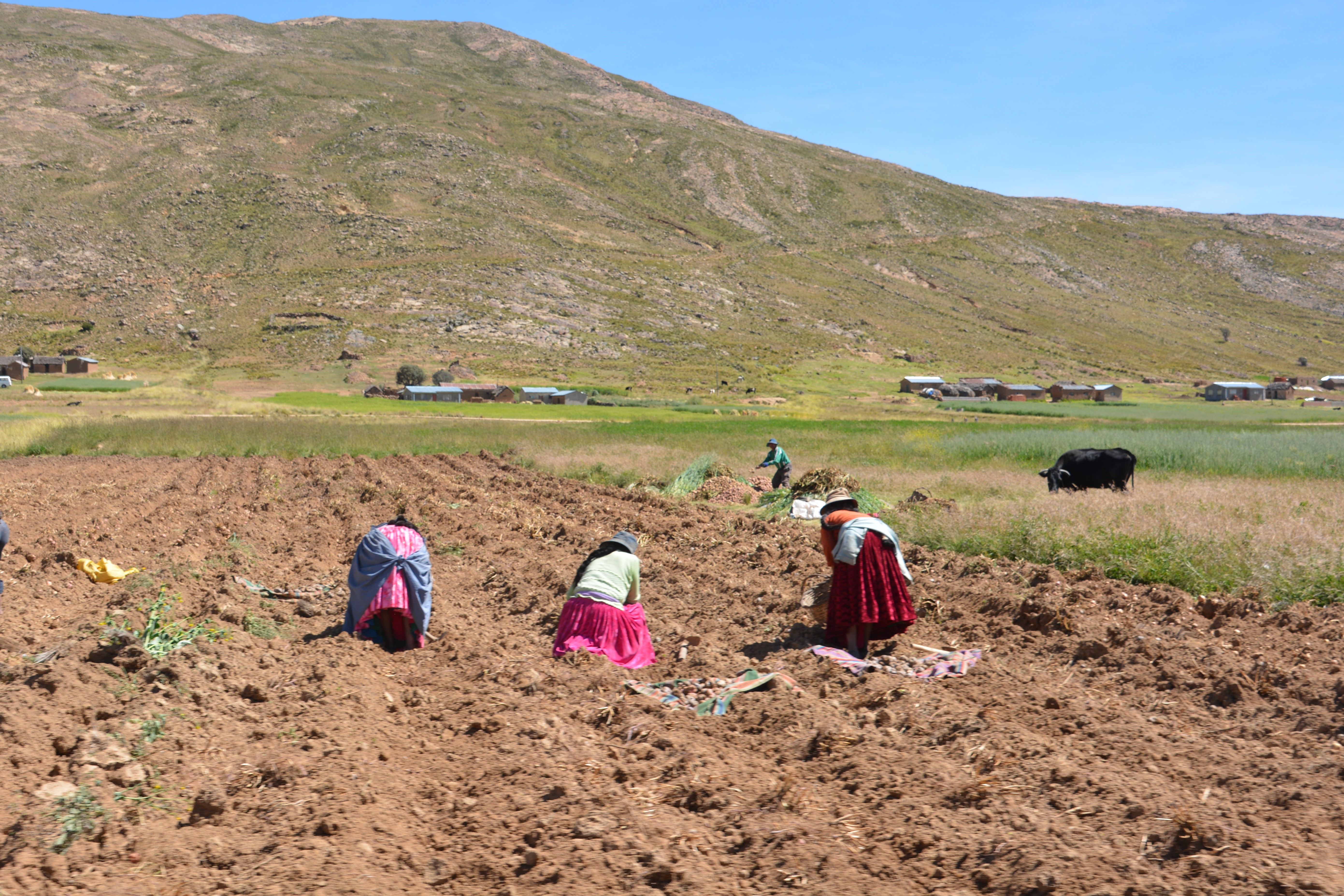
Women in their traditional dress doing their age-old duties – working the fields by hand
We spent the next morning in the large regional centre of Oruro where we did some shopping and sorted out a few administration issues. Then it was south on Highway 1, the Pan American Highway, to the southern town of Potosi. This was barren altiplano, or high plains desert, with very little productive land and rocky mountains in all directions. We crossed a pass of over 4,300 metres before dropping down into the colonial mining town of Potosi, a bustling town historically built on the mining of silver, lead and zinc. Friday night rush hour on Potosi’s old narrow cobblestone streets was a challenging way to end the day.
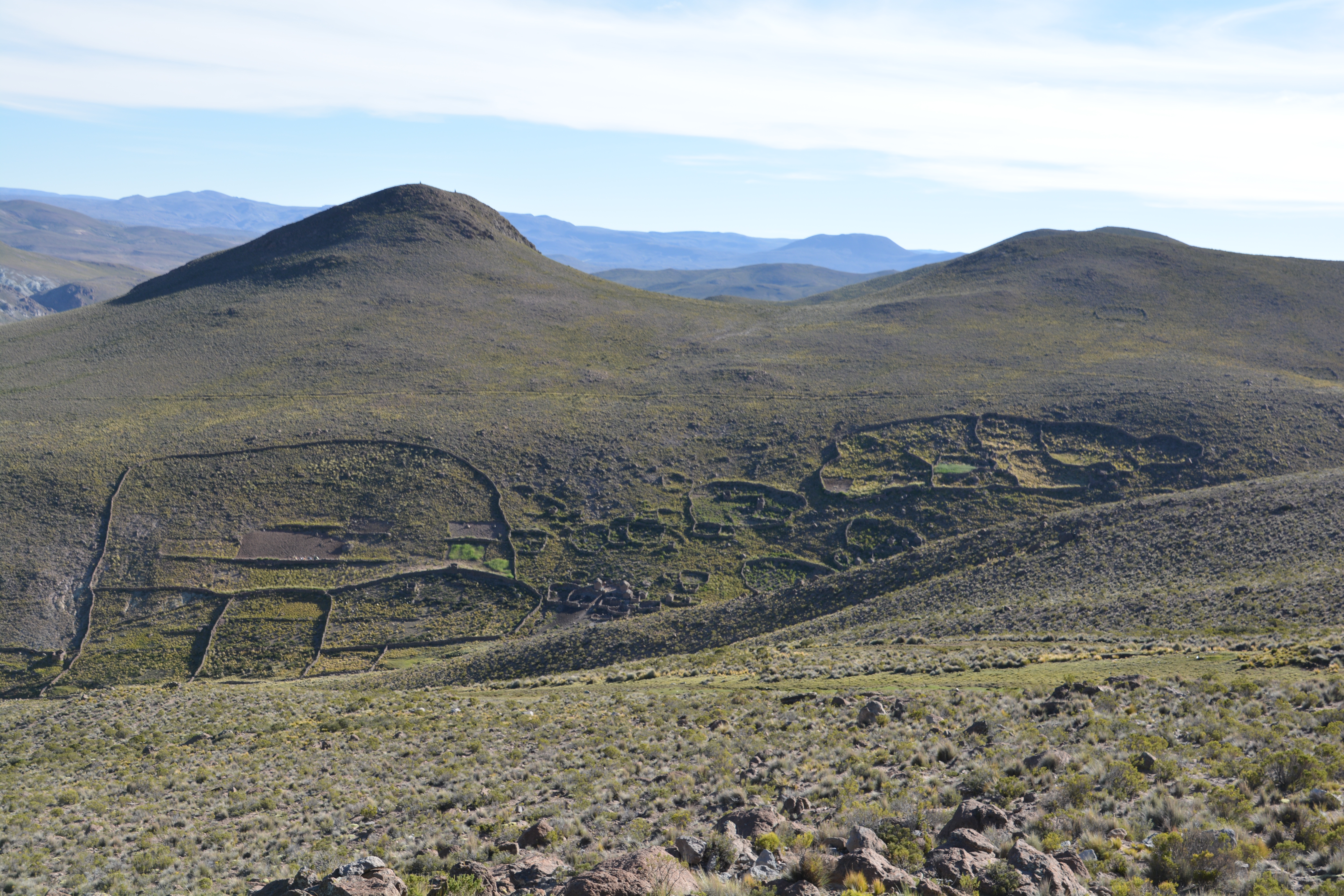
The scenery was spectacular but you couldn’t help but marvel at the hard work the farmers must do – like building these stone fences – to survive in these places
We couldn’t get enough of this scenery – all of it over 4,000 metres
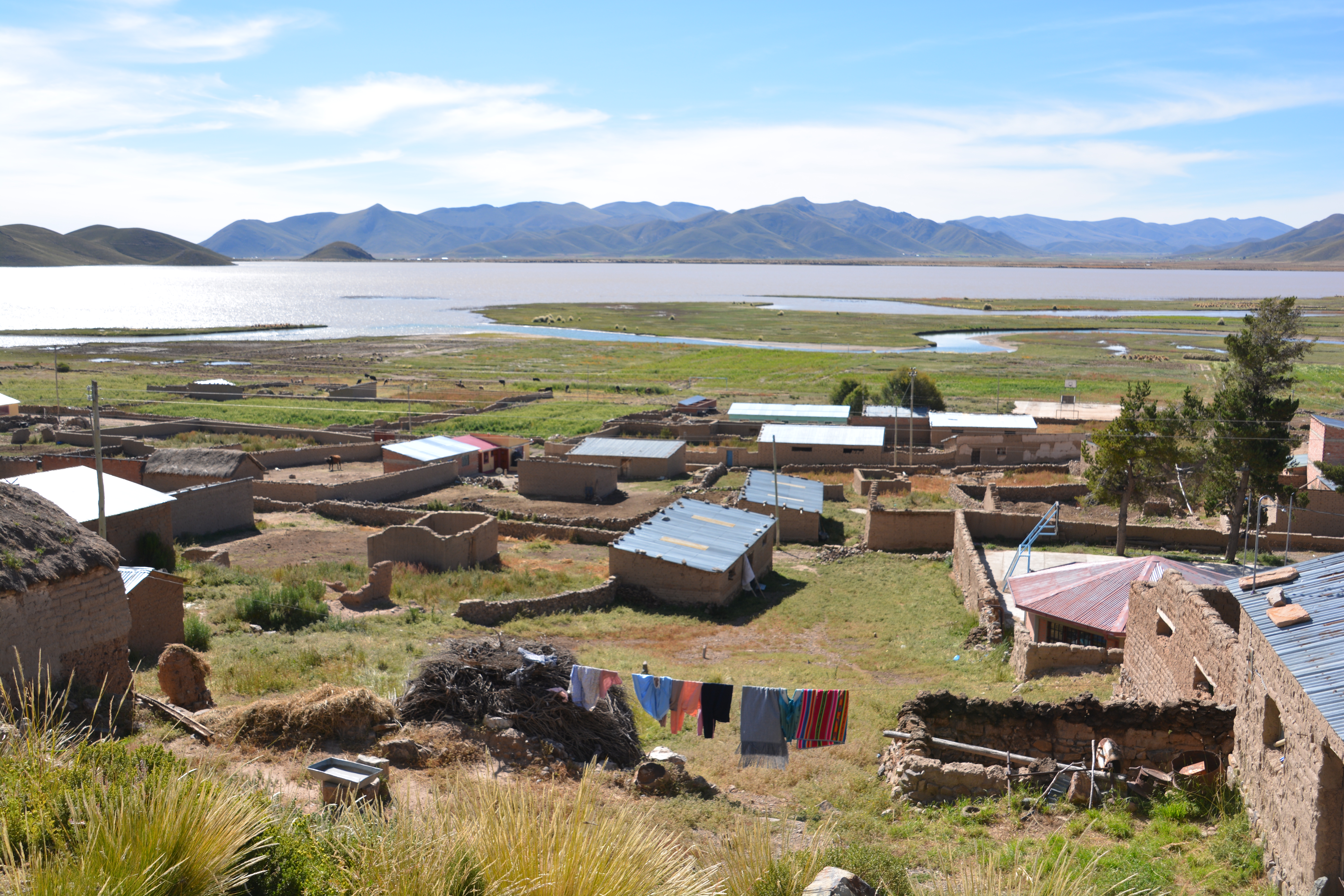
Another village scene on the shores of a shallow lake
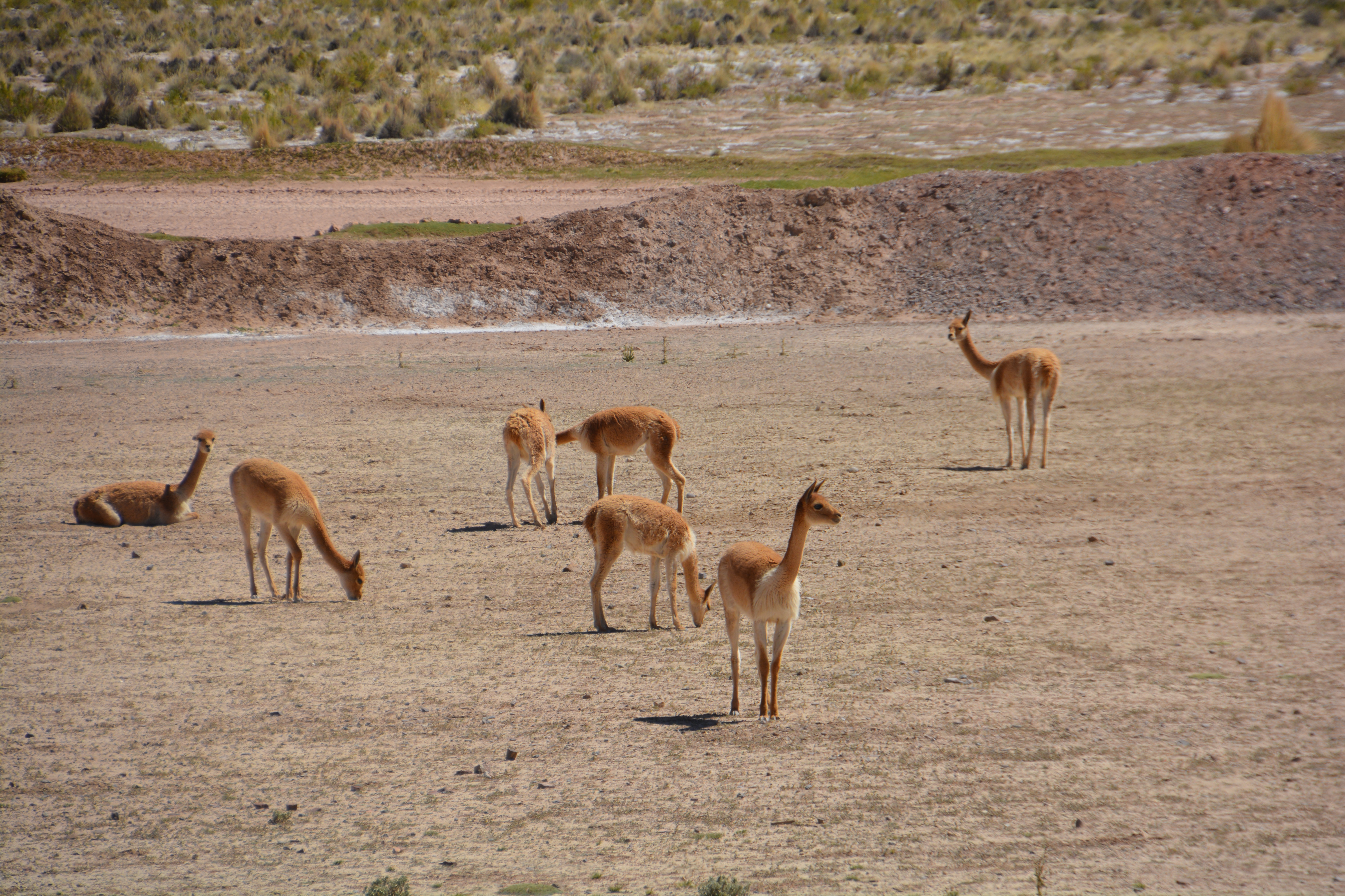
Our first views of vicanas, another member of the camelid family but very shy and not domesticated
Potosi claims to be the highest city in the world at 4,070 metres (13,350 feet) but by this time Julie and I were getting acclimated to these levels, having spent the best part of the last two weeks around or above 4,000 metres. But all it takes is to jog across a busy street or climb some steps to get a view at a lookout and we were quickly reminded that this is not normal. Poor sleeping habits, lack of appetite and shortness of breath also add to the challenges.
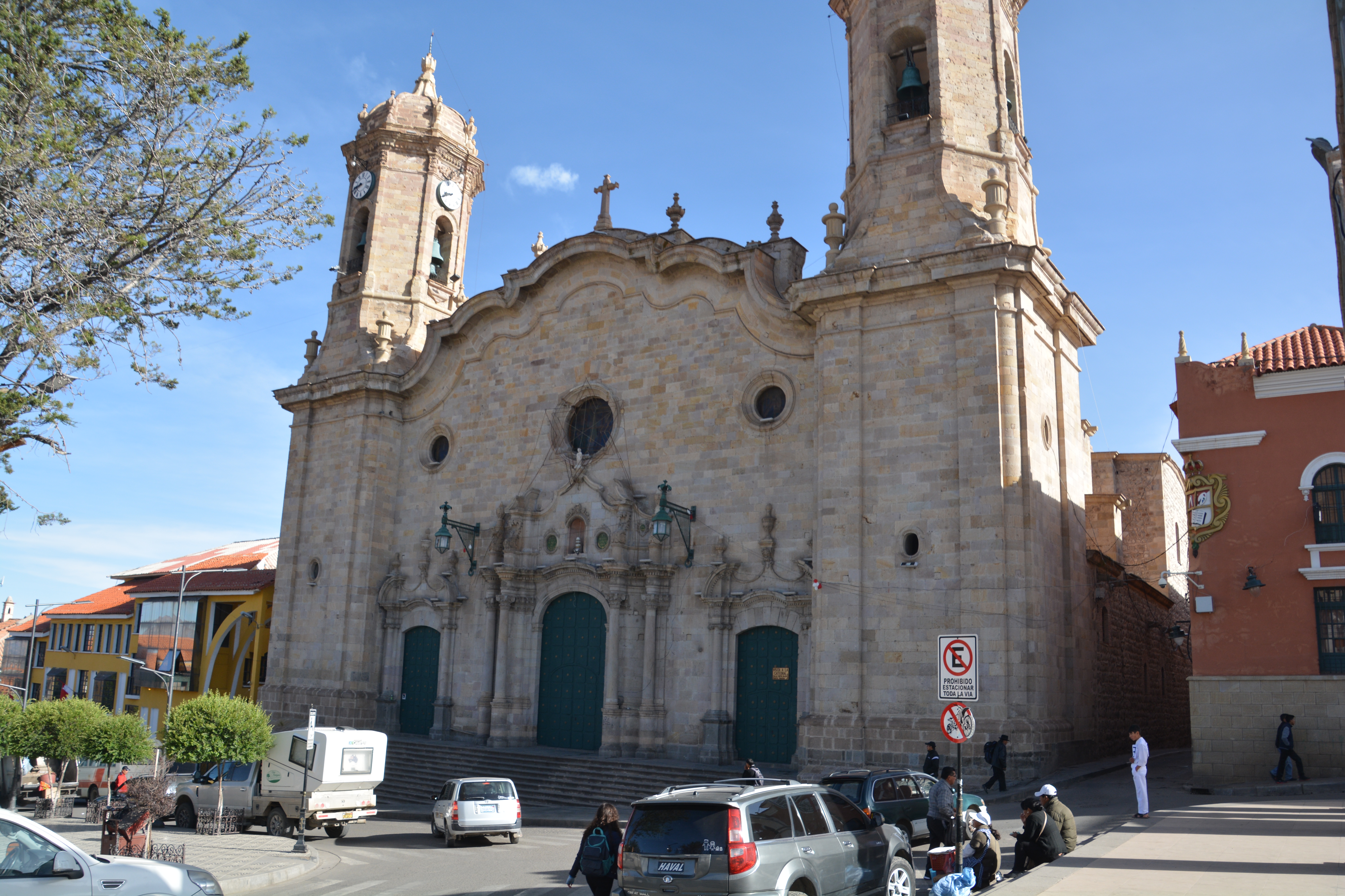
Tramp casually parked in front of the cathedral in Potosi, said to be the highest city in the world
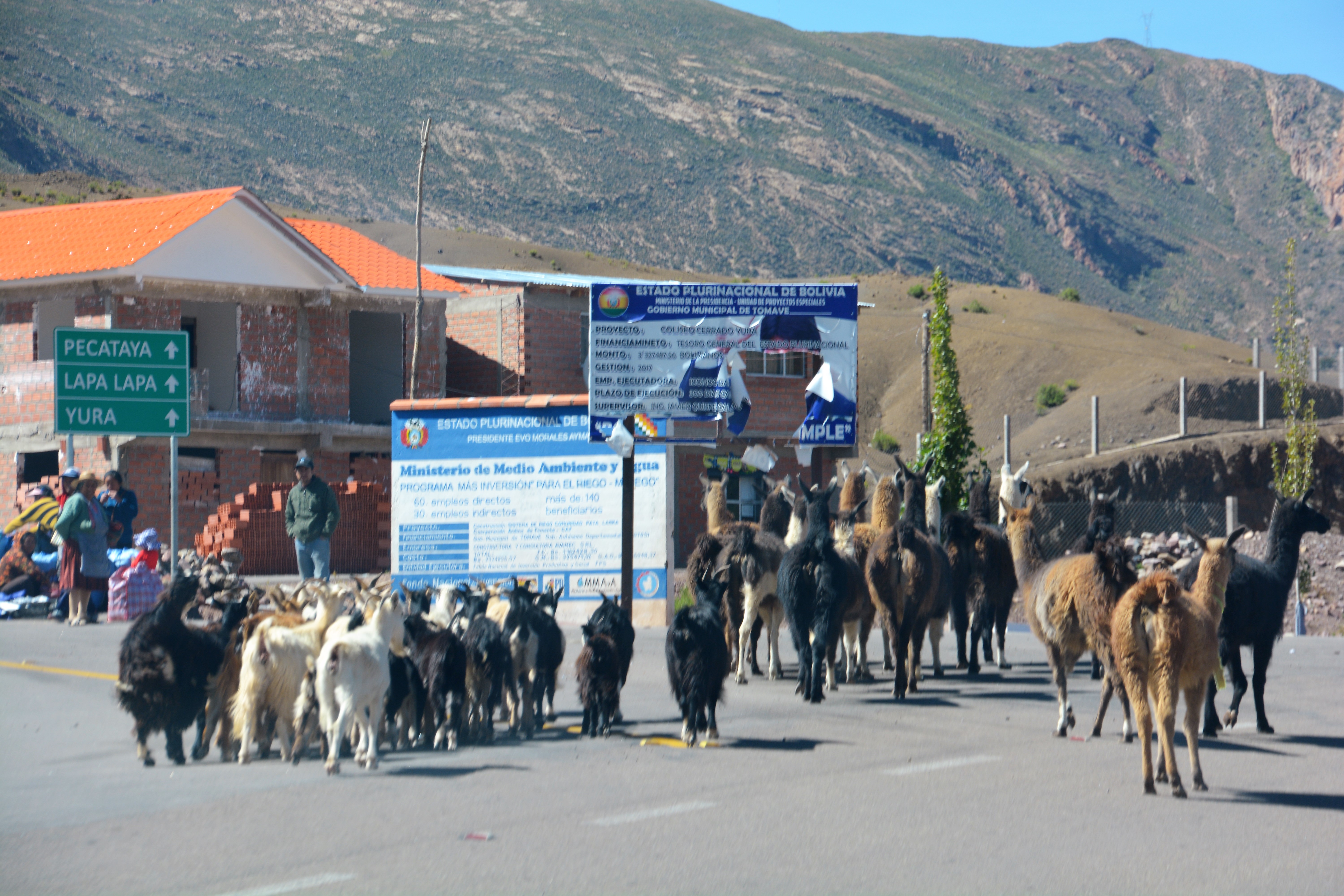
Traffic jam – goats and llamas are herded through an intersection in a small town
Our major target for our time in Bolivia was the famous Salar de Uyuni, otherwise known as the largest salt flat in the world. The drive to Uyuni was through colourful desert with rocks flashing brown, grey, red and yellow, sometimes in amazing stripes running up and over the mountains. Sand dunes often nestled in the bottom of these rocky mountains and the terrain was so harsh we hardly saw a llama, alpaca or any other form of life.
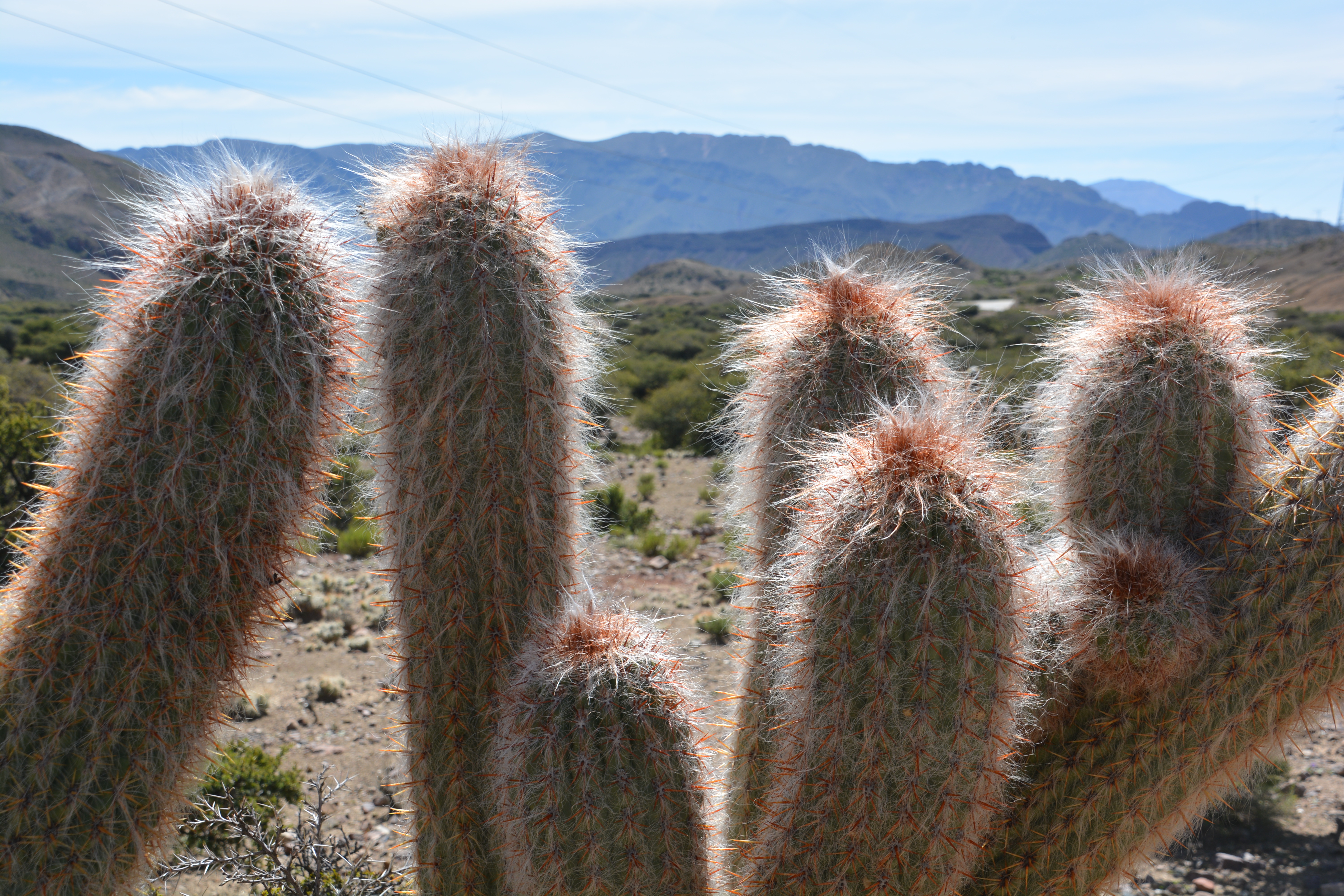
We rarely saw any cacti and these interesting plants only grew in one short section we drove through
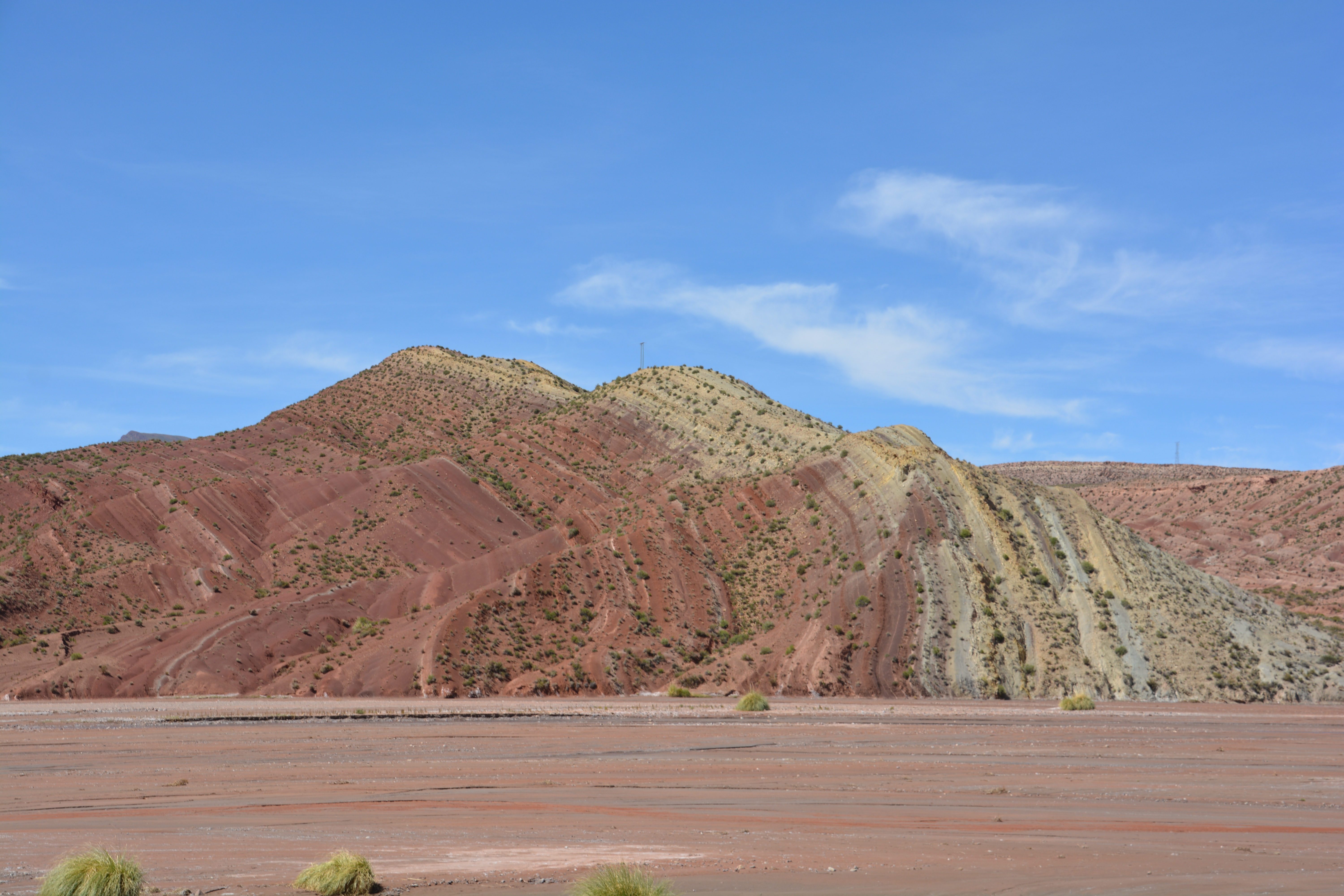
The desert takes on many different colours, including these stripes running through the rocky hills
Where there’s a bit of water there is also green, adding rare colour to the scenery
As we approached the town of Uyuni from a high vantage point in the mountains we had our first glimpse of the Salar de Uyuni and began to grasp the immensity of this amazing natural phenomenon. The Salar sits at 3,600 metres and is the largest salt flat in the world covering a staggering 12,000 square kilometres. In the rainy season it is covered in a thin layer of perfectly reflecting water. In the dry season you can drive all over its trackless flat terrain. We were arriving in between these two seasons.
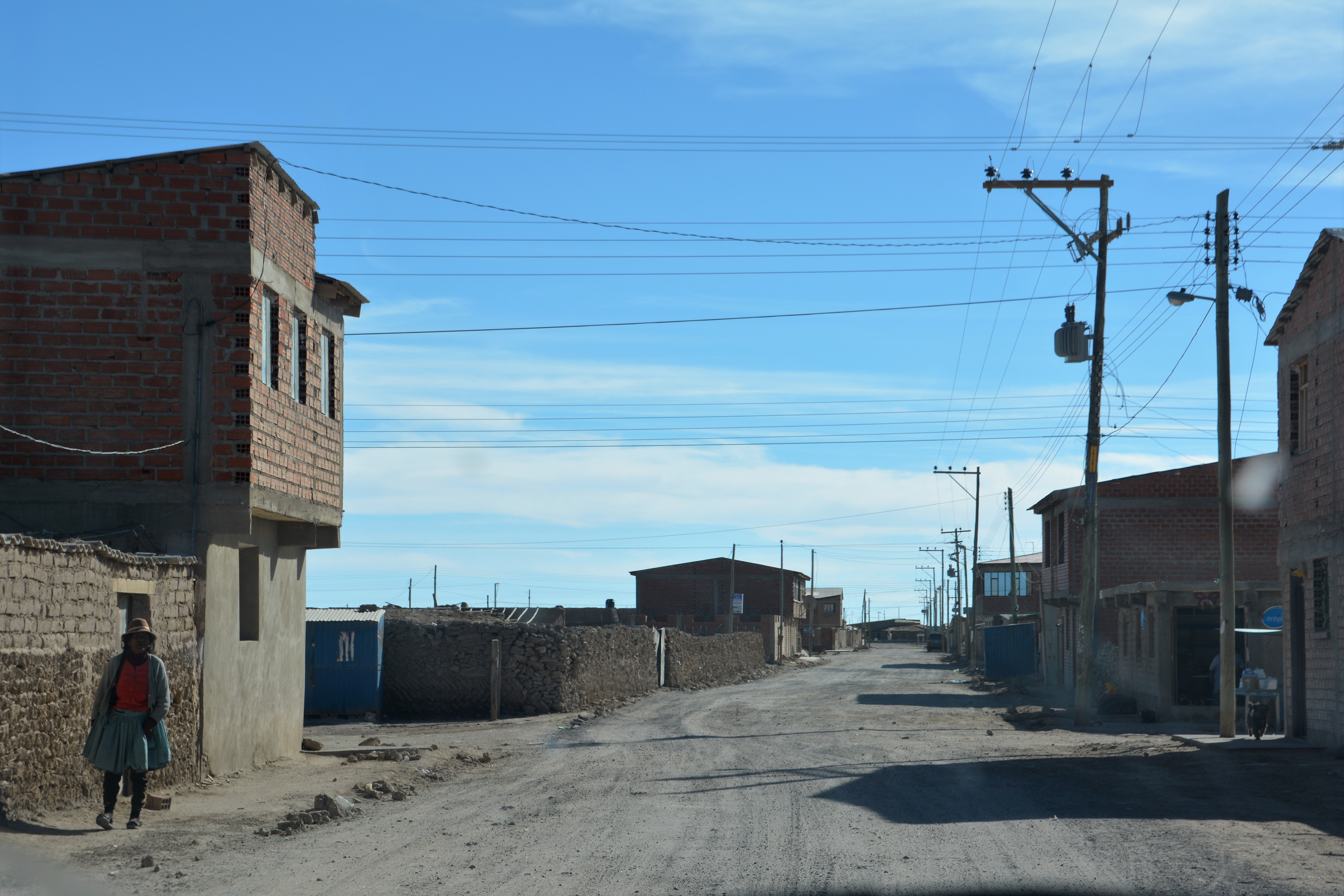
The town of Uyuni was a dry and desperate place to live, also featuring a strong wind the blew salt from the nearby salt flats
We went down to Uyuni, a town of about 15,000 people, and were stunned by what we saw. Virtually all the streets were dirt, rubbish lay everywhere, everything looked covered in dust from the wind coming off the Salar, the houses were bland and simple, there was almost no colour. It reminded us of a wasteland from a Mad Max movie.
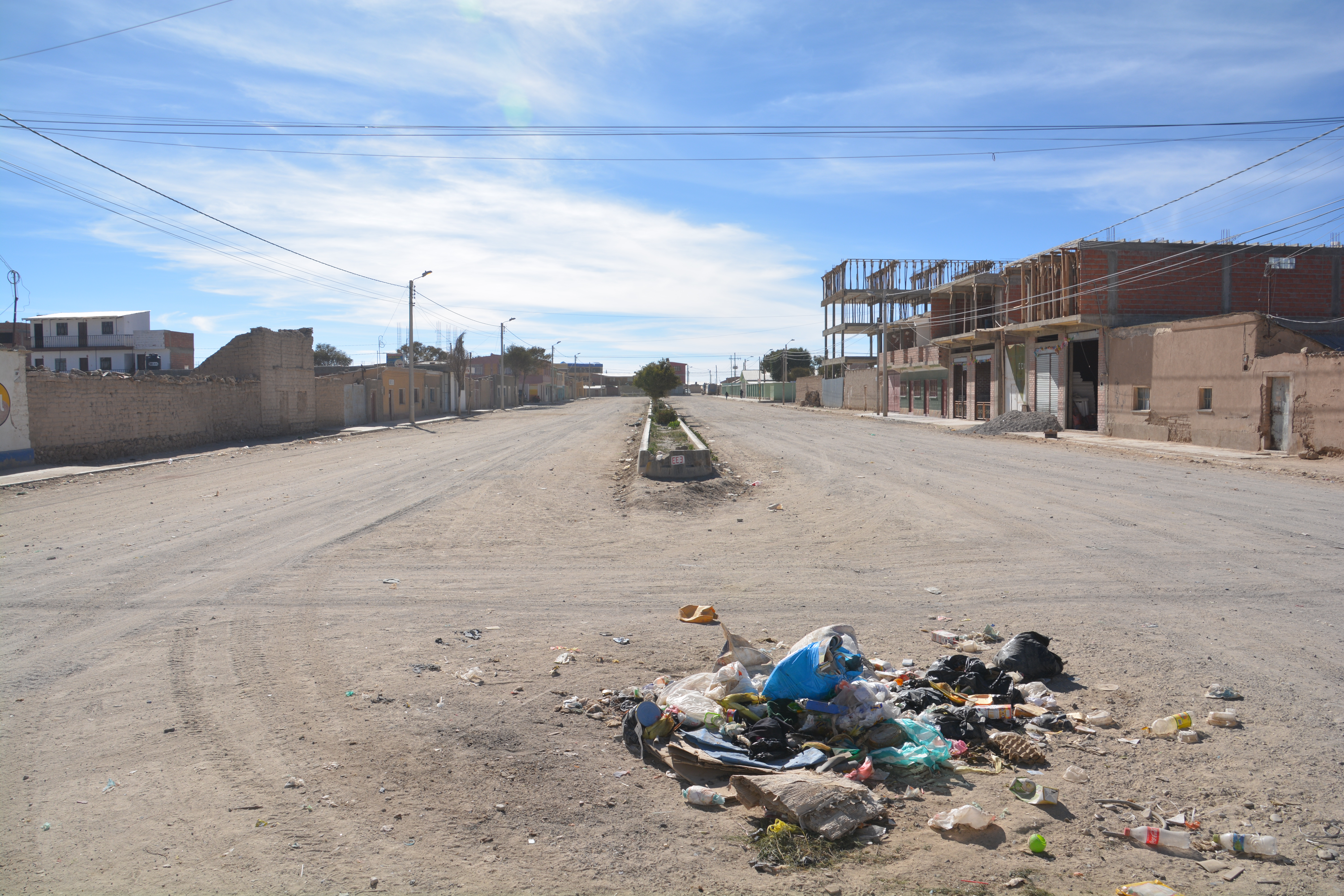
Another view of Uyuni…pretty grim
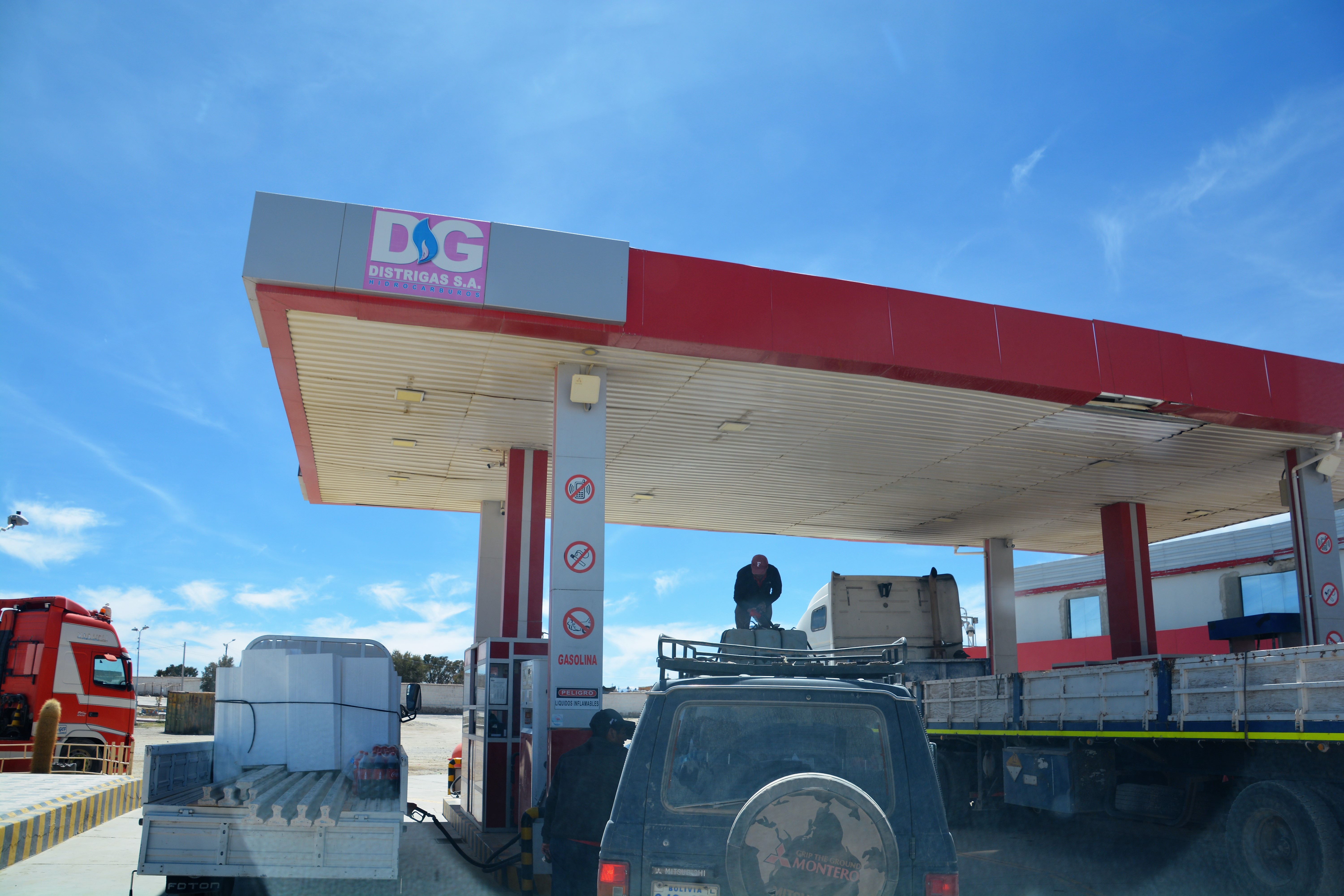
We filled up all our tanks with fuel in Uyuni because stations are very rare in southern Bolivia. Here the government charges foreigners triple the amount for fuel so the local station owners charge you less, give you a dodgy receipt and pocket the rest. Only in Bolivia.
We had some lunch and stocked up on supplies from the meagre store in town before heading out to the Salar. Unfortunately the region had some heavy rain a month ago so the salt flats weren’t as dry as they normally would be. Many areas were still under water and impassable. We shelved our original idea of driving across the Salar in a two day trip and opted for a more doable plan under the circumstances.
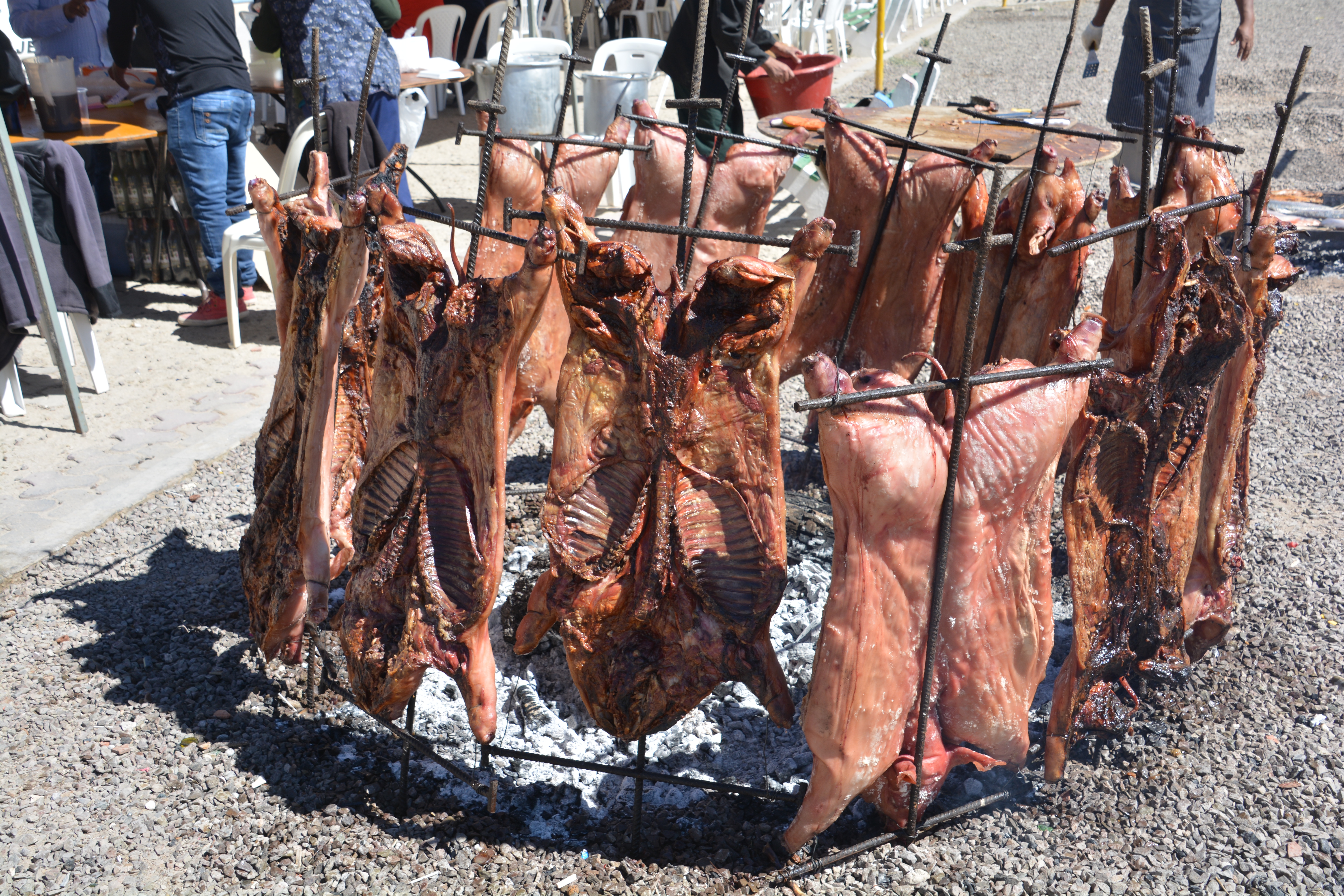
Some locals preparing a parrilla which is a public barbeque on a Sunday
From the entry point onto the salt flat we followed a local Landcruiser through a large area of briny water that was still sitting on the salt and made it out onto the slightly higher dry salt flat on the other side. These Landcruisers are used by the local tour companies to ferry visitors out for short term experiences on the salt and many were driving about the flat white expanses in preparation for the sunset show.
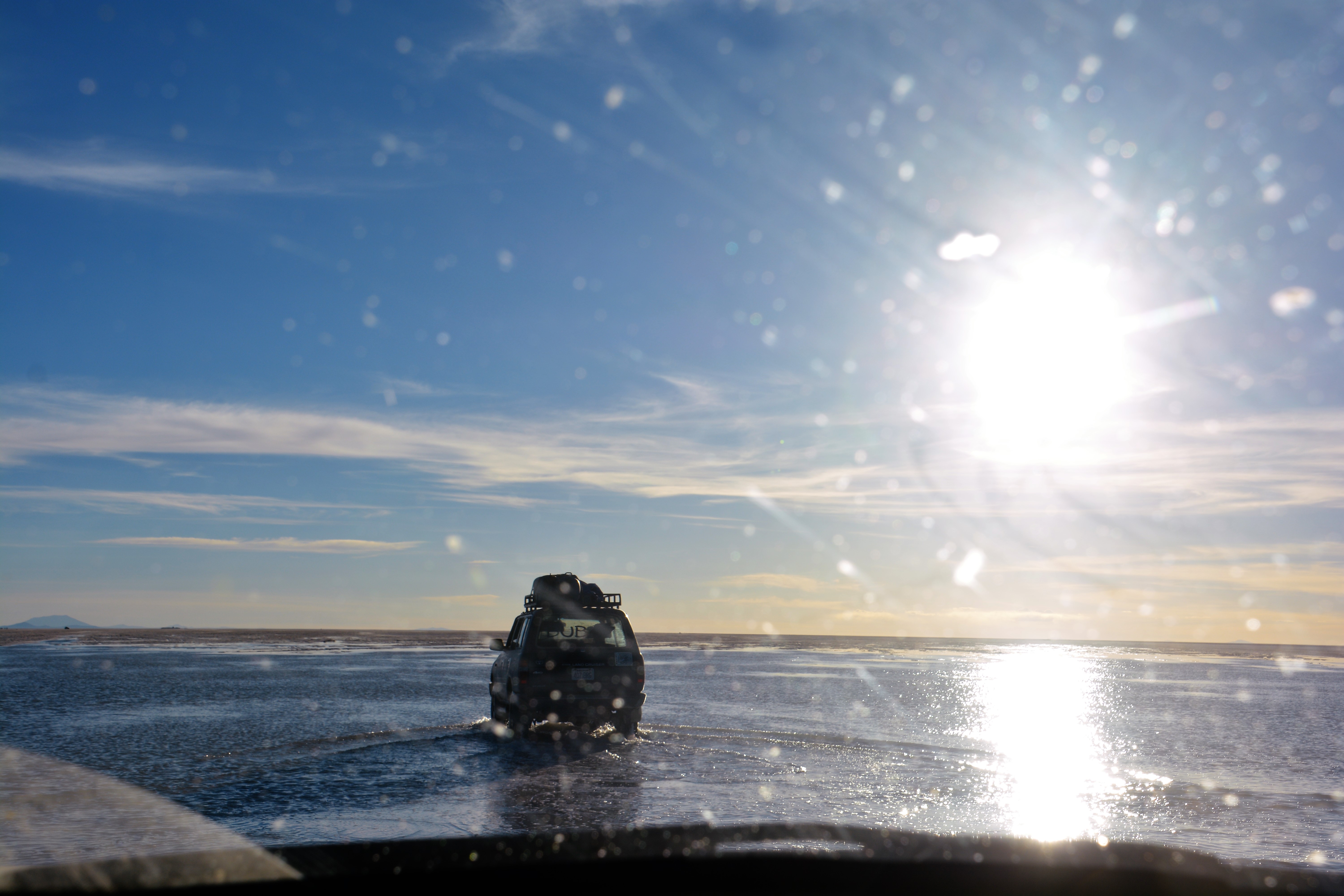
Driving on the flooded salt flats was a new experience for us, and because of Tramp’s weight he tends to sink easily so we cautiously followed a local vehicle carrying tourists out to see the sunset
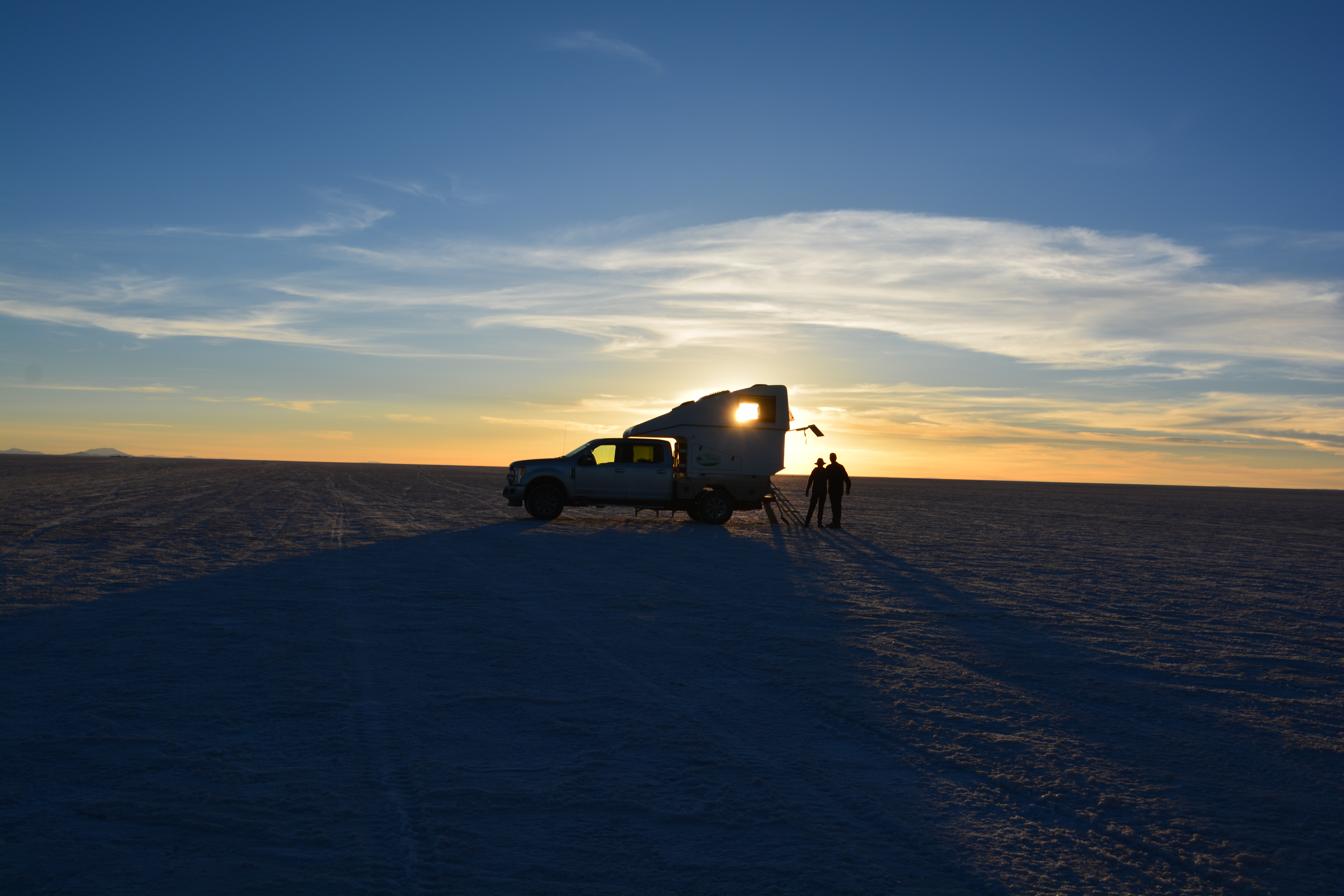
Sunset out on the salt flats, an extraordinary experience, totally unique in the world, a real highlight on our Follow the Sun journey
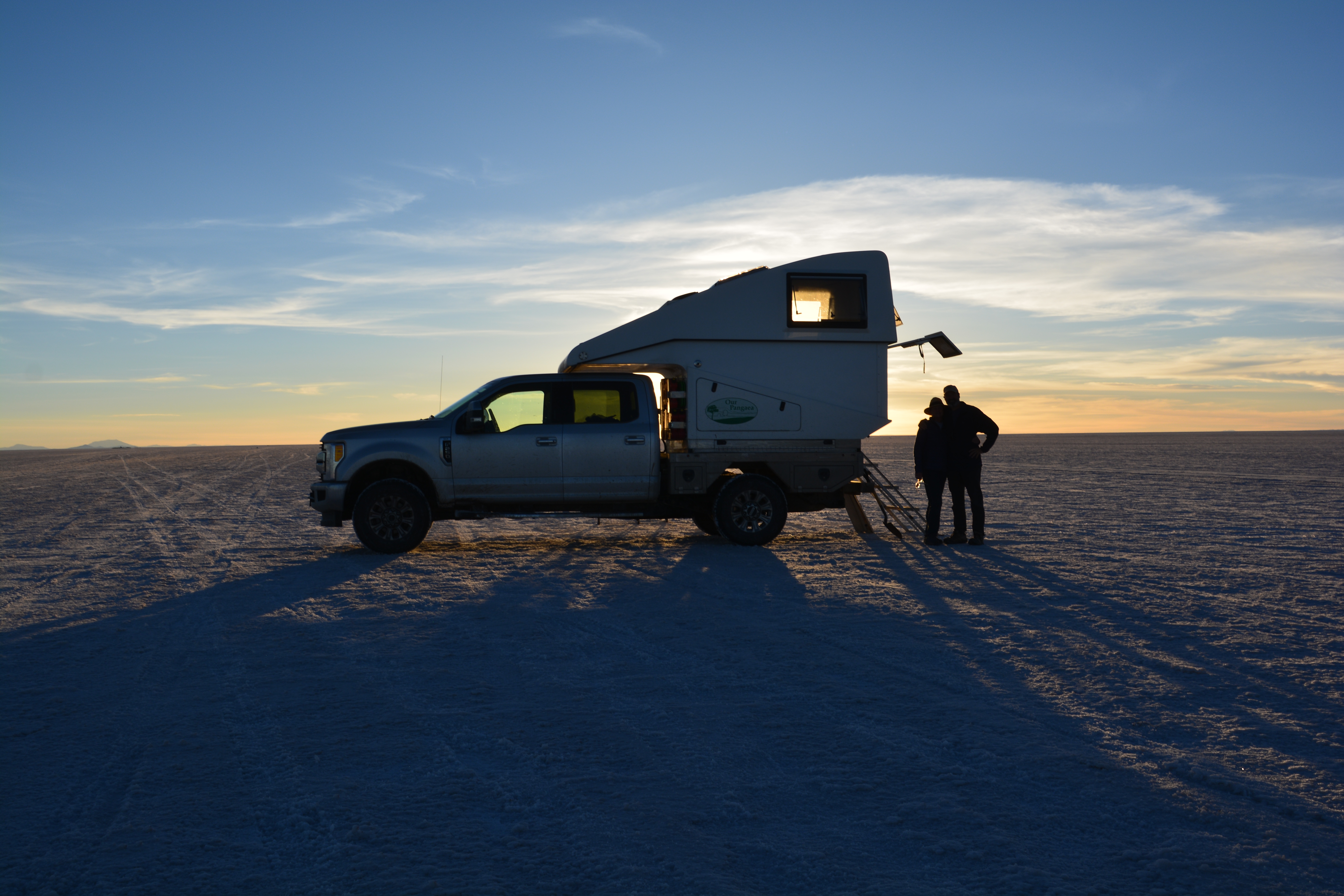
Julie and I drove ‘offshore’ for about eight kilometres, an extraordinary experience across the flat blindingly white crusty salt, and parked in time to enjoy a fabulous sunset and try to take in this amazing scene. Once the sun set all the tour operators had to scurry back home and left us to look after the endless salt flat. And as a special treat, we had just enough firewood left for a small fire after dinner while millions of stars floated above us and we had the world to ourselves. A very special experience, one of our favourites on the entire trip.
Cocktail hour was very cool on the salt flats and we even had a bit of ’emergency’ wood for a very special fire after it got dark and all the other vehicles had left
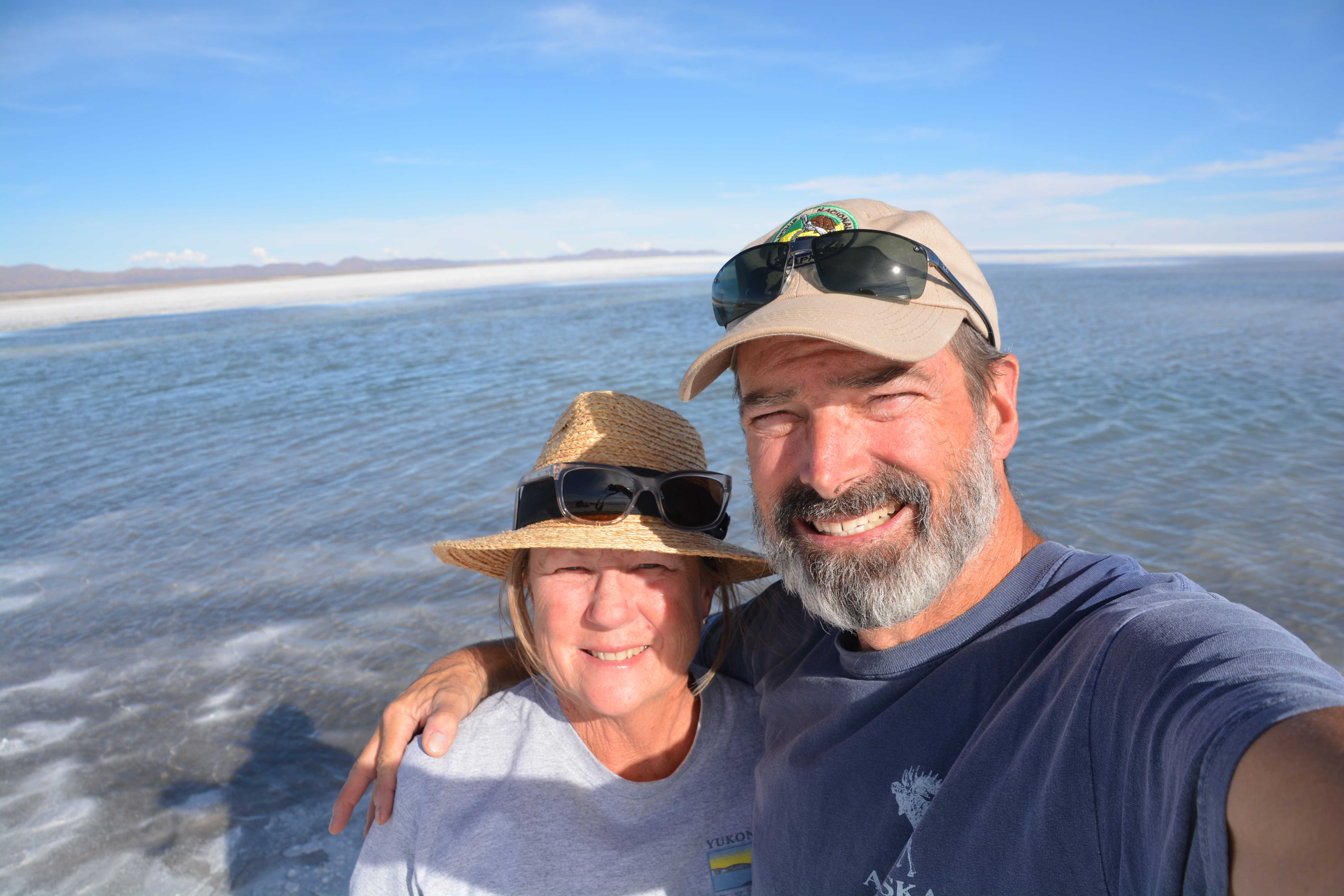
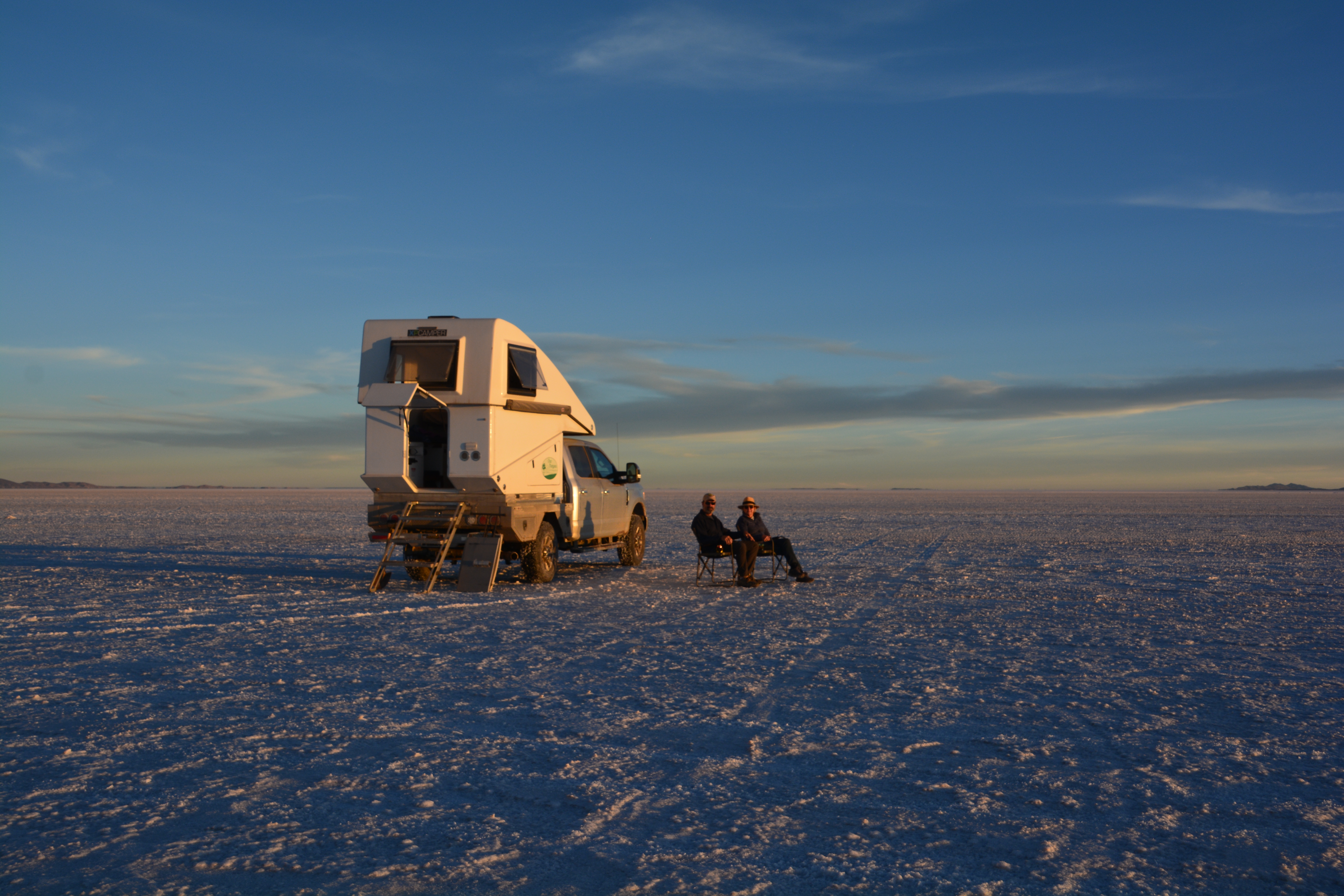
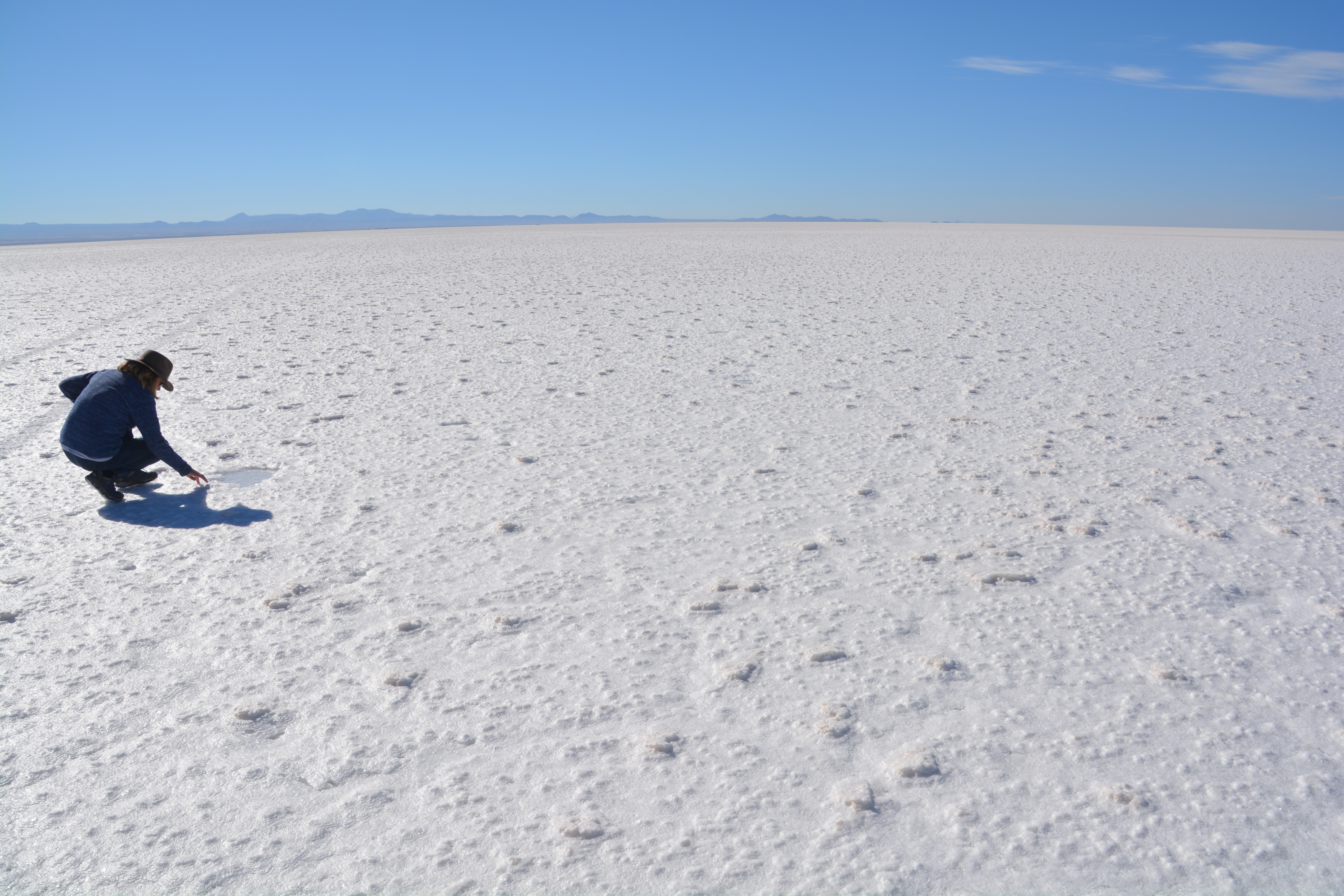
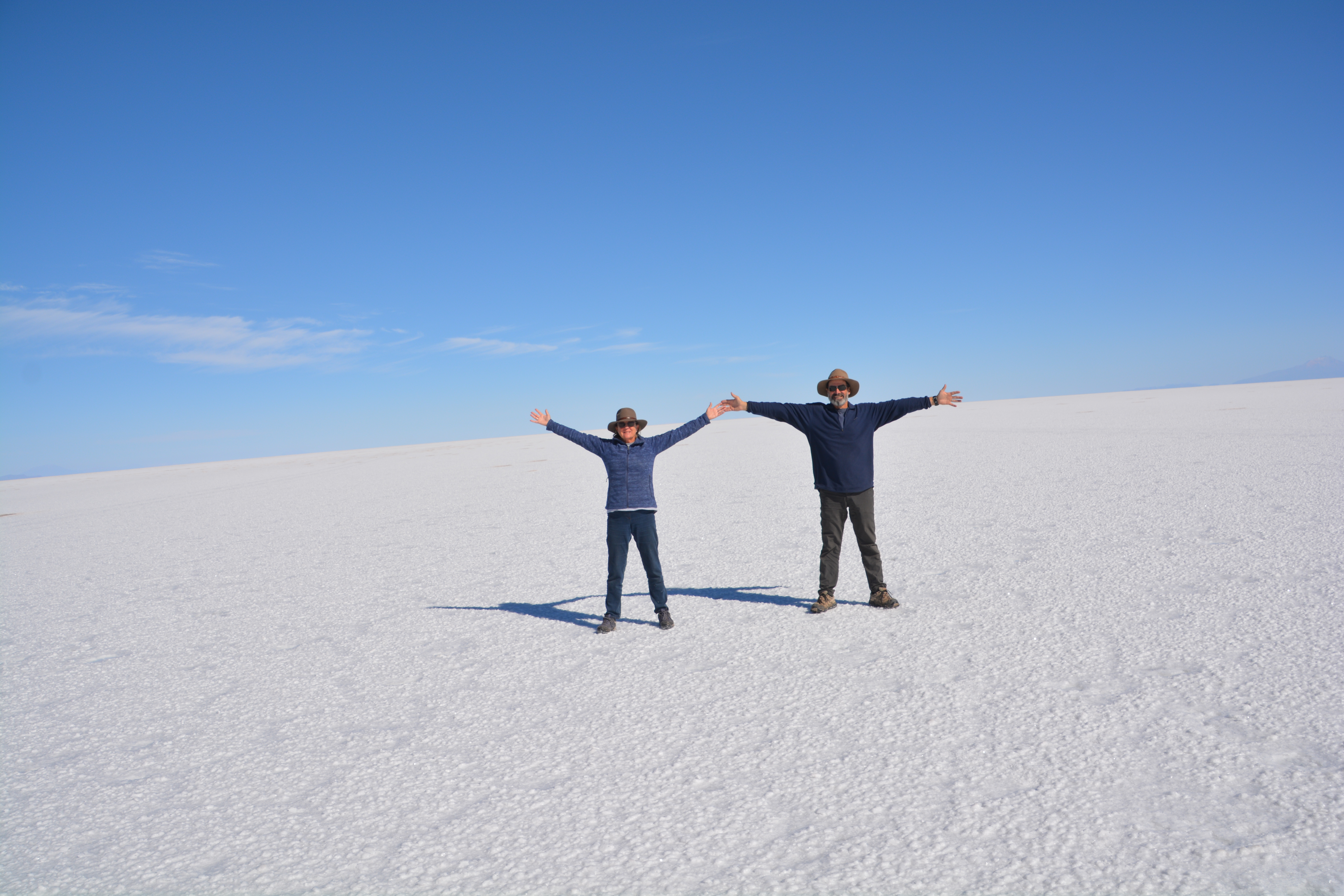
We woke to sunrise across the endless Salar and once again felt the vastness of our setting. We knew we couldn’t drive across the salt flats due to many large wet areas but we decided to explore a little of this amazing place. We drove about 25 km (18 miles) due west on our compass until only the distance mountains were visible. From here there was nothing to break our gaze and the crinkling of the salt under our feet was the only disturbance. I’ve never felt such an extraordinary experience as knowing it was only Tramp, Julie and myself here with nothing else but white salty flatness.
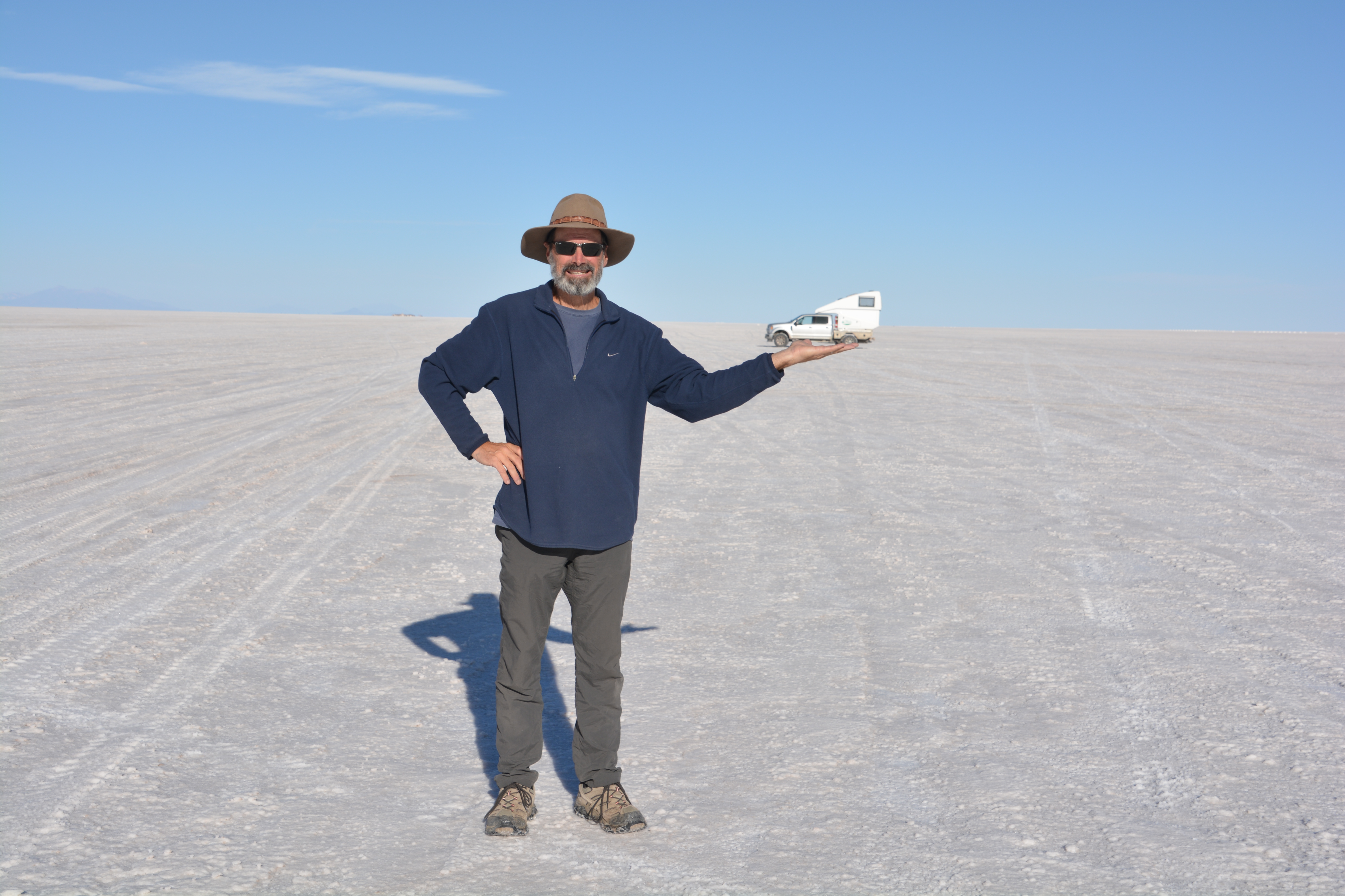
I’ve got Tramp in the palm of my hand…distances can be very misleading out on the featureless salt flats
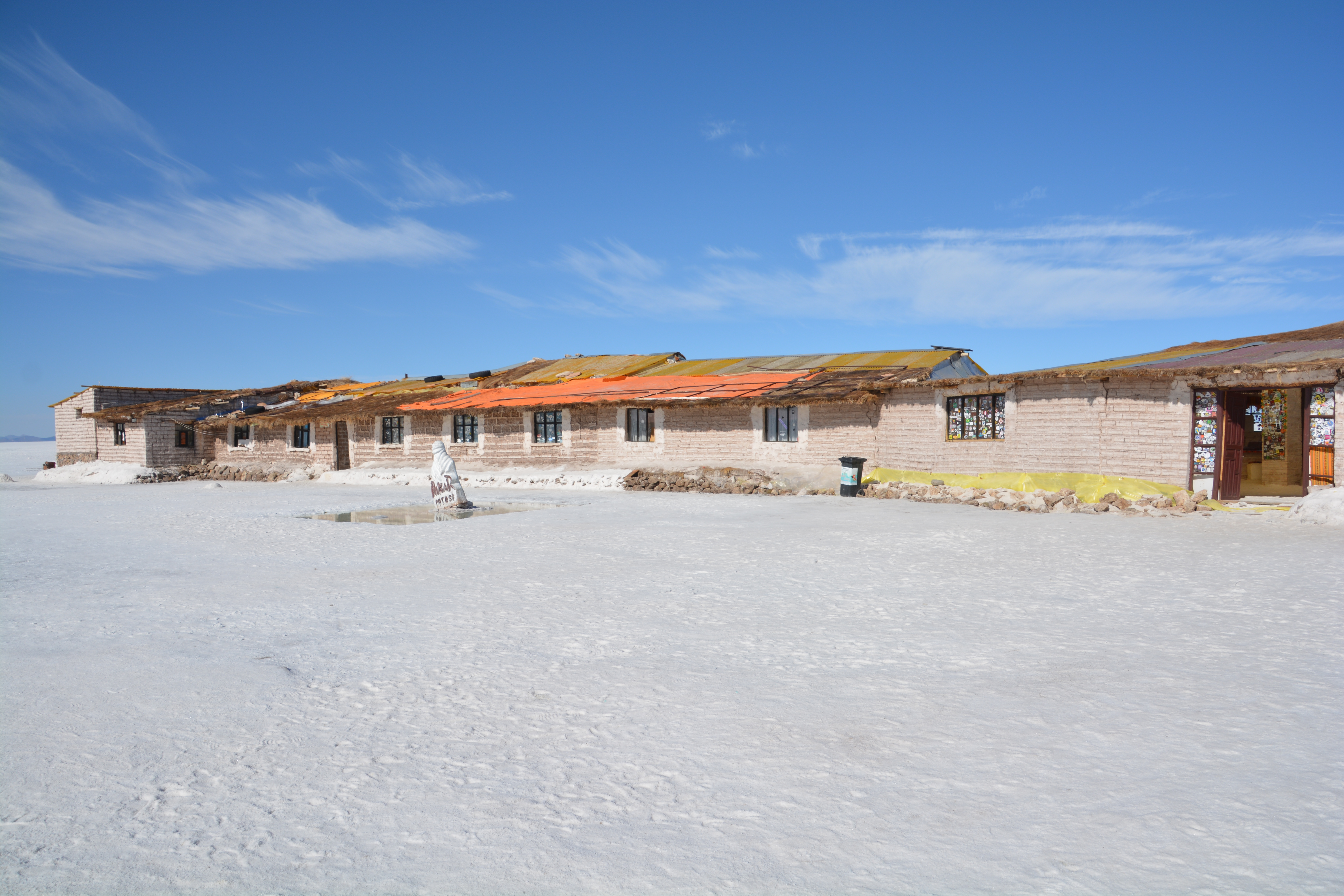
We drove directly out towards the middle of the salt flats and had a brief look at the old salt hotel – made of blocks of salt, including its furniture – that has now been moved for environmental reasons
The vastness of this place, just endless miles of flat nothingness, made us feel very insignificant
One more photo because this place deserves it
By the time we re-entered Uyuni Tramp was covered in a white crusty salty brine, not good for any car, and we had him spray cleaned to return him to his shiny silver. We then headed southwest into Bolivia’s furthest corner across lifeless desert nothingness with a light sprinkle of white salt everywhere. This corner of Bolivia is some of its most beautiful but also most desolate, well known for its high plains and countless volcanos.
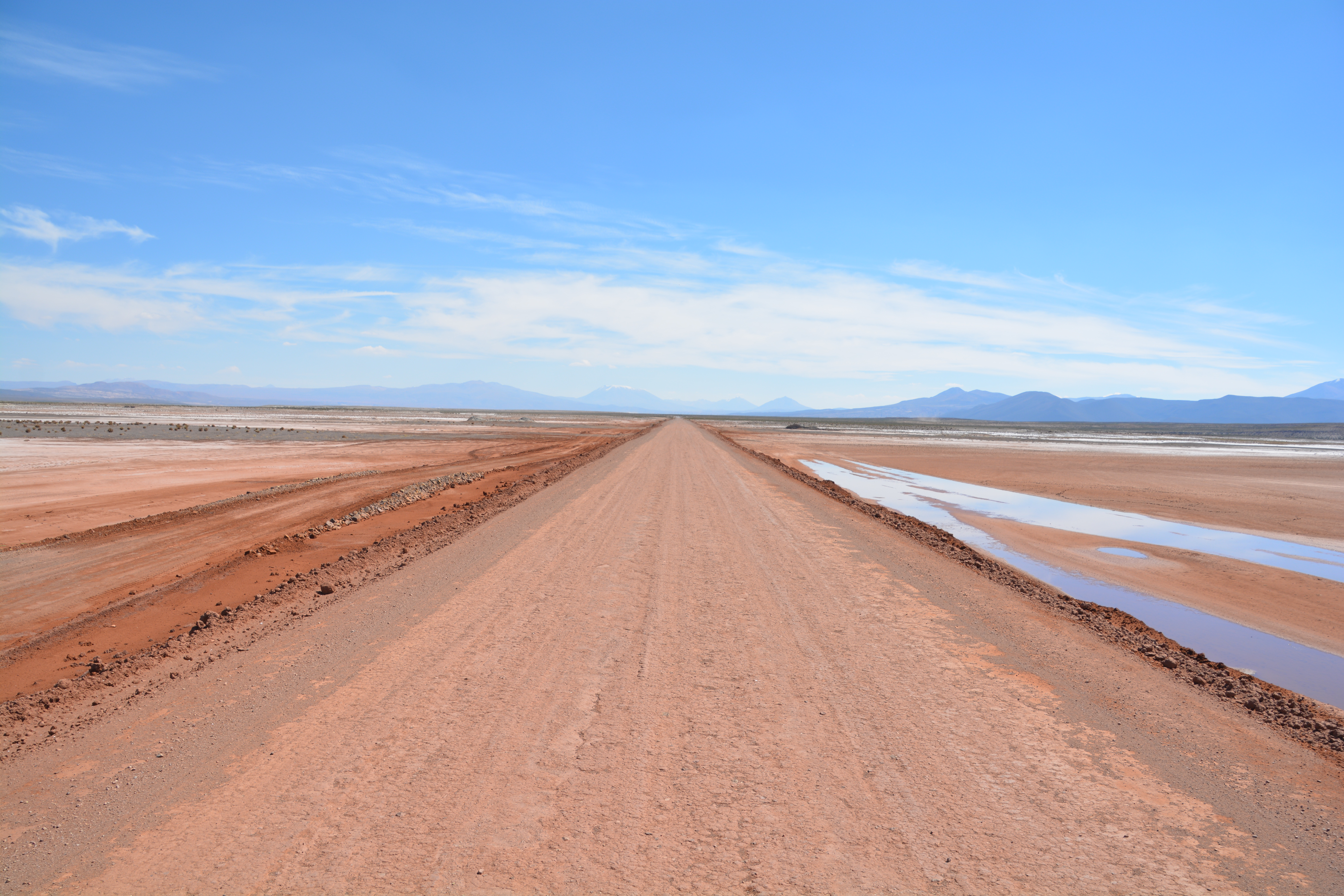
The road south into the remote corners of Bolivia provided more spectacular views of its nothingness
Our target was the southern most border crossing between Bolivia and Chile but to get there we needed to negotiate some diabolical tracks, the worst we’d seen the entire trip (which is saying something!) and cross through a national reserve called Eduardo Avarao.
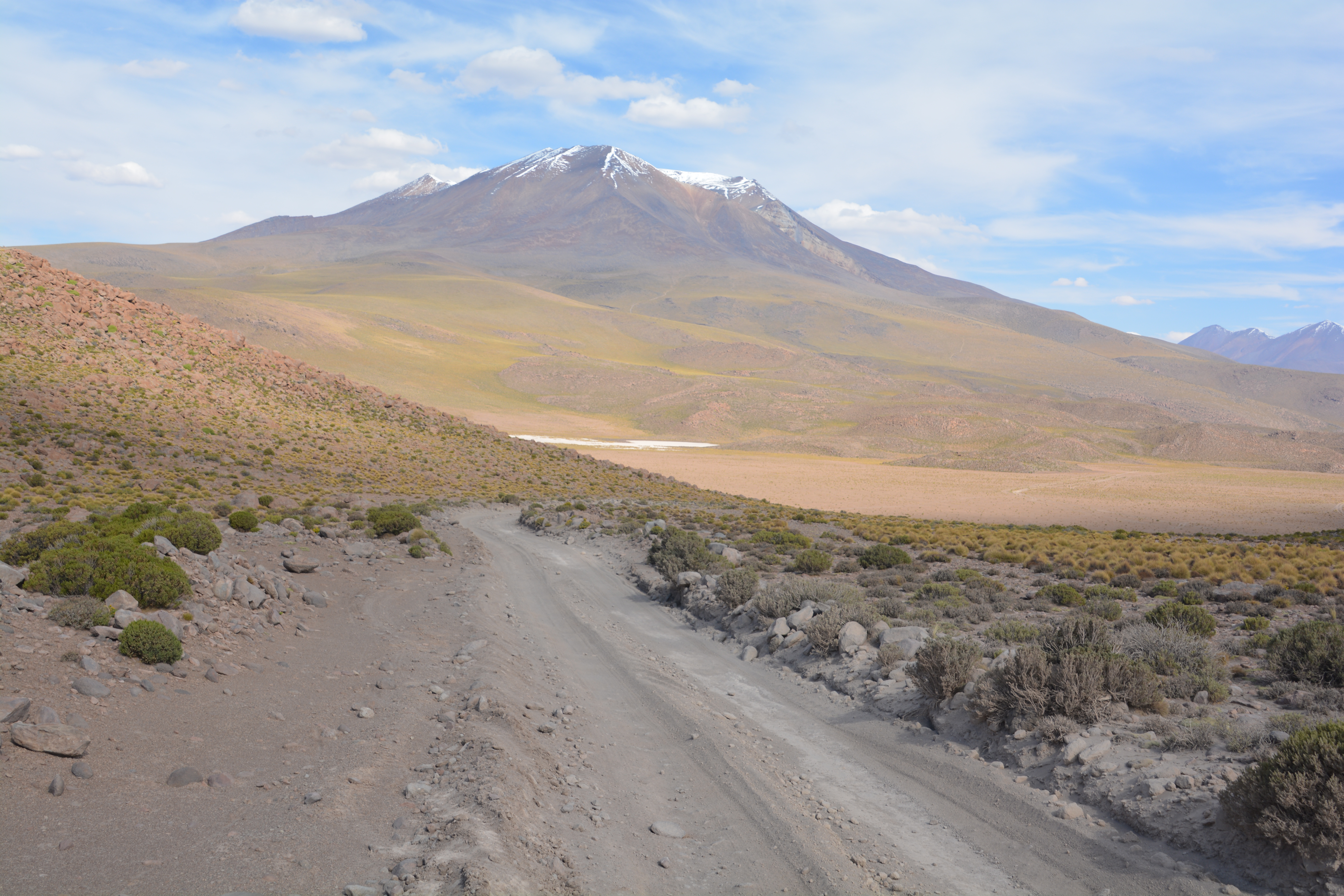
The ‘road’, nothing more than a rough single lane track without any fresh tire marks, weaved its way through a series of volcanoes
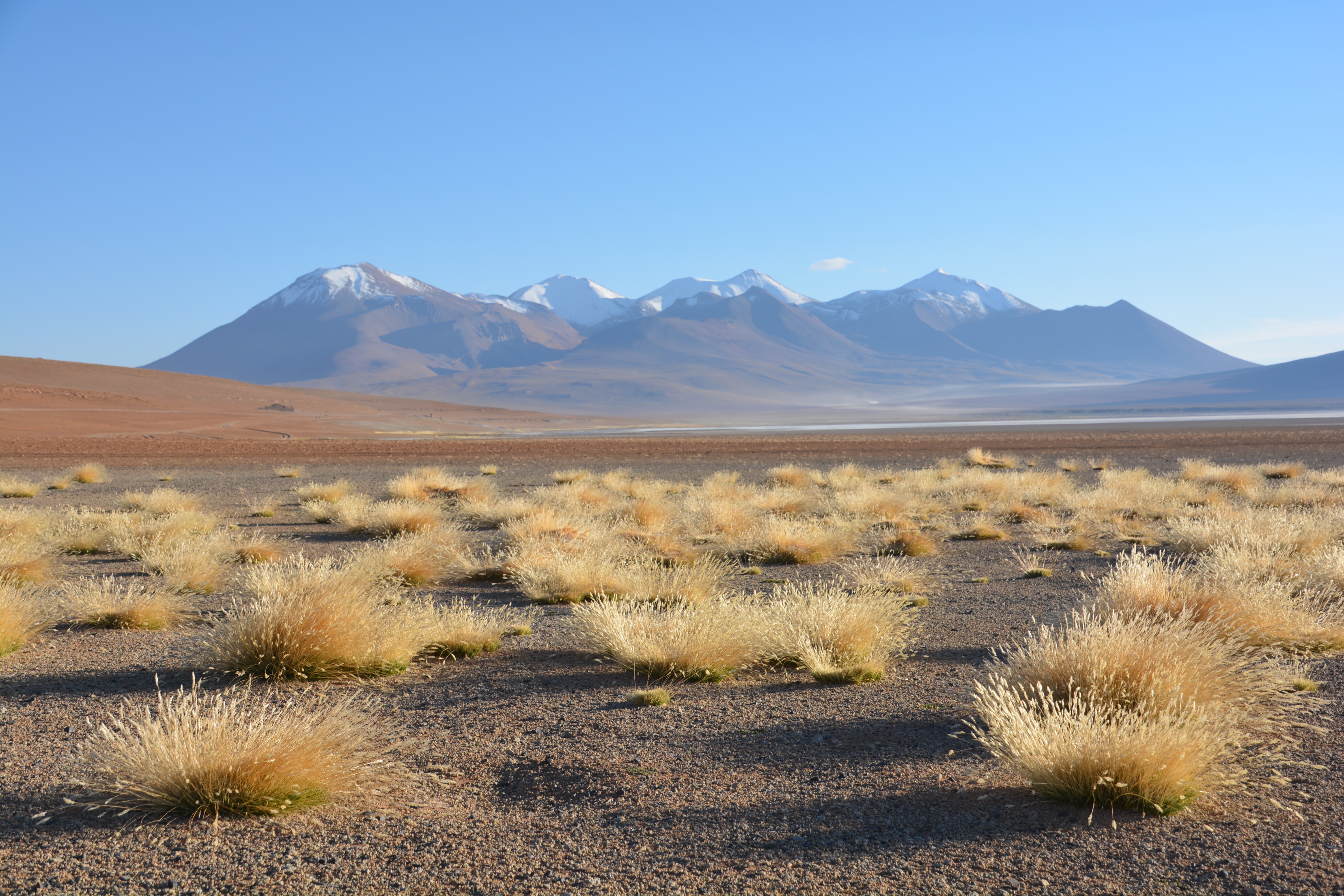
Between the roads over 4,000 metres, snow-capped volcanoes, salt lakes and absolute desolation we were in seventh heaven
We spent the afternoon slowly climbing over each hill, ridge and saddle between the field of volcanos, all of this well over 4,000 metres. The sharp stones, steep inclines and deep ruts were hard on Tramp but he never missed a beat.
The tracks were rough and heavily corrugated but the most curious thing was that in some places there were dozens of tracks all going to the same place, drivers just trying any smooth track to avoid the washboards and rocks
Late in the afternoon, after passing numerous stunning lagunas, or lakes, some home to large flocks of flamingos, we followed the track through a long winding narrow gorge before passing over a flat open rocky plain to drop down into the bowl of Laguna Kachi. Here we camped for the night with a string of snowy volcanoes starring down at us, the salty marsh of the lake nearby and a frigid wind keeping us inside.
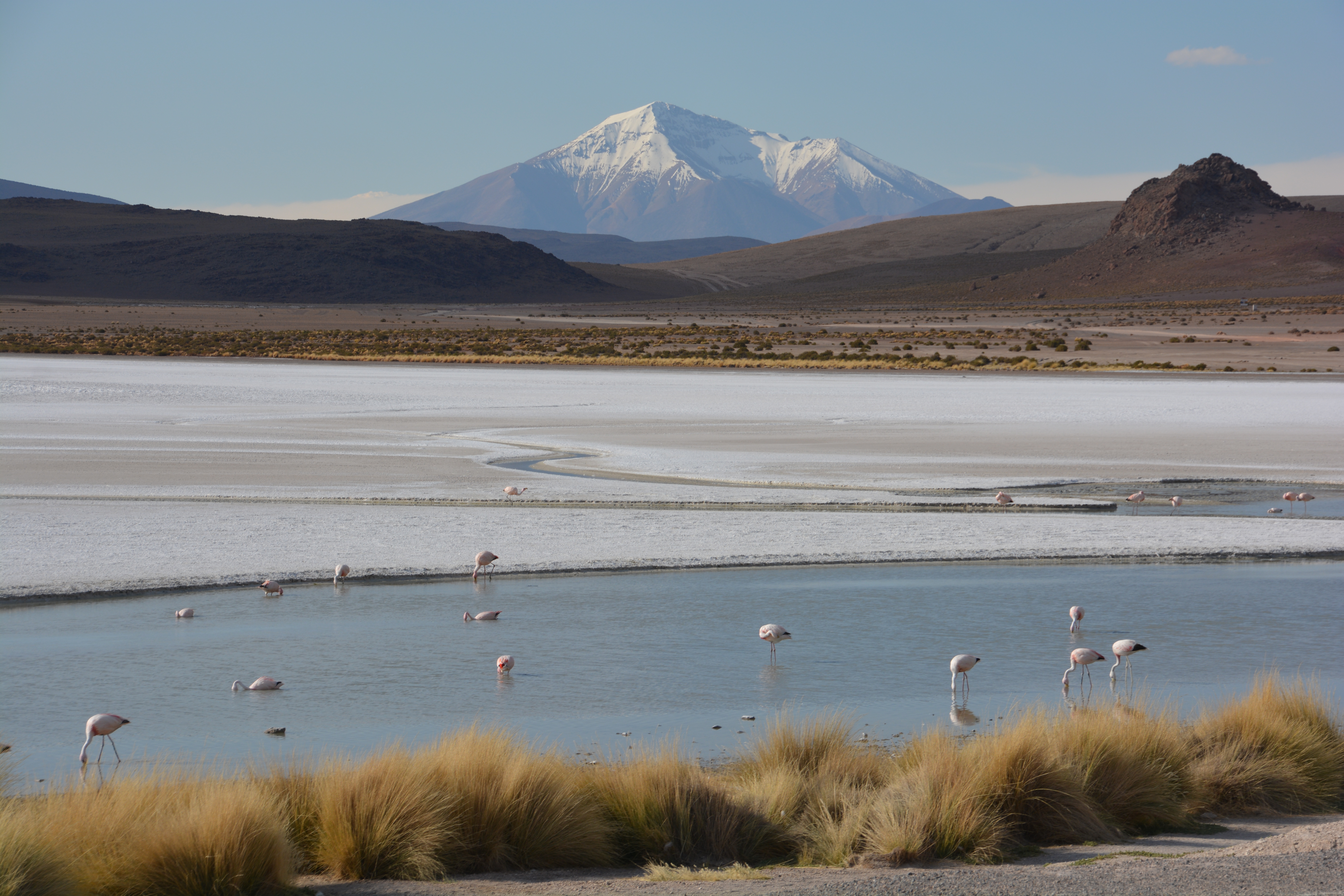
Really, can you beat this? Pink flamingos, salt flats, high altitude tundra, snow-capped volcano.

Cross another high altitude ridge, another salt lake, another one or two or three volcanoes
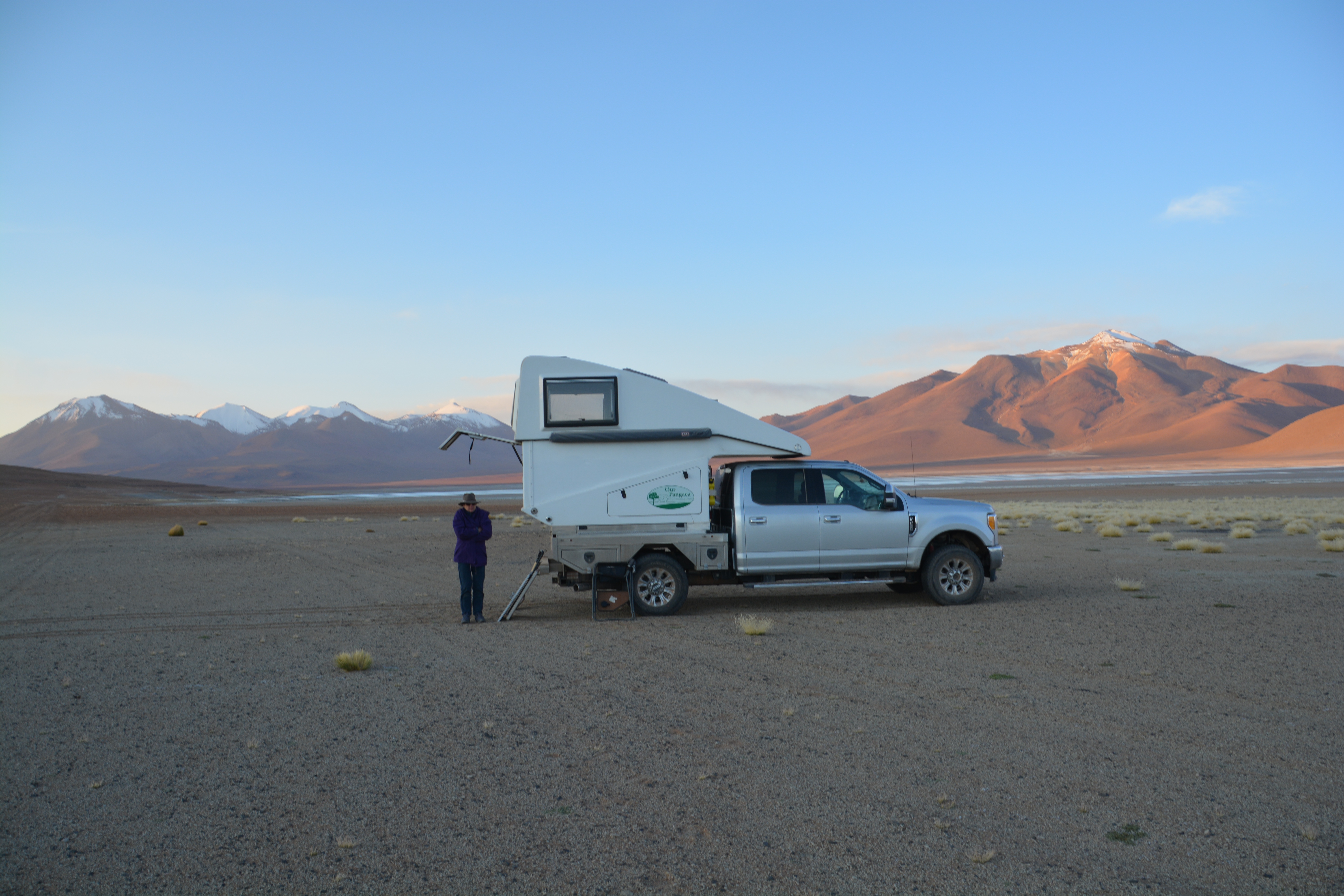
Julie happily posing for a photo next to Tramp at Laguna Kachi in sub-zero weather with a fierce wind that made it excessively cold
As a so-called ‘superlative buff’ I liked our camp at Laguna Kachi. Not only was it one of the most stunning places we had ever camped but at 4,500 metres (16,100 feet) it was also our highest and at -6C (21F) it was also the coldest night we had ever camped, bar none. We watched the sun rise over one of the many volcanoes that surrounded us and couldn’t stop staring at the snow-capped mountains, salty lake and desert scenes all around us.
Our sunrise view from Laguna Kachi, just about as high and as cold as we can get
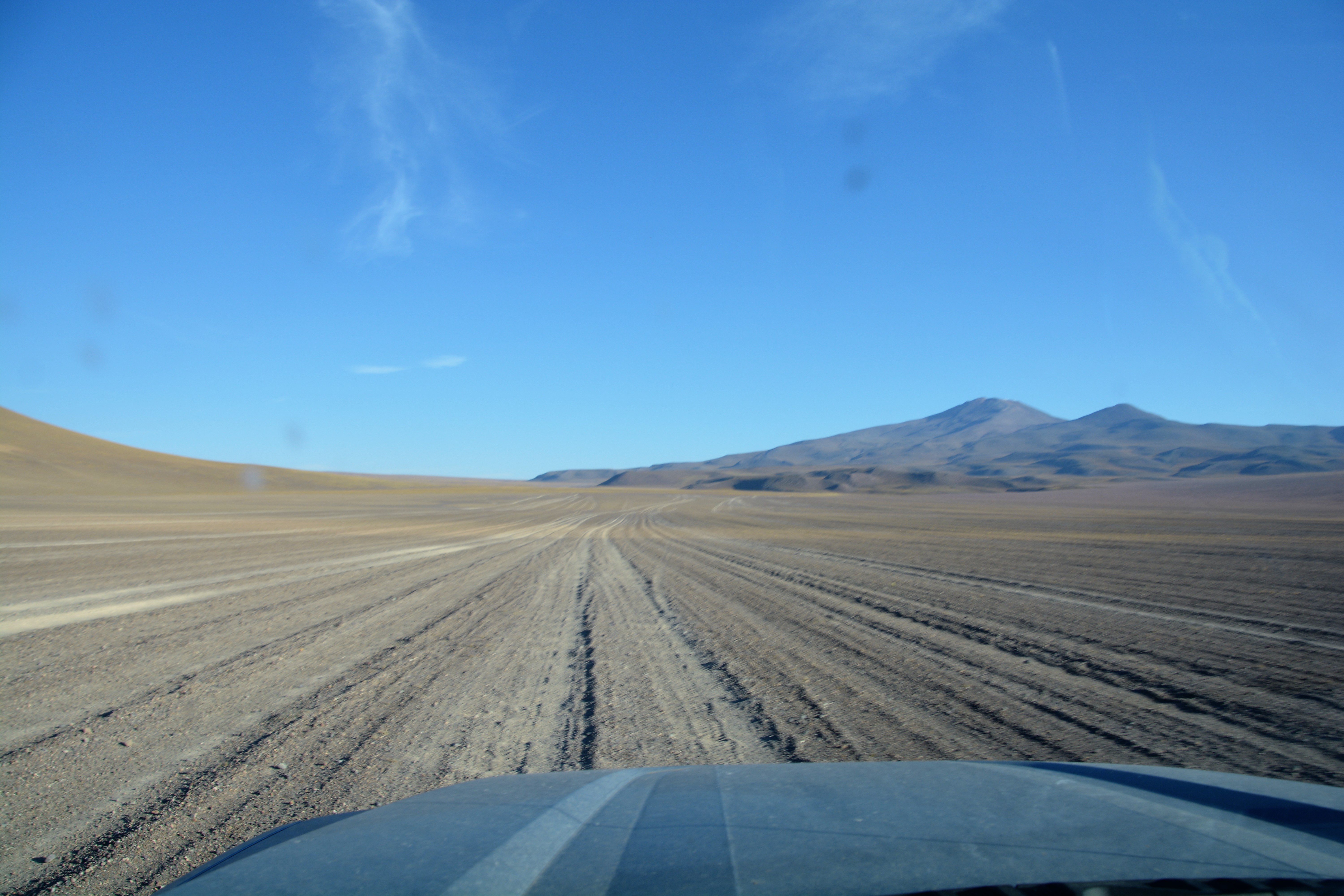
We headed south on an obscure track, up and over hills, dry lifeless desert landscape everywhere, passing a number of salty lakes that dot these high mountain plains. It was like we were the only ones left on earth, an earth completely scorched of life, colour or movement, save us. We needed to be totally self-sufficient and dependent only on our own capabilities. There was nothing else.
How much did we rely on the mighty Tramp to see us through this remote land? There were no other options.
But the track was rough, deep ridges, terrible washboard, gibber rock that we know from experience can slice a tire wide open, huge ruts and holes without warning. We knew Tramp was tough but this was a major test and we also knew – based on recent experience – that our belongings inside the camper would be tossed around like a green salad.
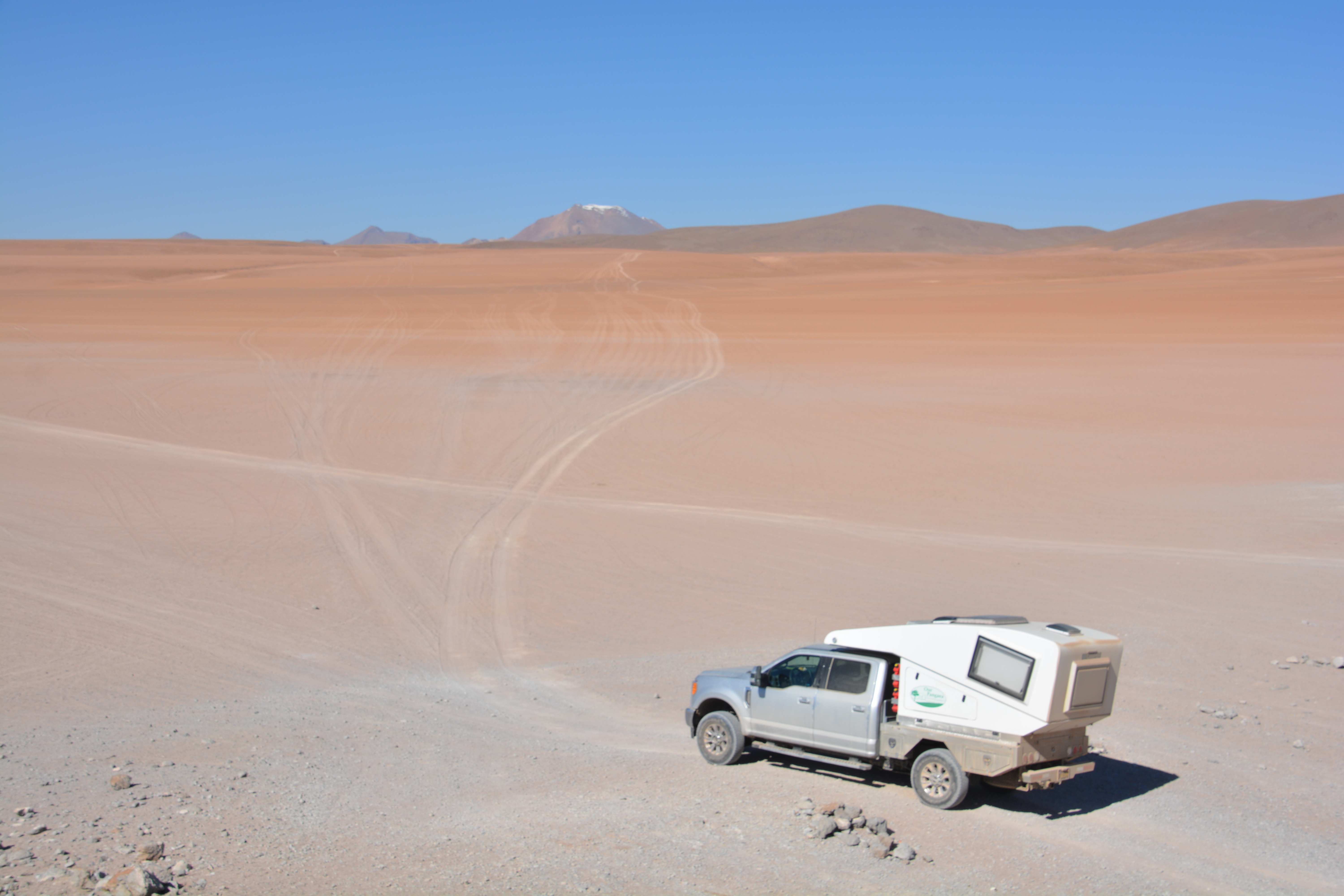
That’s where we’re going, up that faint track and over into the next valley, whatever it may be
Not sure which laguna this was to be honest, there were a lot and they all looked great
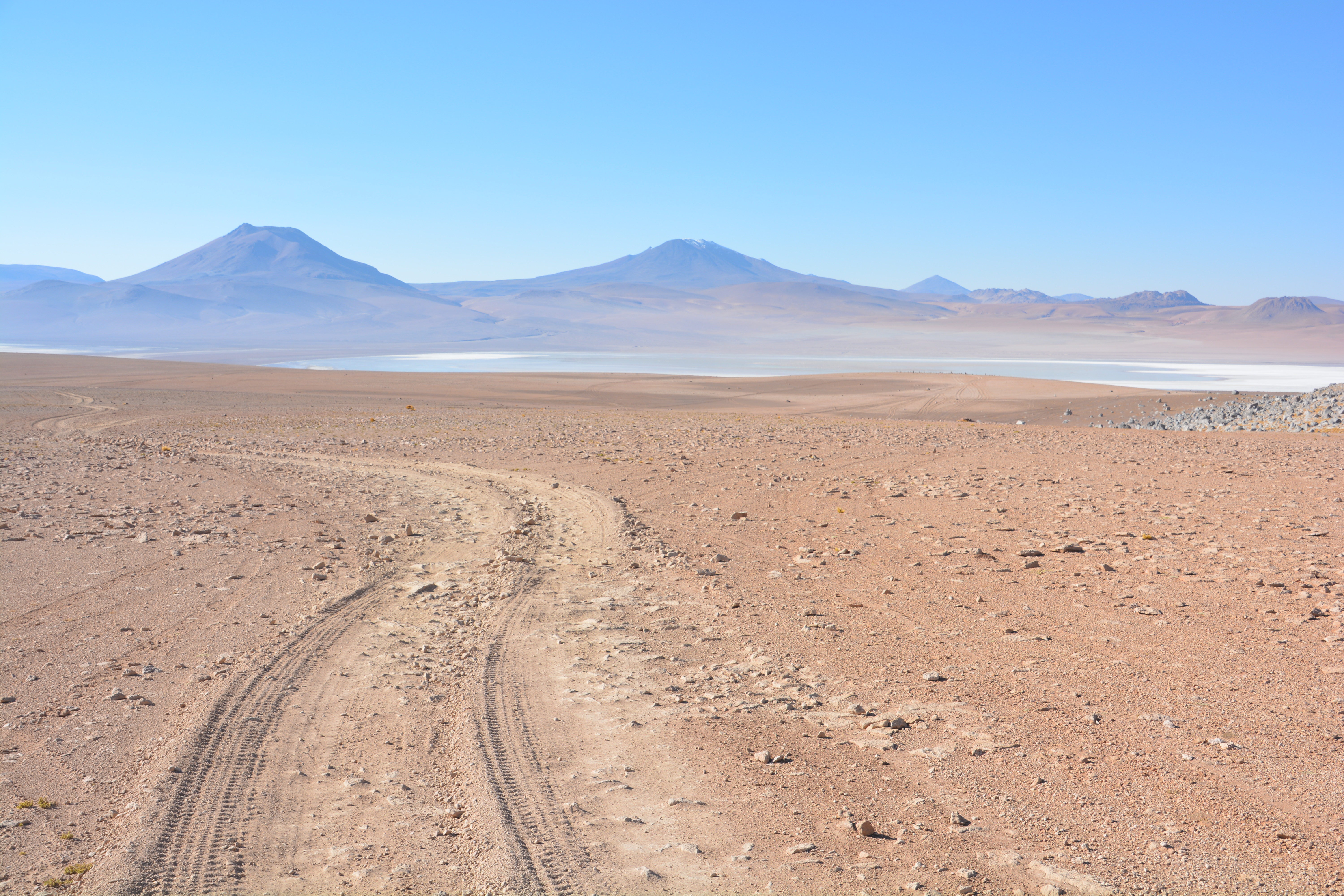
By late morning we passed into the National Reserve de Fauna Andina Eduardo Avaroa, the large protected southwest corner of Bolivia. It seemed the roads only got worse but the scenery kept on delivering with a continuous stream of volcanic moonscapes, shallow salty lagunas and an endless choice of four wheel drive tracks, all of them unmarked and undeveloped, heading off in what sometimes seemed indeterminate directions.
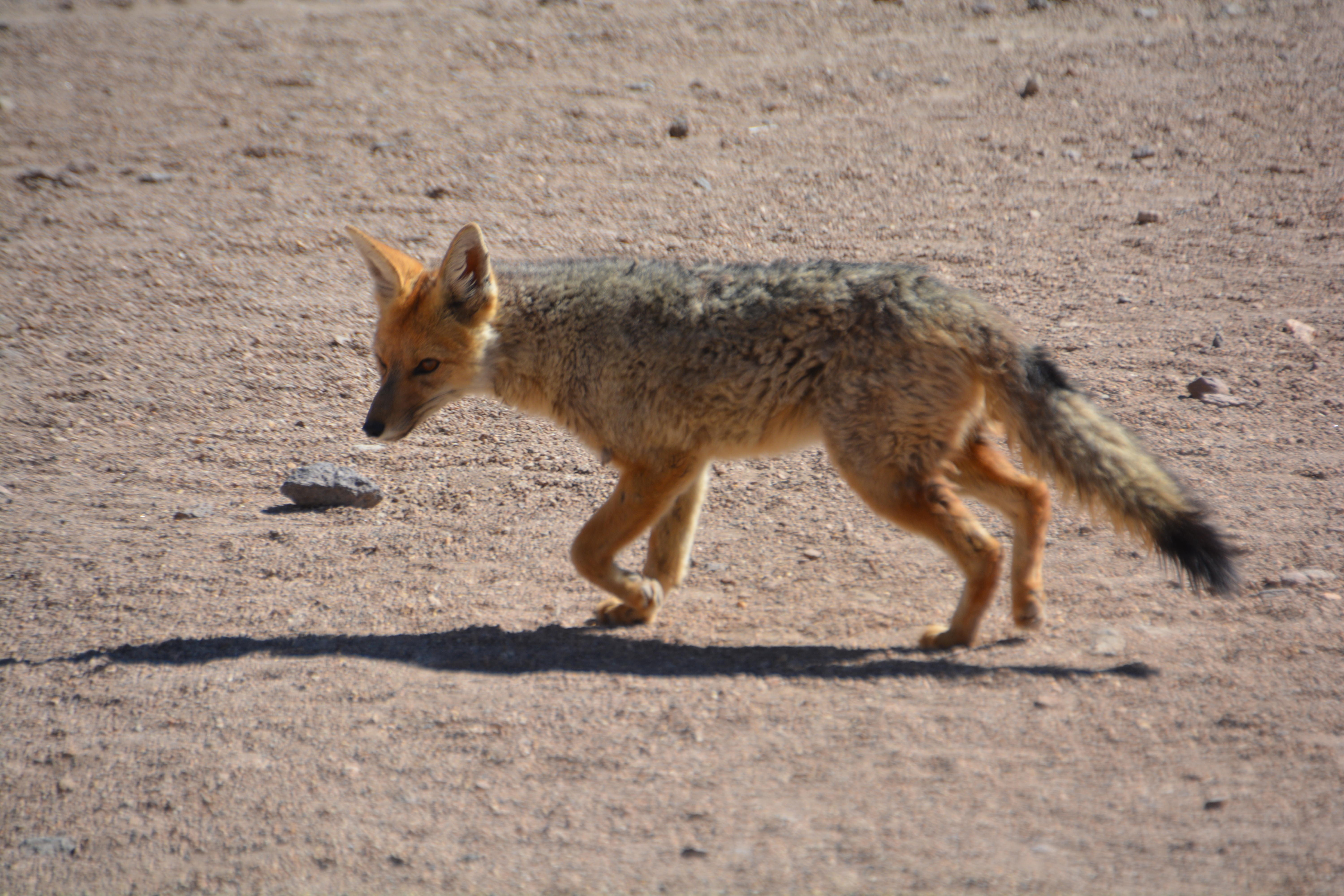
An unexpected surprise, a desert fox was sniffing around when we stopped for photos – how he survives out here is anyone’s guess
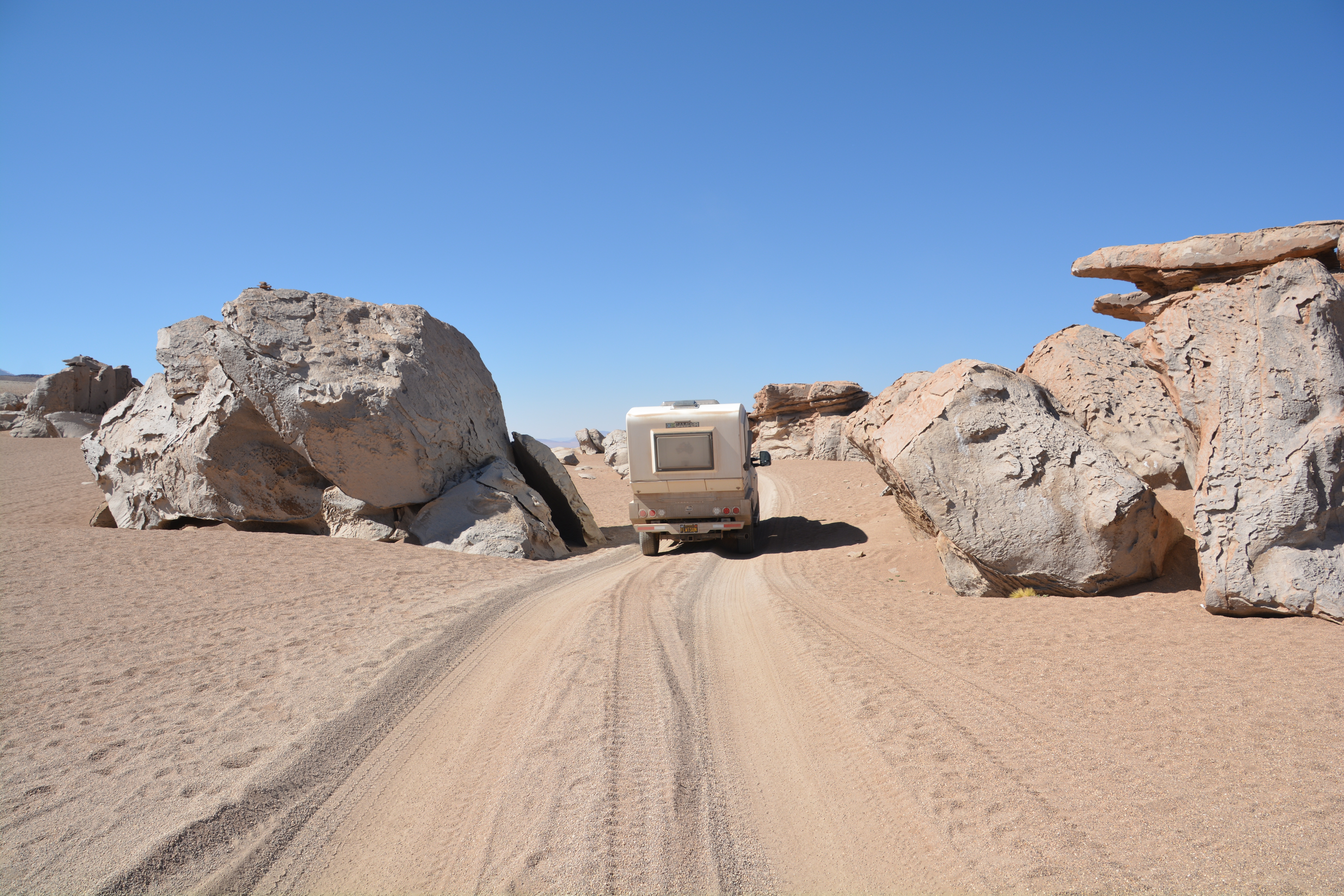
Large ancient volcanic boulders provided some brief variety to our driving day
This drive was all at extremely high altitude and Tramp laboured many times up steep sandy slopes with his low octane gas and low oxygen intake. After cresting one hill we stopped to see some amazing geyser activity and read the information board which said we were at 4,990 metres (16,350 feet), the highest point we had reached on this entire trip. And still the mountains soared above us.
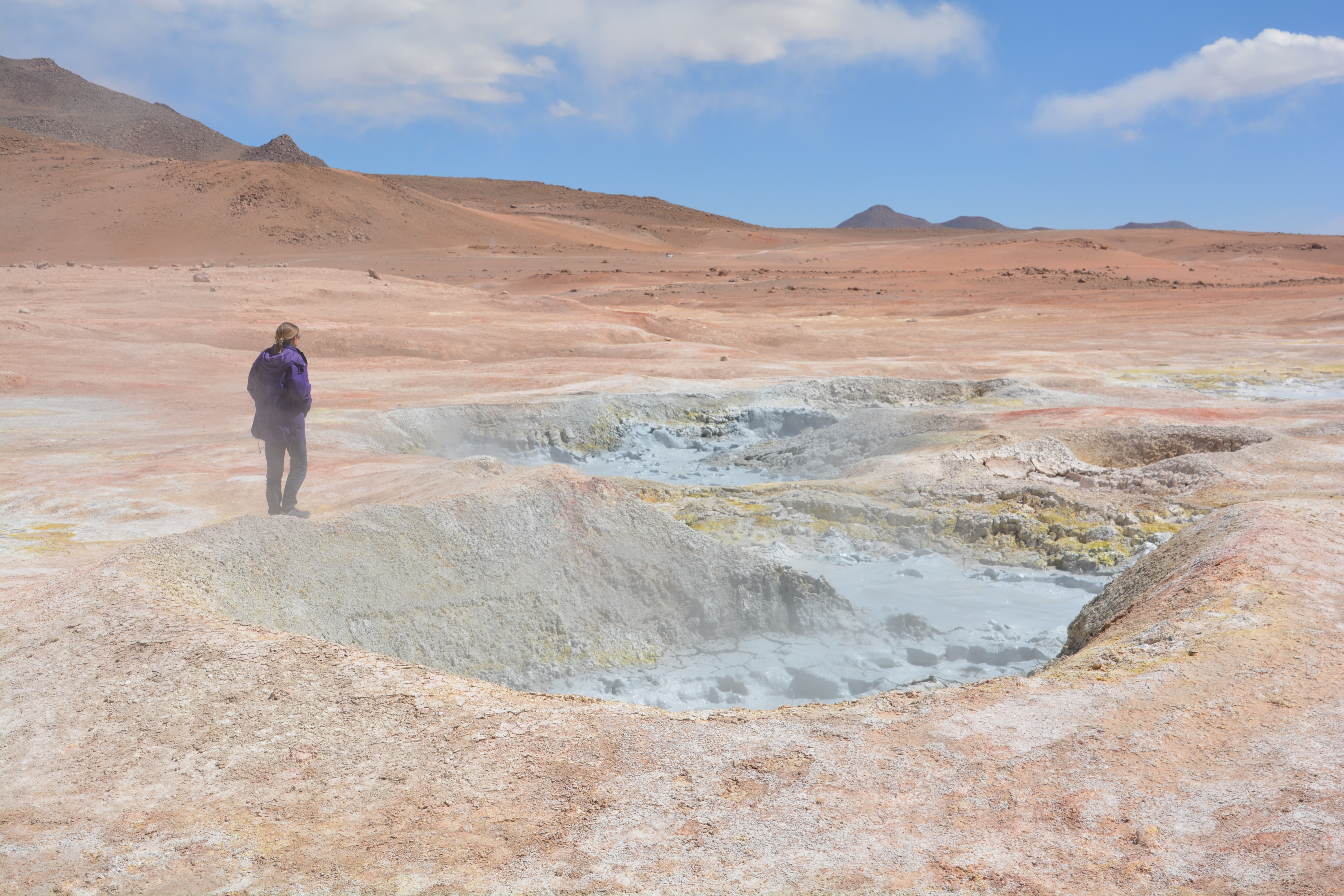
A bubbling brew at these volcanic baths…and the sulphuric smell was not pleasant
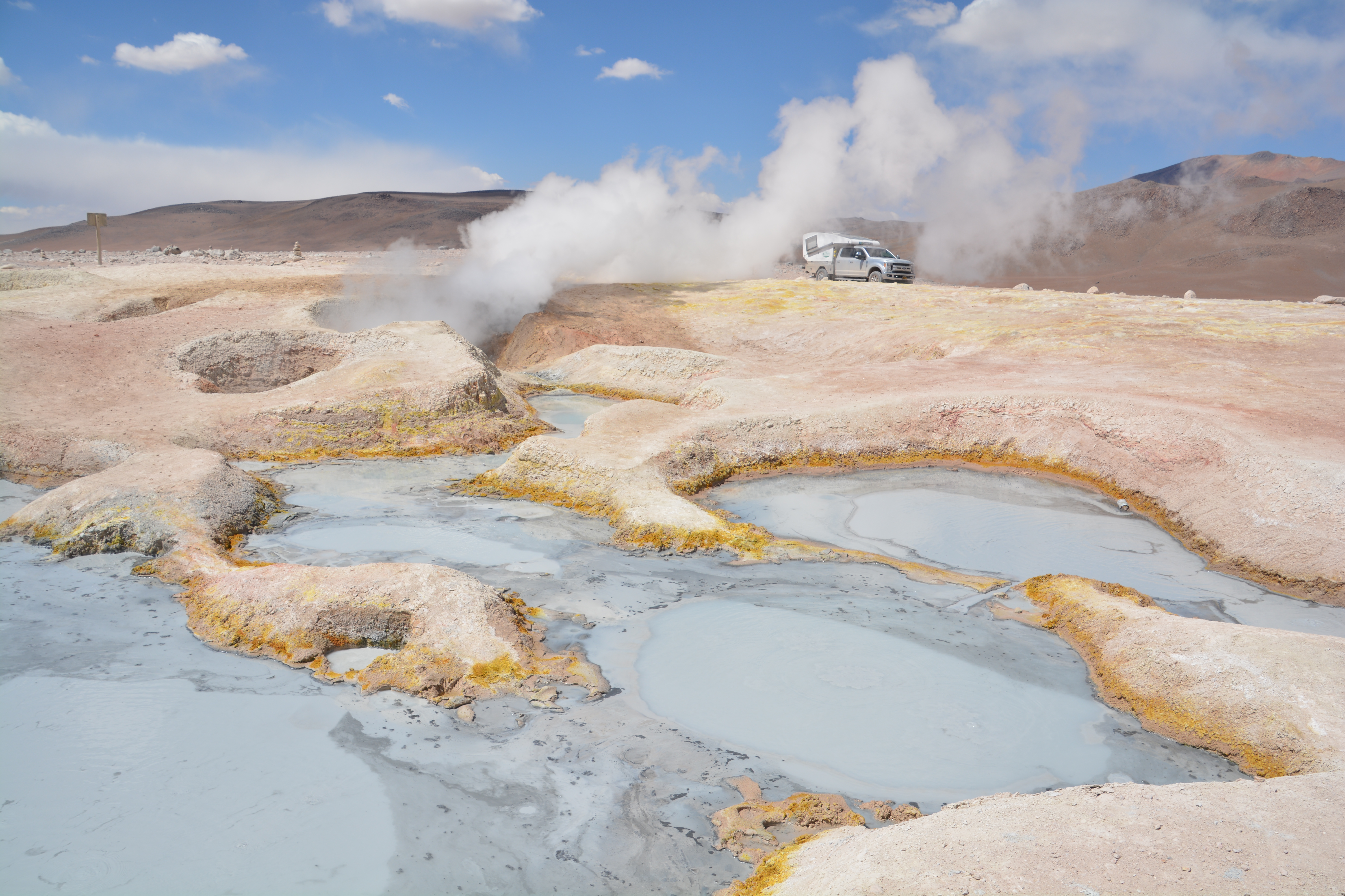
This geyser activity was super cool but at almost 5,000 metres Tramp was wheezing a bit
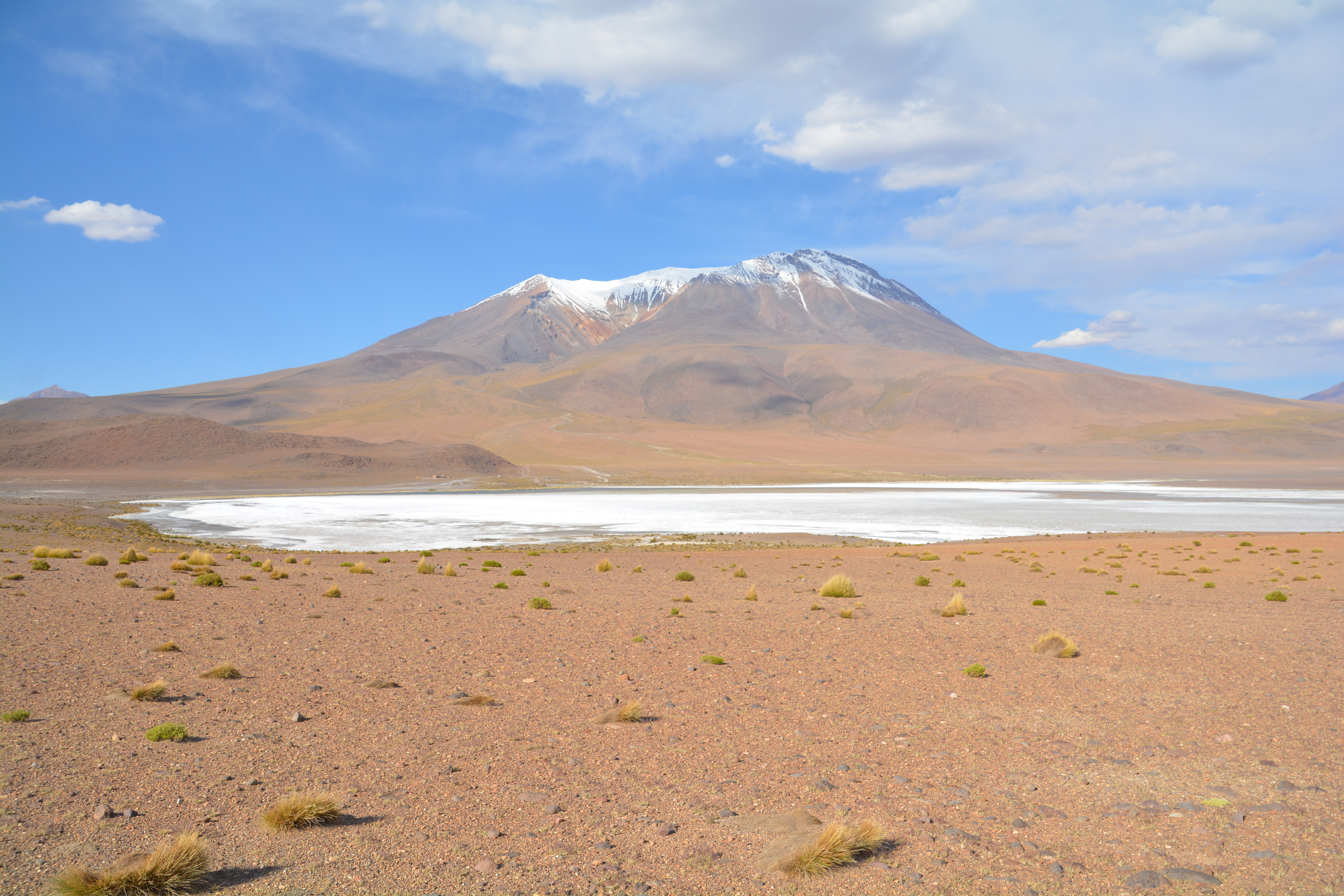
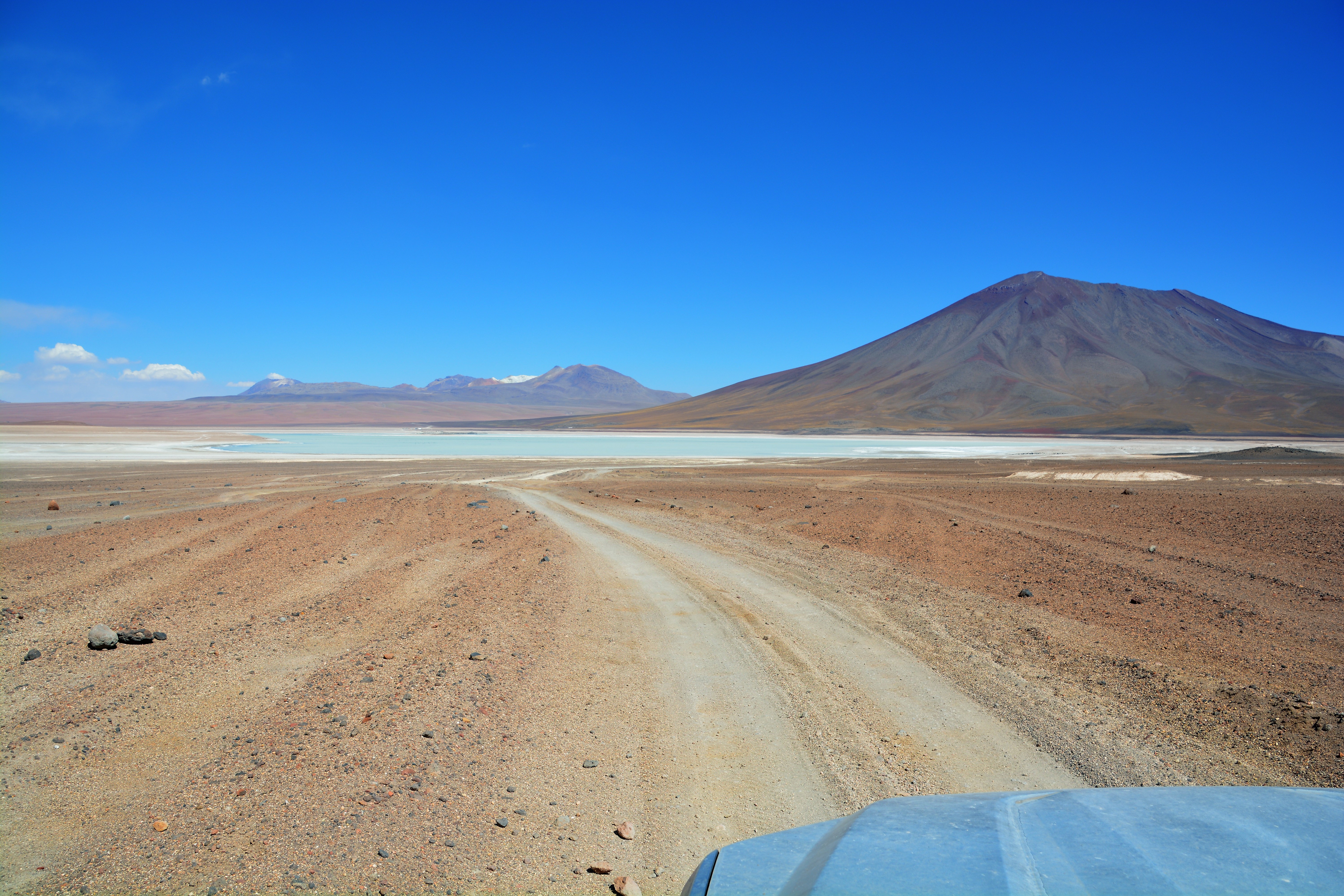
The three main lagunas we wanted to see were Laguna Colorado, which featured a dark red tint and huge piles of salty mineral that looked like icebergs, Laguna Blanca with its white sand-like shorelines and Laguna Verde which had a towering volcano as a backdrop.
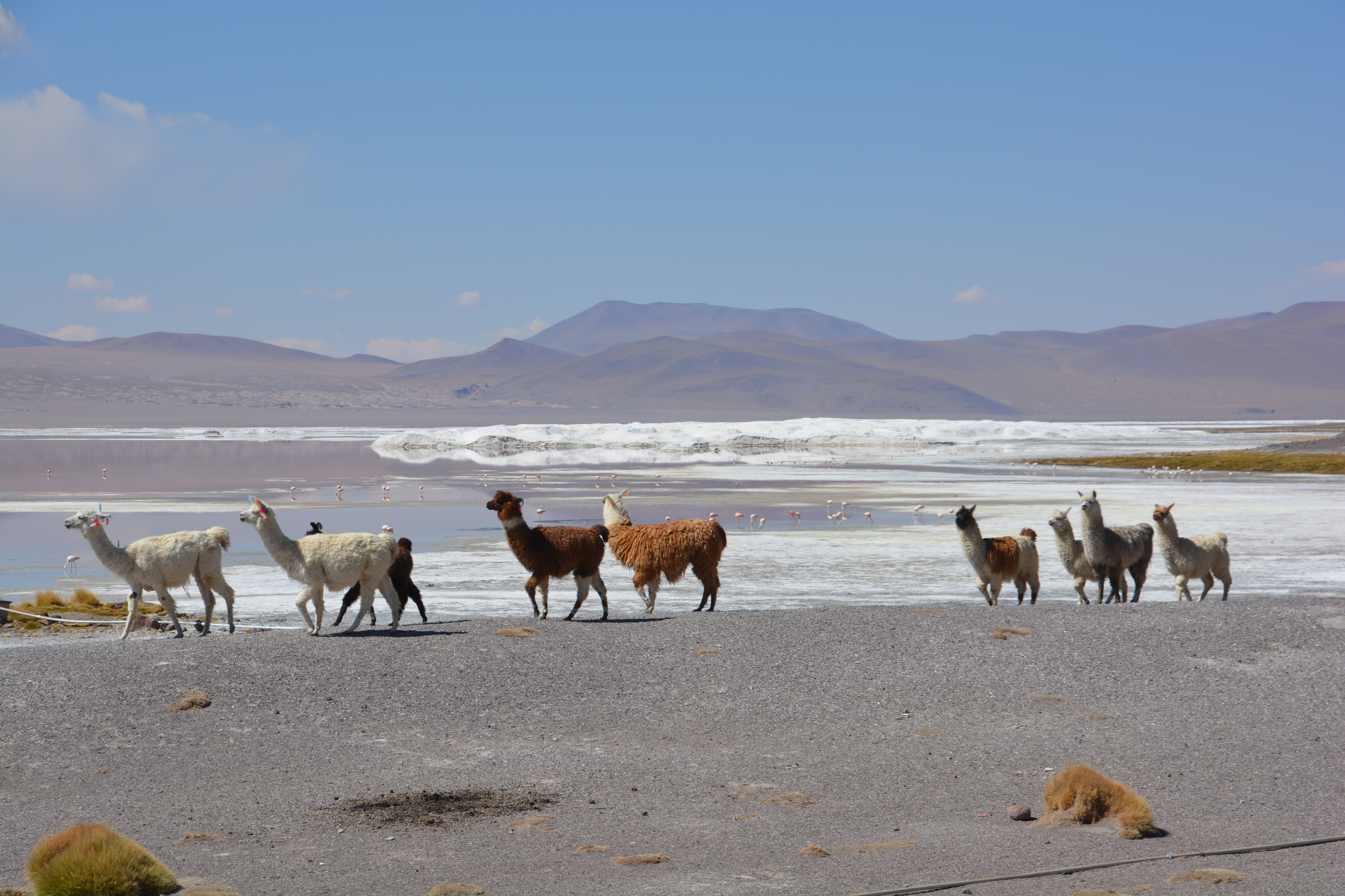
These fascinating but forlorn llamas cut a good profile in front of Laguna Colorado with its unique iceberg-like salt formations in the background
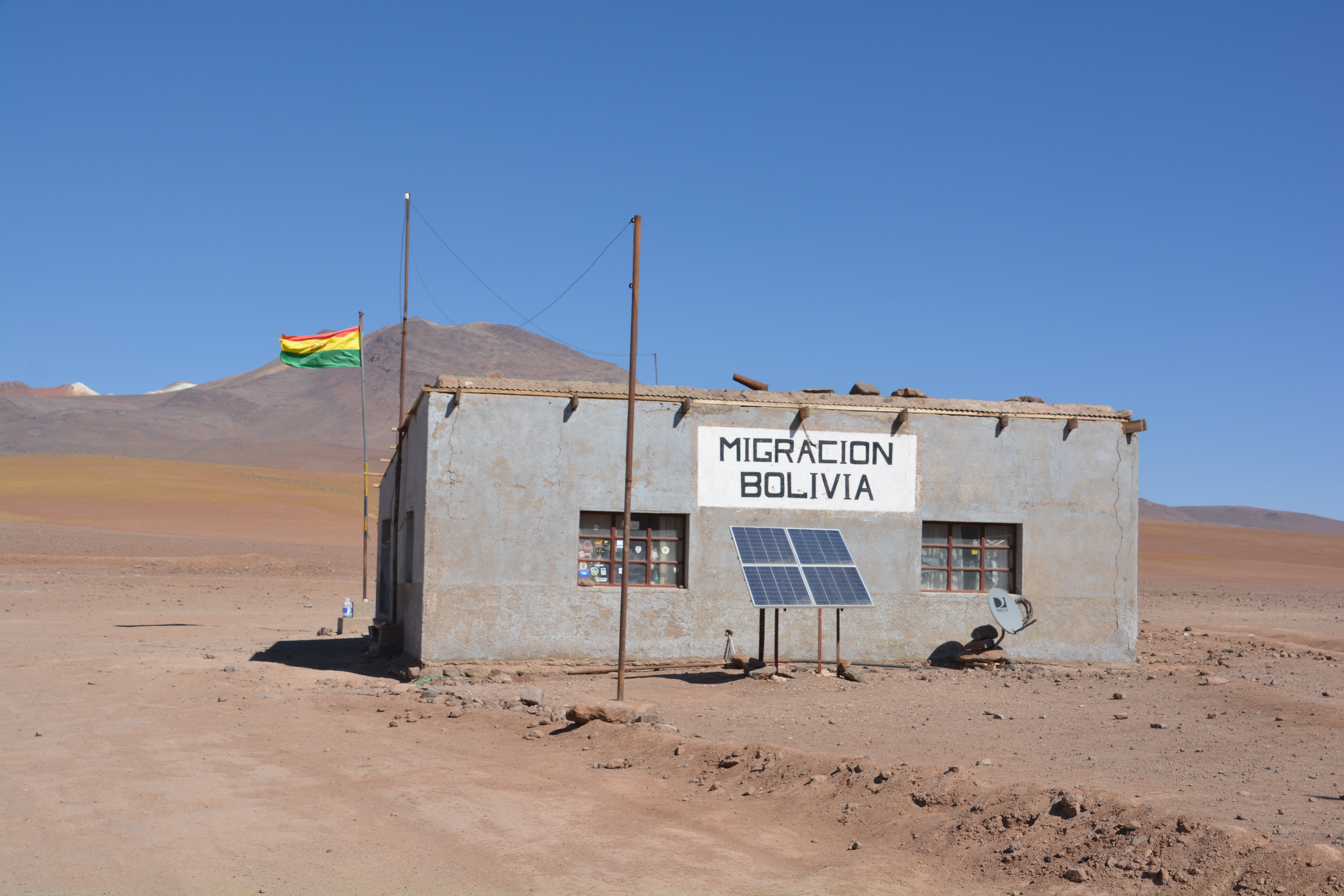
We then crossed the remote Bolivian border, no more than a windswept mud hut, and crossed over into Chile where the road immediately became paved and it seemed we had returned to the 21st century. From that lofty ridge we dropped an astonishing 2,000 metres into the Atacama Valley. This was a steep straight road, not a switchback in sight, a string of volcanoes behind us, just down down down out of the Andes and into the town of San Pedro de Atacama, Chile.
Our last view of Bolivia summed up the place – remote beauty but significant economic challenges
In San Pedro we dealt with many admin issues, fuel, SIM cards and shopping, camping that night at a proper overlander campsite about eight kilometres from town. It had been an extraordinary day, one of the most spectacular drives we had ever done, we were grateful to finally be out of the taxing 4,000 metre mountains and we looked forward to a new country – Chile!
A couple of final panoramic shots taken by Julie up in the salt lake area of southern Bolivia
Another Kodak moment
Unbelievable scenery in Bolivia. So beautiful. I can see why it is one of your favourites.
I bet you had a hard time finding a good camping spot on the salt flat, but it looks like you nailed it.
Bolivia has a pile of serious problems but they’re hosting some of the most spectacular scenery we’ve ever seen. And camping on the salt flats was a serious highlight!
the pictures of the isolation on the salt flats made me feel a bit panicky….give me civilization anytime! Such an amazing experience.
Hi Linda, I agree, the salt flats completely changed our thinking of the space around us and how we fit in. A very eerie feeling…it made us feel very small.
Bill